Happy Boxing Day.
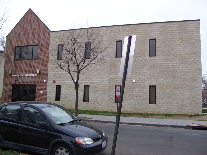
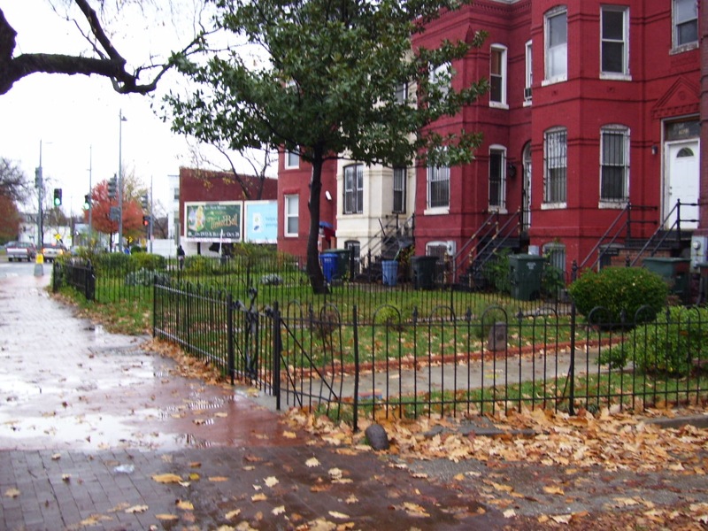
A quick look at this photo taken in 2005 shows the block before the Fourth St Friendship Seventh Day Adventist church built their modern wing. It appears ground had been broken and fencing was up.
Happy Boxing Day.
A quick look at this photo taken in 2005 shows the block before the Fourth St Friendship Seventh Day Adventist church built their modern wing. It appears ground had been broken and fencing was up.
The period between 1920 and 1950 seems so short, but those are the years where the DC Recorder of Deeds records and the US Census overlap so I can find the Black people who owned their homes. After 1950 it gets a little hard to get in depth info on people. Prior to 1920, I don’t get the same level of accurate information about home owners.
I mapped out which of the homes on Square E. 509 which were at one time owned by an African American resident:

This table has the addresses with links to the blog post about that home owner.
| House # | Street | Head Surname | Head 1st name |
| 1628 | 4th St | Brooks | Lucinda |
| 1616 | 4th St | Darden | Herman |
| 1612 | 4th St | Richardson | Chester |
| 1636 | 4th St | McLean | Daisie Mae |
| 1632 | 4th St | Penny | Louise |
| 1630 | 4th St | Jackson | Edna |
| 1616 | 4th St | Lee | Lula |
| 1612 | 4th St | Richardson | Chester |
| 1606 | 4th St | Logan | Mary |
| 1604 | 4th St | Branham | Clementine |
| 1600 | 4th St | Walker | Johnnie |
| 1602 | 4th St | Evans | Bennie L |
| 1605 | New Jersey Ave | Bellows | Nannie |
| 1607 | New Jersey Ave | Broadus | Wallace |
| 1613 | New Jersey Ave | Harrison | William |
| 1627 | New Jersey Ave | Lomax | Ernest |
| 1629 | New Jersey Ave | Thomas | Carrie H |
| 1605 | New Jersey Ave | Bellows | Nannie |
| 1601 | New Jersey Ave | Broadus | Wallace |
| 1613 | New Jersey Ave | Jones | Rufus |
| 1607 | New Jersey Ave | Broadus | Bessie |
| 1611 | New Jersey Ave | Hollaway | Olinian |
| 1613 | New Jersey Ave | Jones | Lucy E W |
| 1627 | New Jersey Ave | Downing | Virginia |
| 1645 | New Jersey Ave | Dyson | Sidney |
| 1643 | New Jersey Ave | Freeman | Frank |
| 1605 | New Jersey Ave | Bellows | Pauline |
| 408 | R St | Wheeler | James H |
| 410 | R St | Broadus | James R |
| 410 | R St | Broaddus | James R |
| 406 | R St | Strother | Maggie Taylor |
| 402 | R St | Wilson | Virginia |
| 408 | R St | Wheeler | Mayme |
| 408 | R St | Wheeler | James H |
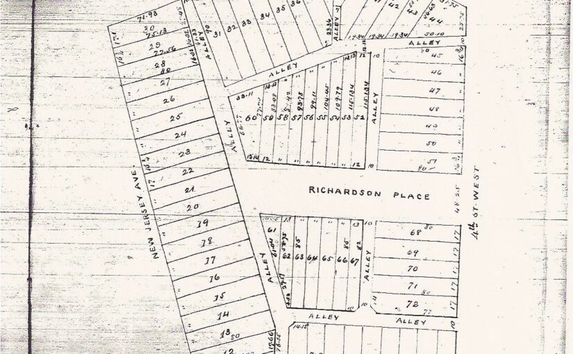
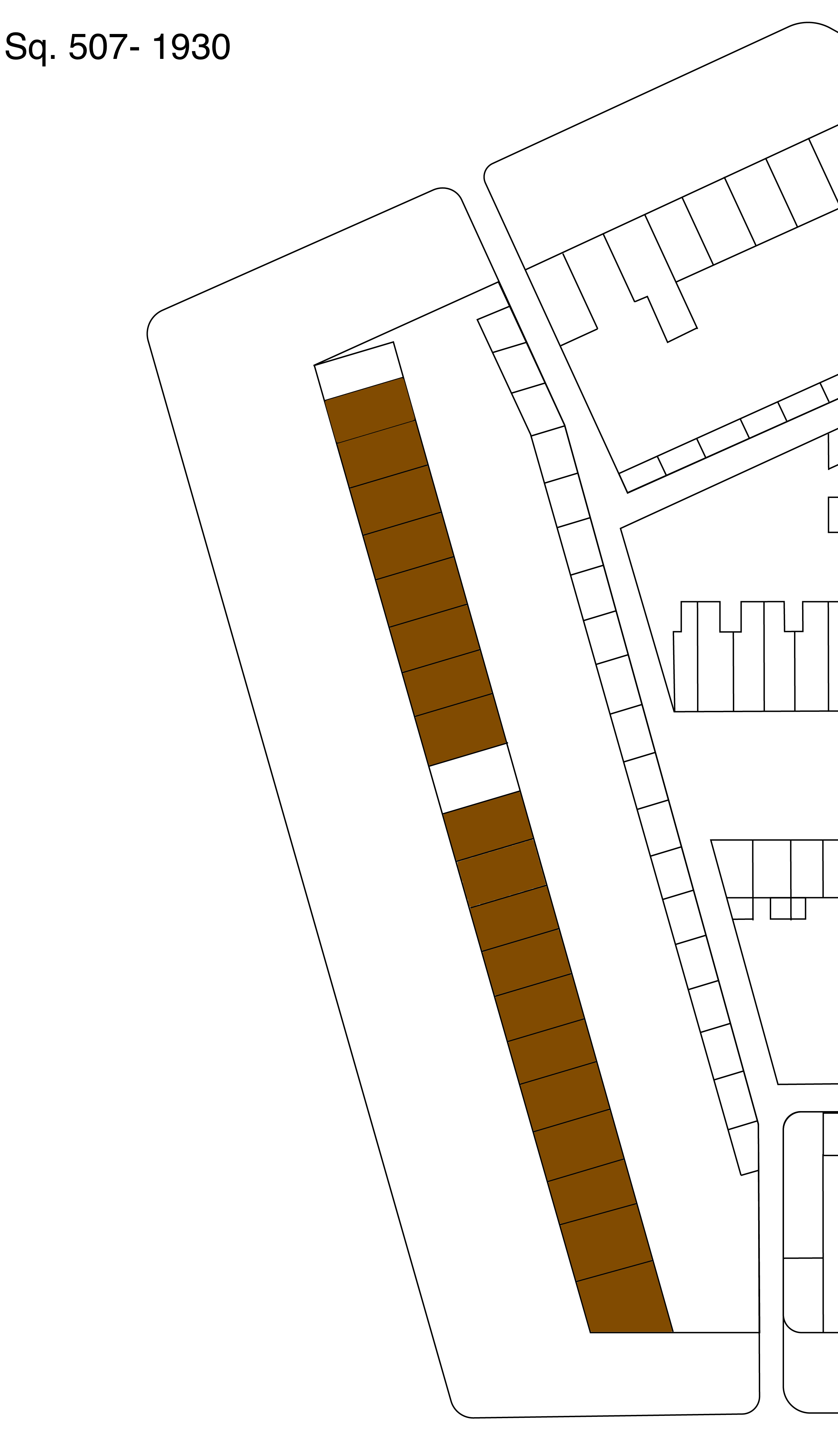
One of the things I noticed with the change in Truxton Circle from 1920 to 1930, was that the neighborhood went from being a racially mixed neighborhood to being a predominately African American neighborhood. One of the places where this change was obvious was on square 507, along the 1700 block of New Jersey Avenue NW.
A stretch of the block that was 100% white in 1920:
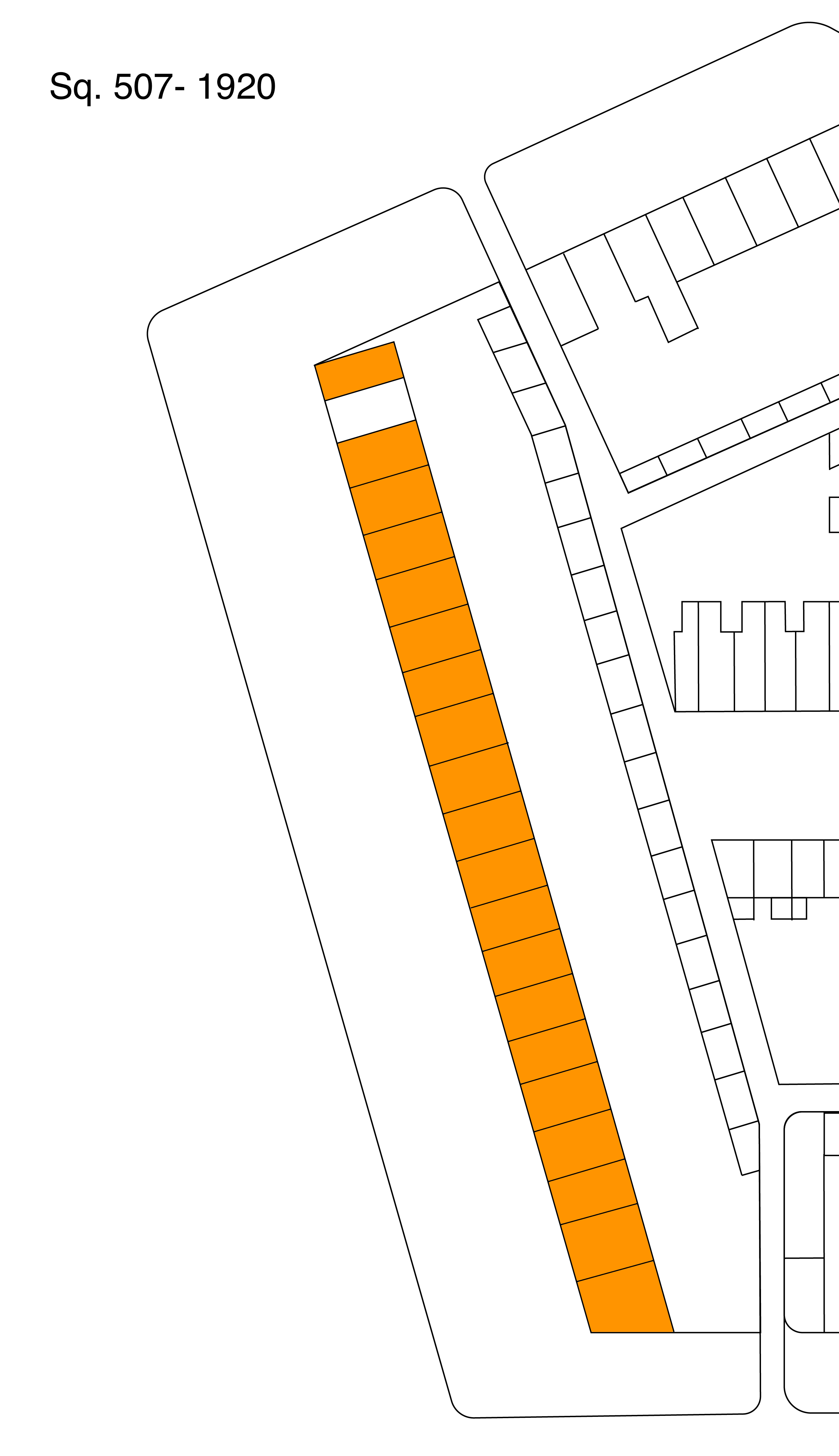
…became 100% African American in 1930:
I wondered why and looked for a reason. The reason may be buried among some of my old posts that I have yet to uncover and repost. I have some gaps between April 2010 and December 2013, and somewhere in there is a post, I swear, about a woman who lived on the block with her sons and I traced them to 1930. By that time Rosalie Flynn (maybe her name, maybe not) had either moved to Virginia or died and one of her sons had moved to the Atlanta area, married and was a lawyer.
So the reason for why one white household left the neighborhood was that people move on.
Many of you are not in the same place you were 10 years ago. A census is every 10 years. People grow up. They get married. Their career takes them to another city or town or even country. Some die. In urban areas, like Washington, DC, people are always moving around.
If you look where the condos at P and 4th/New Jersey NW are, there are two highway billboards. I believe one is advertising the movie Tinker Bell.
When I look back at the post Oh what could have been- a plan to destroy the TC and the map of the plan to have a multilane highway through Truxton Circle. I wonder if the billboards were placed there to take advantage of commuter traffic?
I have written up 100+ histories of former Washington Sanitary Improvement Company houses. I’m sure this is getting boring for the few of you who are reading these histories. It’s getting very repetitive for me.
I don’t plan on stopping, just taking a break to look at other Truxton Circle stories and maybe related WSIC players. I’m all about tedious research, and getting into the details most gloss over, but I need to shake it up a little.
Doing this work has improved some of my research skills. I’d like to revisit some stories I’ve told before.
I’ll return with more WSIC-1950 Sell Off- TC Address posts after Black History month.
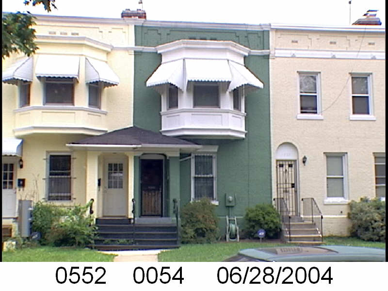
The Washington Sanitary Improvement Company (WSIC) was a late 19th century charitable capitalism experiment that ended in the 1950s. This blog started looking at the homes that were supposed to be sold to African American home buyers, after decades of mainly renting to white tenants.
Looking at WSIC properties they tend to have a pattern where the properties were sold to a three business partners, Nathaniel J. Taube, Nathan Levin and James B. Evans as the Colonial Investment Co. for $3 million dollars. Those partners sold to African American buyers. There was usually a foreclosure. Then the property wound up in the hands of George Basiliko and or the DC Redevelopment Land Agency (RLA). Then there were the odd lucky ones who managed to avoid that fate.
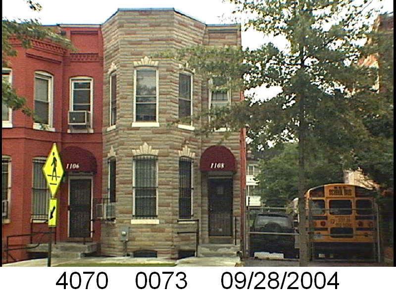
Let’s see what happens with 1539 Third St NW:
Okay now I’m curious. What are the odds that a woman who owns half of the property winds up marrying someone with the same surname as the other owners?
So looking on Ancestry, there were several Virginia M. Lewises living in Washington, DC in 1950. But only one was Black. The Afro-American Virginia M. Lewis was a 40 year old divorced woman who lived at 1108 Florida Ave NE for the 1950 census. She was listed as the head of household, working as a nurse for the District government. She lived there with her three adult daughters, Dorothy L., Juanita M. and Mary V. Lewis. A 63 year old waiter named William C. Thomas was listed as her “partner”, Hazel R. Foster and the Mitchells (all between the ages of 22-37) were listed as lodgers.
From what little I can find on Ms. Lewis she was born in Baltimore, Maryland in 1910.
I’m not sure about the Greens. I can find a John A. Green married to a Florence Green, but not John H. Those Greens lived at 118 S St NW in 1917-1918. I’ll leave it there since there is not much to go on.