A Rose by any other name can stink when it hits the fan

While I was away this weekend, mourning the death of my grandma, the whole what’s the friggin name of the neighborhood blew up. As far as I’ve been able to grasp it, a vocal party in the Bates Area that is opposed to the name Truxton Circle penned a few letters to various city officials expressing their opposition to the name. However, one of those letters was to DDOT requesting “an immediate stay on the grant application for a Truxton Circle Banner pending further review.” Considering that city grant money may be harder to come by in the future, and that it is easier to get grants once you’ve gotten one, our little disagreement about the name of the neighborhood has gone too far.
I had not seen the letter that started it when I had seen the Truxton Circle dot org’s Daily (somewhat weekly-ish) dispatch in my inbox on my cell phone. I read the dispatcher’s letter, which expressed anger and irritation, leaving me to wonder WTF? It wasn’t until Sunday night when I read the offending letter and got a fuller account from the co-founder of TruxtonCircle.Org. Dang.
I respect the right of my fellow neighbors to disagree and go into the public sphere to express said disagreement. Regarding the name and history of the neighborhood, I welcome any research that others bring forth. The problems in the offending letter were a few statements and one poor citation. Let’s review:

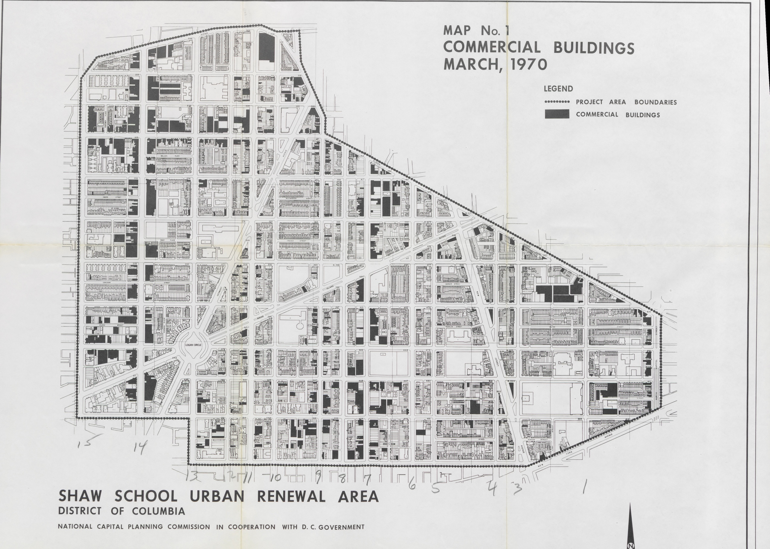
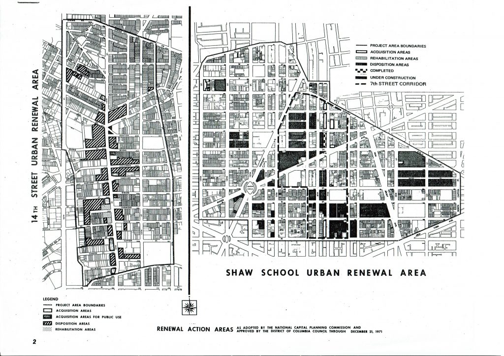
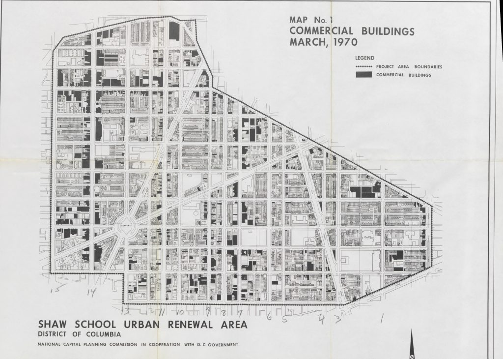
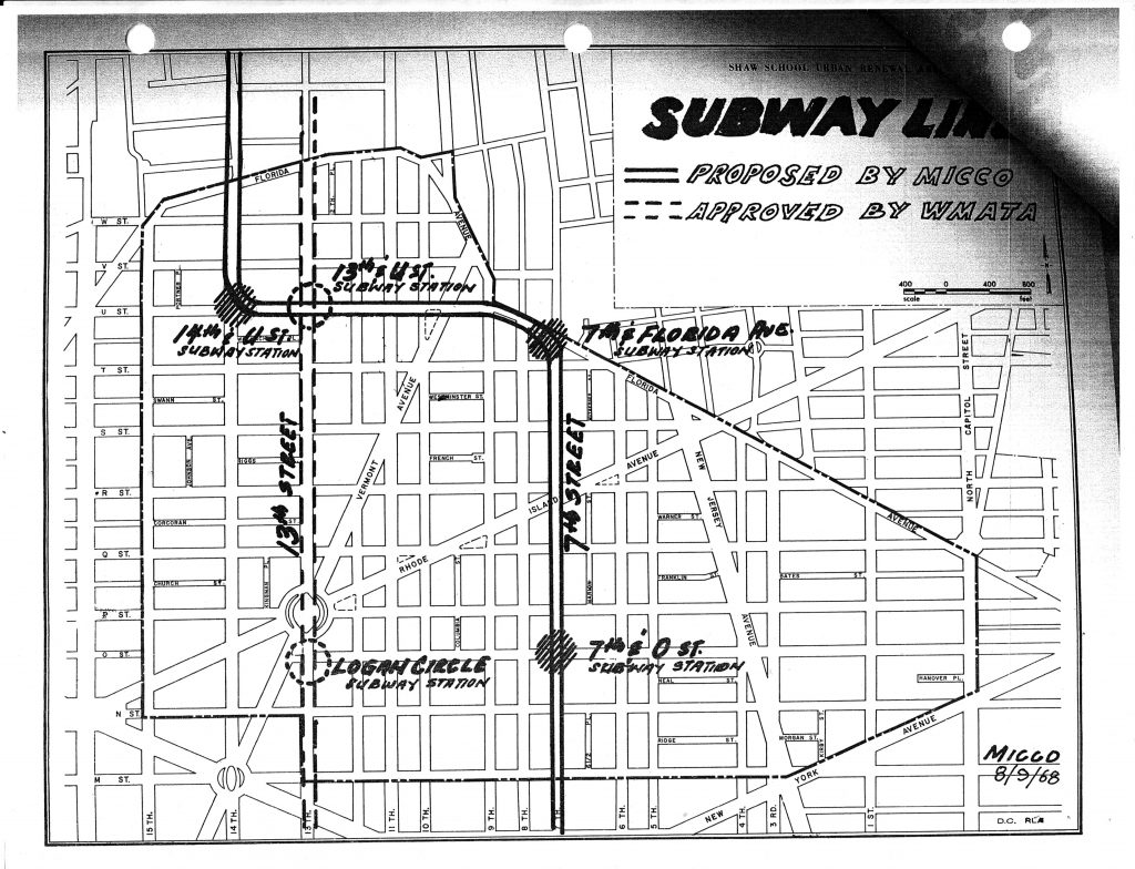
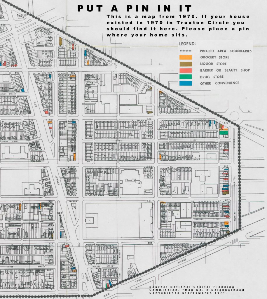
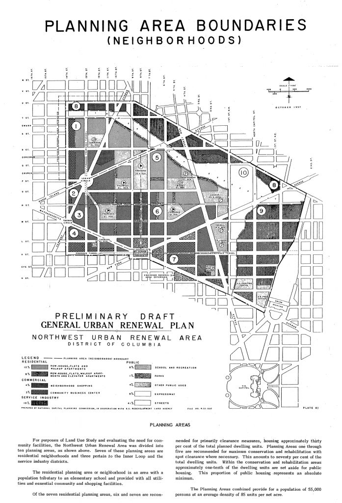
Specifically, the Hanover project grant states that the Hanover neighborhood is “bounded by P Street NW, North Capitol Street, New York Avenue NW and 1st Street NW”. This is inaccurate. According to the Shaw School Urban Renewal Plan, the historic borders of the Hanover Street are limited to Hanover Street.

I haven’t seen anything in the SSURP defining smaller areas, but then again, I haven’t seen the SSURP in its fullness. But the borders cited by the Hanover people are the same borders they’ve been citing for the last 5-6 years as their section of the TC, as opposed to the Bates Area. I’d hope that if we went hunting for grant money for just BACA it would not be limited to Bates Street and denied to Q, R, 4th, 3rd, 1st and North Cap.

Therefore, the grant applicant’s request for a Truxton Circle banner on 1st NW is inaccurate. According to the text “Washington DC, Past and Future ” the former Truxton Circle was located at the 1600 block of North Capitol Street NE, not in Old City, Bates Shaw East community. Additionally, there was not and is not a neighborhood called Truxton Circle. It was a landmark, not a neighborhood.

I already did the when the TC was a neighborhood and not a landmark or a post office in another post. And I can’t find Washington DC, Past and Future in Amazon or Half, nor is an author cited. I did a Google search and came up with nothing, which leads me to think this might be an article, and if that is so citing the journal would be nice.
There was some other stuff, but to go over them would be nitpicky. We’re all human and prone to error. One of the undersigned in the counter grant letter had nicely pointed out a typographical error on my main site. I am thankful for that correction and in the same spirit of neighborliness, while having differing opinions, I suggest that in this public sphere argument, stronger citations and proof be brought forth. Meaning, if you are going to cite a source if it is a book or article cite the title and author and journal if applicable. If it is an oral history, interviewee, interviewer, date and repository where the interview is housed. And if anyone has a question about any of the sources I cite or use when asserting a statement as fact contact me if you feel that my bibliography or citations are incomplete. The idea is to let you the reader and member of the public review the research for yourself (should you decide to drag yourself to the MLK or the historical society’s library) and decide.

Old City

I am getting the feeling that few people have any idea of what the heck I’m talking about when I mention Old City. Much less Old City II. Some of you know it as the area mentioned on the real estate database with the tax office.
Because I don’t have a neat little book at my side saying so, nor am I sitting in the Washingtonia room at the MLK, please allow for some error. And if there is error, please correct and cite source.
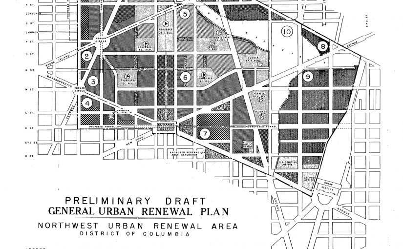
I’m 89% sure the map shown in this post is of Old City. Basically, it is the L’Enfant drawn city, within the District of Columbia. So, there is Georgetown, which isn’t part of Old City, it is labeled #7 on the map. Then there is the Old City, which are Police and Fire Districts 1-6, and there is the rest of Washington, which isn’t shown anywhere on the map.
I don’t think of Old City as a neighborhood. It is a city, a very small city in the District of Columbia. Georgetown, a town, in the District of Columbia. Everything else, farmland. And like a lot of farmland in our nation’s history, got gobbled up by developers and turned into communities. Oh, sometime in the late 19th, early 20th century.
So are we clear?

What makes Shaw, Shaw?

I posted something on Shaw Rez’s blog that made me think I should just post here instead of ranting there.
What unites us? What makes Shaw, Shaw, and not Glover Park or Fort Lincoln or Avondale? What makes the stuff that falls outside of the borders (and for the sake of argument I’m sticking with every neighborhood that falls within the border, whether they like it or not) different and within the same? And does it hold true over time?
The easy answer, which I’ve been pointing to over and over and over again like a broken record is the Shaw School Urban Renewal Area hashed out by the Redevelopment Land Agency and the National Capital Planning Commission and any other government body that wanted to ‘fix’ the area in the 60s and 70s. But there is a past, preceding the creation of those borders, and possibly the creation of the school’s borders, with various notables ‘passing through’ and buildings of various sorts being built for various sorts for various reasons. And in the past and the present there is the hard answer of what makes Shaw, Shaw.
Just sticking with the present, what makes Shaw, Shaw? I’m going to say there is probably not one answer. And I’m saying that because I know I’m going to leave something out. First thing that comes to mind, right now, lunchtime on a Wednesday, is the amount of ‘affordable’ and public housing that exists with private and market rate housing in the same space. That is part of the character because it puts people of various income levels together in the same neighborhood. It puts services and service organizations that serve and advocate for the poor, in the neighborhood. If you want to talk history, you can find bits of or ghosts of“the Great Society” in Shaw. Anyway, those things play a part in the character.
There is more but my lunch hour is over with.

The Plan & Wiki

Not the Florida Market Plan. Another plan. A plan that I thought was born in the fifties and sixties and died possibly in the 90s. But like an aging celebrity you thought was dead because you haven’t heard about them doing anything recent, this thing is still alive too.
I write of the Shaw School Urban Renewal Plan. Poking around the National Capital Planning Commission website I found the plan, buried down the list:

Shaw School Urban Renewal Plan, Washington, D.C.
7/7/05, Modifications to the plan

So, it was adjusted in 2005, for what I don’t know, but that hints that The Plan is still alive. Admittedly, I’m too lazy to walk over and ask for a copy of The Plan from their offices, and they might charge me for it. The District Government may also have a copy of The Plan, but I fear it is in the hands of the Department of More Important Things, where they never return your phone calls and really that’s handled by someone else.
*****
Another thing I noticed poking around on the Internet, was the Wikipedia entry for the neighborhood formerly or currently known as the Shaw School Urban Renewal area. “Shaw, Washington, DC” has in it’s history that

Shaw grew out of freed slave encampments in the rural outskirts of Washington City. It was named after Civil War Colonel Robert Gould Shaw, the commander of the 54th Massachusetts Volunteer Infantry.

Can anyone provide a dead tree reference for the slave encampment part? I’m aware of encampments around the city, and the big Freedmen’s camp was out in Alexandria, not so much one notable here.
And this is one of those moments I wish the African American papers were in an accessible database. ProQuest allows me to search the Post back to the late 19th century, but it was the white paper, and up until the Shaw School Urban Renewal Plan, the Post called this area the 2nd District. I’m curious about what Black residents called the area prior to The Plan, well besides Northwest.

Fun with ProQuest: Bates Street gets shafted

I started a new search “Bates Street” between 1950 to 1990. I decided to focus on Bates because of some of the rehab projects that were to take place in the first Marion Barry admin on the street.
One 1969 article got my attention and I’m just going to quote it:

…said its first ghetto aid effort was expected to be in the Bates Street Project — part of the Shaw redevelopment plan.
Later a spokesman…. said in Washington that the initial phase of the PIC plan will probably be shifted from Bates Street to a block of 8th and 9th Streets nw., bounded by S and T.
Russo said the RLA now feels it would be better to start in that block, with 25 houses on 8th Street and 20 on 9th Street.

Ronald Russo was the spokesman for the RLA. The RLA was the Redevelopment Land Agency. PIC was the People’s Involvement Corp, a federally funded group. Ghetto and slum are words the Washington Post used [past tense] to describe our neighborhood. They just use ghetto now and then these days.
Addition:
I’ve waded through several “Crime and Justice” articles to get to the next quote and let’s say, I’m depressed.
Anywho, in a Jun 1971 article:

Two years ago, at a convention in Atlantic City, the league pledged $7 million toward the Bates Street project. “This soon became hopelessly involved in government red tape and citizens’ indecision,” league president Thornton W. Owen said recently, “so that any tangible activities in this area in the near future seems highly improbable.”

Bibliography:
All articles from the Washington Post
“S&Ls Pledge $7 Million For Homes; Rehabilitation” by S. Oliver Goodman. June 1, 1969. p. 125
“Firms To Fund Housing; S&Ls to Build Huge Project For City Poor” by William H. Jones June 10, 1971. p. B1

Shaw History

For the rest of the week, maybe the rest of the month, I haven’t decided, I will refer to Shaw by one of its original names, the Shaw School Urban Renewal Area. Okay, that’s too many words, for the rest of this post SSURA.
Anywho, while going through some papers, I came across something mentioning the Shaw PAC. In 1984 the PAC appears to recognize the borders of Shaw as the city did when it was starting to renew the Shaw School U.R.A., being 15th to N. Cap, Florida to N, M, & NY Ave.
Yet the reason I write, I decided to look up info on the Shaw PAC on the web and found a resource that has some decent DC history, the George Washington University Library. Within their archive are the papers of David A. Clarke, and they have a folder list which lists the Shaw PAC, as well as some other things of interest. I am curious as to what they have on BACA and the Bates Street block club and other community groups. So besides the Washingtonia room at the MLK and the Washington Historical Society’s archive, you can find materials about DC neighborhood history at the various universities (Catholic, Georgetown, & George Washington) and federal institutions like the National Archives and the Library of Congress.

Fun with ProQuest: Truxton Circle pt 2

Find part 1 here
The name Truxton Circle is somewhat controversial. There are residents of the TC who loathe the name and will on occasion mention how offensive the name is. Personally, I have no problem with the name, and it was the name on the map at the Washingtonia room at the MLK Library. It is a decent description of this eastern side of Shaw
The circle that Truxton Circle is named after is long gone. The man the former circle was named after, Revolutionary war vet Thomas Truxtun, is long dead, and we couldn’t bother spelling his name right and nobody ’round here really cares who was anyway. Regardless of all that, the name has stuck. Fun with ProQuest is simply tracking the name and its use in the Washington Post.
So up until the 1940s Truxton Circle was a traffic circle. Then circle go bye-bye. The next time Truxton Circle appears in the paper is in the 60s when it is a Post Office area. In 1964 the Truxton Circle postal annex at 17 Florida Avenue NE was robbed at gunpoint. Most of what I found in the 60s was in relation to the post office. The closest in this period of it being a neighborhood name or an area name is a classified ad in 1963 listing an address as “Box 26001, Truxton Circle, Wash, D.C.”
Nothing in the 70s. Nada.
Then in 1984, the city somehow christened the area as Truxton Circle when it was launching a subsidy program to encourage home buying in the District. Truxton Circle was one of the target areas, which also included “Columbia Heights; Shaw-Westminister, Carollsburg, Capitol Hill South….” Yeah, now I’m wondering what was so wrong about the area that it had to be a target area. The other funny thing about the 1984 article was the description of the program:

What the loan terms are: Fixed interest rate of 11.39 percent for 30 years. Buyer pays 1 point and seller pays 2 points.

Eligible candidates were to be first time District home buyers making less than $42,960. I was making less than that in 2000. Anyway, from 1984 on Truxton Circle was a neighborhood as far as the city was concerned.
I’m open to researching (light researching) the other possible alternate names the area may have held.

Bibliography:
All Articles from the Washington Post
“Classified Ad 343” Sept 22, 1963 p. G6
“2 Gunmen Rob DC Postal Annex of $2000, Shut 8 in Rest Room” by Alfred E. Lewis. Sept 3, 1964 p. A1
“Postal Machines, Men Move Mountain of Christmas Mail” by William Clairborne. Dec 7, 1972. p.A36
“Subsidy Program’s Nuts and Bolts” August 2, 1984. p. A15.

Monday Miscellany

Well the dinner honoring Our Great Leader Jim James Jimmy Berry, former ANC for the TC, this weekend was successful. A fair number of mucky-mucks, like David Catania, showed up to honor Jim. Some of us learned a lot about Jim that we didn’t know. Like, hey he got married 4 months ago and she’s quite pretty. But the main thing was Jim’s leadership, not just with the ANC but in his professional and personal life. He is a humble man who serves, and his leadership was for all, newbies, old timers, all races, everyone. He was what was right with the ANC system.
Mentioning the ANC system, I’m a little fuzzy on aspects of the history of ANCs in the District, but I gather they came in with Home Rule (I dunno) and did what the various civic and citizens associations were trying to do. I will post a “Fun with ProQuest: Truxton Circle pt II”, but while trying to figure out what was going on with the citizen’s association covering the area that can be now described as the TC, I learned a little (just enough to be dangerous) about the neighborhood associations. I knew, because of B.’s research on DC stadiums, that citizen’s associations were the white groups and the civic associations were the African-American groups. Whatever citizen or civic association held sway over the area, so far what I’ve found are really dull names, North Capitol Citizens(?), Northwest Civic, Central Civic, and Central Northwest Civic Associations. So, I’m going back to searching just Truxton Circle.
If you are just dying for me to mention something about the house, well Sunday we taped out the layout of the upper floor. It appears that I might have an extra foot that I didn’t think I had. When I was measuring I had to employ my poor math skills. So the plans I drew up were more of a guide, because I’m using that extra foot for the small bedroom. Looking at the 2nd floor with no walls made me realize how friggin small these houses are and every inch is valuable. Which is why I nixed (along with financial concerns) the contractor’s idea to make the stairs normal sized. The stairwell is less than 3 feet wide, and probably is a little over 2.5 feet. He mentioned widening the stairwell would make it easier to get furniture and other bulky things upstairs. Um, bulky stuff don’t belong upstairs, because that whole not having a whole lot of space to begin with thing.

Fun with ProQuest: Truxton Circle pt I

I ‘heart’ ProQuest. It allows me to post on things historic without having to do to much work. Anyway, another part of my lazy posting because I have no pictures of the renovation right now….. Fun with ProQuest: Truxton Circle.
Using the all articles prior to 1968 in the Washington Post and all other papers it ate (like the Washington Star), the first mention of Truxton Circle is August 1891 regarding the District Surveyor. Then the name appears again in 1900 regarding shrubbery, which then just makes me think of the Holy Grail. A cursory look at the rest of the articles bringing up the TC in the 1900s refer to the circle as just the circle or a park, not so much a neighborhood, unless you count “near Truxton Circle”.
That “near Truxton Circle” thing appears in an April 27, 1919 article regarding house sales where it is written:

For Robert M. Harper, 51 Q Street northeast, an attractive six room and bath house near Truxton circle, at consideration of $3,500. Mrs. Henry Price has purchased this property and will occupy it as her home.

The same article does mention “1766 Church street an attractive residence in the neighborhood of Dupont circle….” So Dupont is a neighborhood, the TC, not so much. And we see it again more as a landmark than as a neighborhood designation in another house sales article from November 20, 1920, where a house on the 100 block of Bates street is “located near North Capitol and Truxton Circle” and 1842 North Capitol Street was “located in Bloomingdale.”
However I do see something very interesting in an April 26, 1925 article “Ryan Quits Central Citizens’: Will Head Movement to Form Another Association in Same Territory. Section called too big” The section Francis J. Ryan decides to chop up for himself was to “have as its approximate boundaries New York avenue to Truxton circle, and New Jersey Avenue to North Capitol street.” My, that sounds awfully familiar.
Well I need to pursue this further, doing another search, so maybe part II.

Bibliography:
THE DISTRICT SURVEYOR.; Recommendations About the Preservation of Plats and Records.
The Washington Post (1877-1954). Washington, D.C.: Aug 1, 1891. p. 5

ASKS DISTRICT TO PAY; Dog Catchers Caused Injury to a Bicycle. CHASED BULLDOG, BROKE A WHEEL Animal in Attempting to Escape the Net Ran Into the Bicycle of P.J. Nee, Who Claims Damages — District Auditor Approved Application and Recommends Payment — Plants from Mount Vernon Square to Decorate Other Reservations.
The Washington Post. Mar 15, 1900. p. 12 (1 page)

SALE OF SIX HOMES SHOW PRICES HIGH
The Washington Post (1877-1954). Washington, D.C.: Apr 27, 1919. p. R6

$110,500 IN SALES OF HOMES IN CITY; Houses Fetch $17,500 Disposed by Hartung & Gibbons.
The Washington Post (1877-1954). Washington, D.C.: Nov 7, 1920. p. 34

RYAN QUITS CENTRAL CITIZENS’ PRESIDENCY; Will Head Movement to Form Another Association in Same Territory. SECTION CALLED TOO BIG
The Washington Post (1877-1954). Washington, D.C.: Apr 26, 1925. p. 2

I have an old house

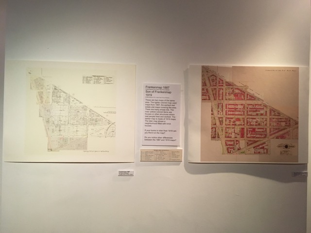
I found out that my house was built sometime between 1871 and 1873, somewhere in there. Because of the tax assessment for my house did not show up in the 1869-71 assessment, but big as day in the 1872-1873 assessment as a brick house worth $1000. These assessments are located on microfilm at the MLK library in the Washingtonia division. Well at least the 1874ish one. 1860something to whenever in the 19th Century is located at the National Archives downtown, record group 351, entry 49 (or 46, 40something, I forget). I don’t know if the Washington, DC Historic Society has it too.
If you are going to look at property assessments know your square number and your lot number by heart. It also helps to know around about what time your lot existed. My block in the late 18th century was subdivided into 6 to 8 lots. In the late 19th century it was divided further and my lot became into existence.