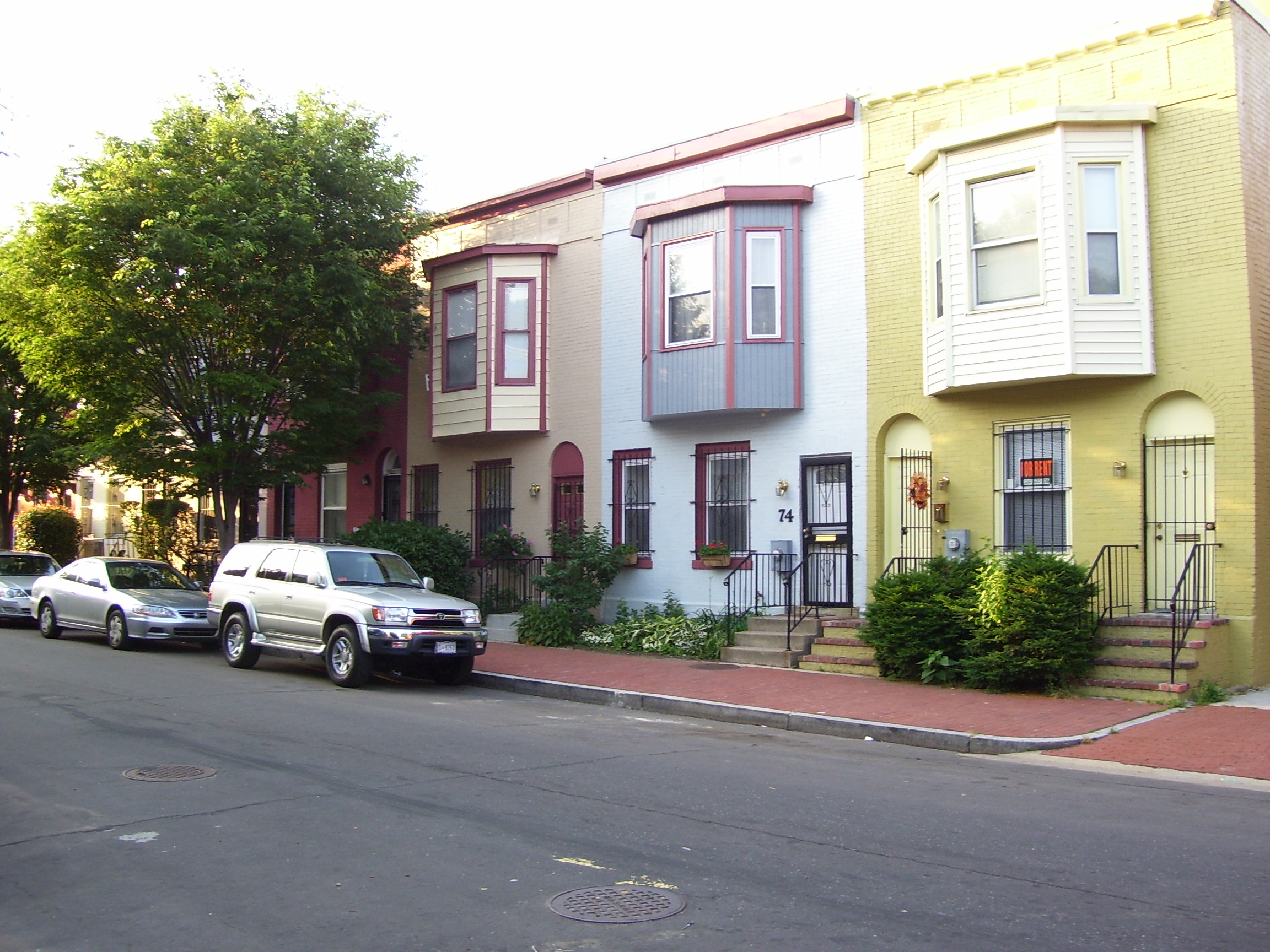
There was a great turn out for the Neighborhood History and Housing session for the DC History Conference at the MLK Library. I ran into the amazing Scott Roberts. I had a handout, I’m not sure he got a copy. And for those of you who want to know what resources you can tap into to do similar histories take a look below:
DC Public Library– https://www.dclibrary.org/
Under Research & Learn (DCPL library card required)
Ancestry (AncestryLibrary)- https://www.dclibrary.org/research-and-learn/ancestry-library-edition
Historical Washington Post (ProQuest)- https://www.dclibrary.org/research-and-learn/washington-post
Library of Congress– https://www.loc.gov/
Chronicling America/ Evening Star – https://chroniclingamerica.loc.gov
 Sanborn Fire Insurance Map for DC (volume 2)- https://www.loc.gov/item/sanborn01227_003/
DC Recorder of Deeds (online land records)- https://countyfusion4.kofiletech.us/countyweb/loginDisplay.action?countyname=WashingtonDC
Find A Grave– https://www.findagrave.com/
National Archives & Records Administration– https://www.archives.gov
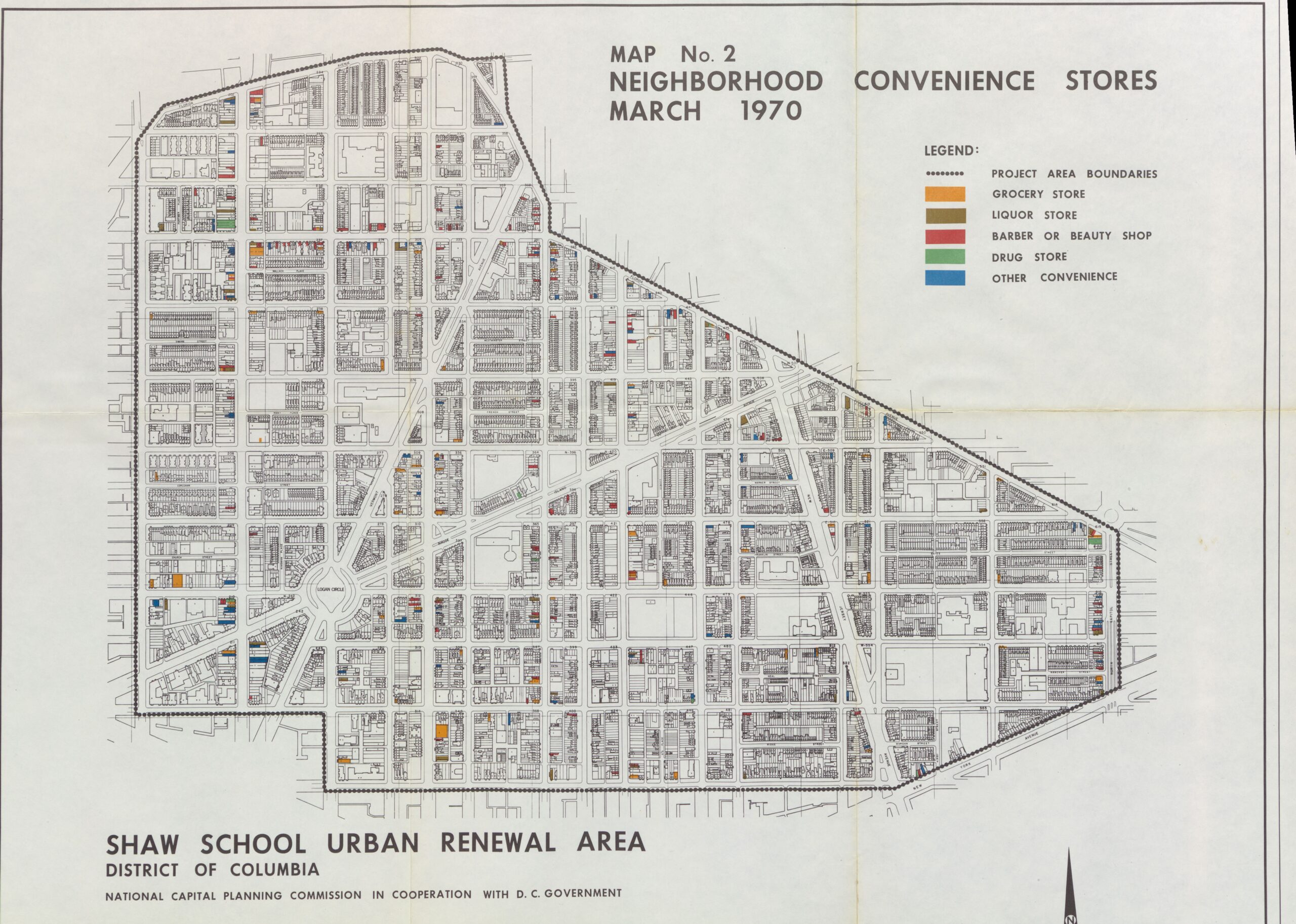 Map No. 2 Neighborhood Convenience Stores; Records Relating to Urban Renewal, 1934–1998, entry A1 13, Records of the National Capital Planning Commission Record Group 328, National Archives Building, Washington, DC. (NAID 784266)
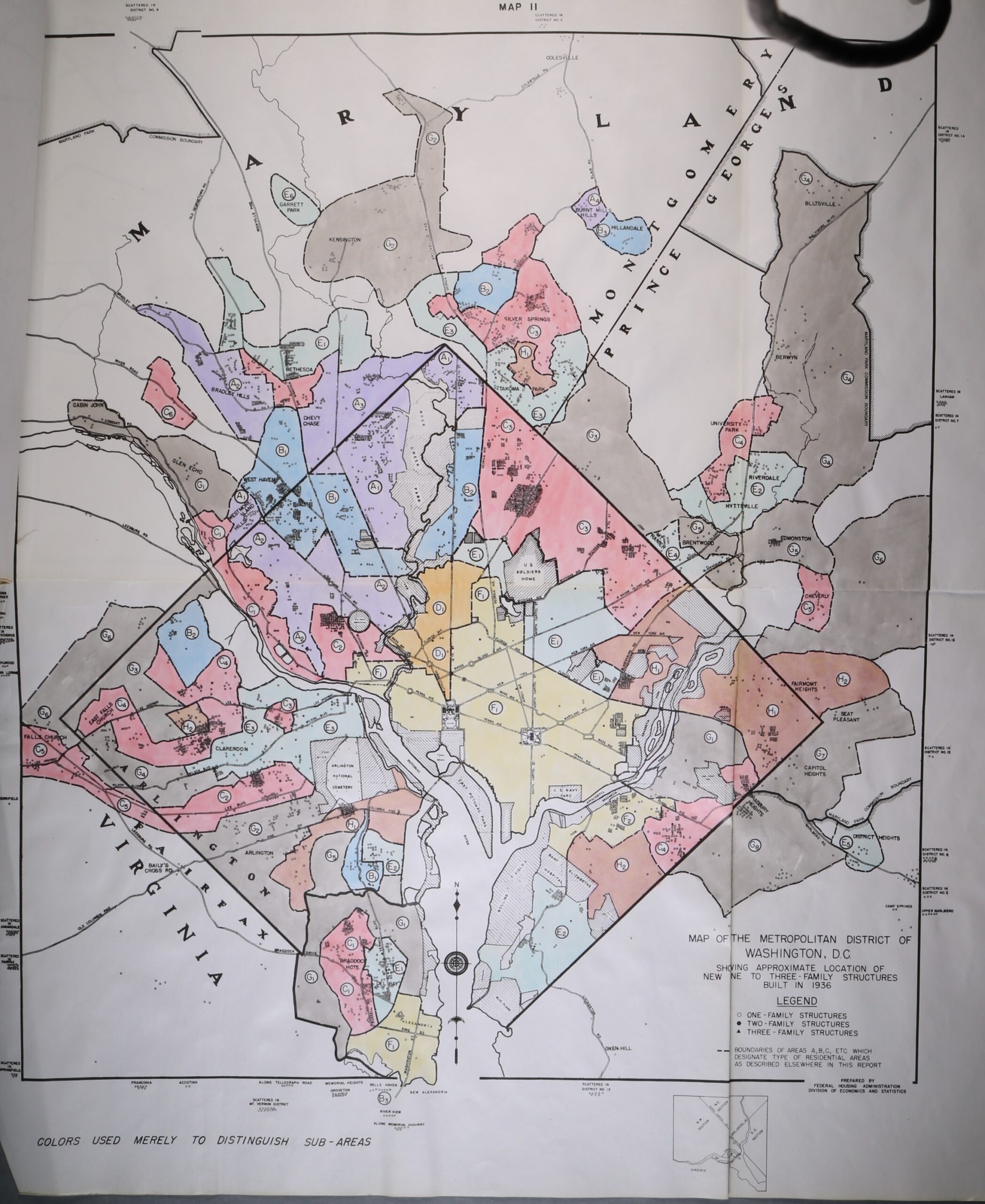 Map of the Metropolitan District of Washington DC, 1936; file Housing Market Analysis Washington, D.C. July 1937; Records Relating to Housing Market Analyses, 1940–1942, entry A1-6; Records of the Federal Housing Administration, Record Group 31; National Archives Building, College Park, MD. (NAID 122213881)
..and I managed to leave this one off- also from the National Archives. AND I gave the wrong citation. oops.
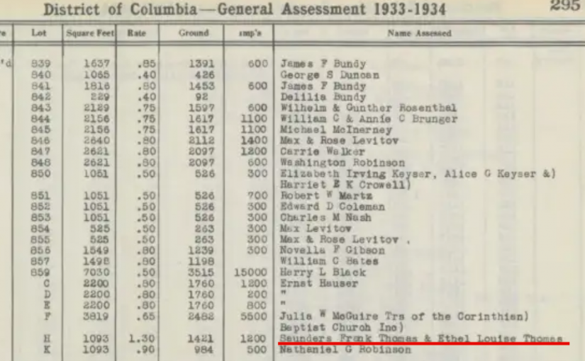
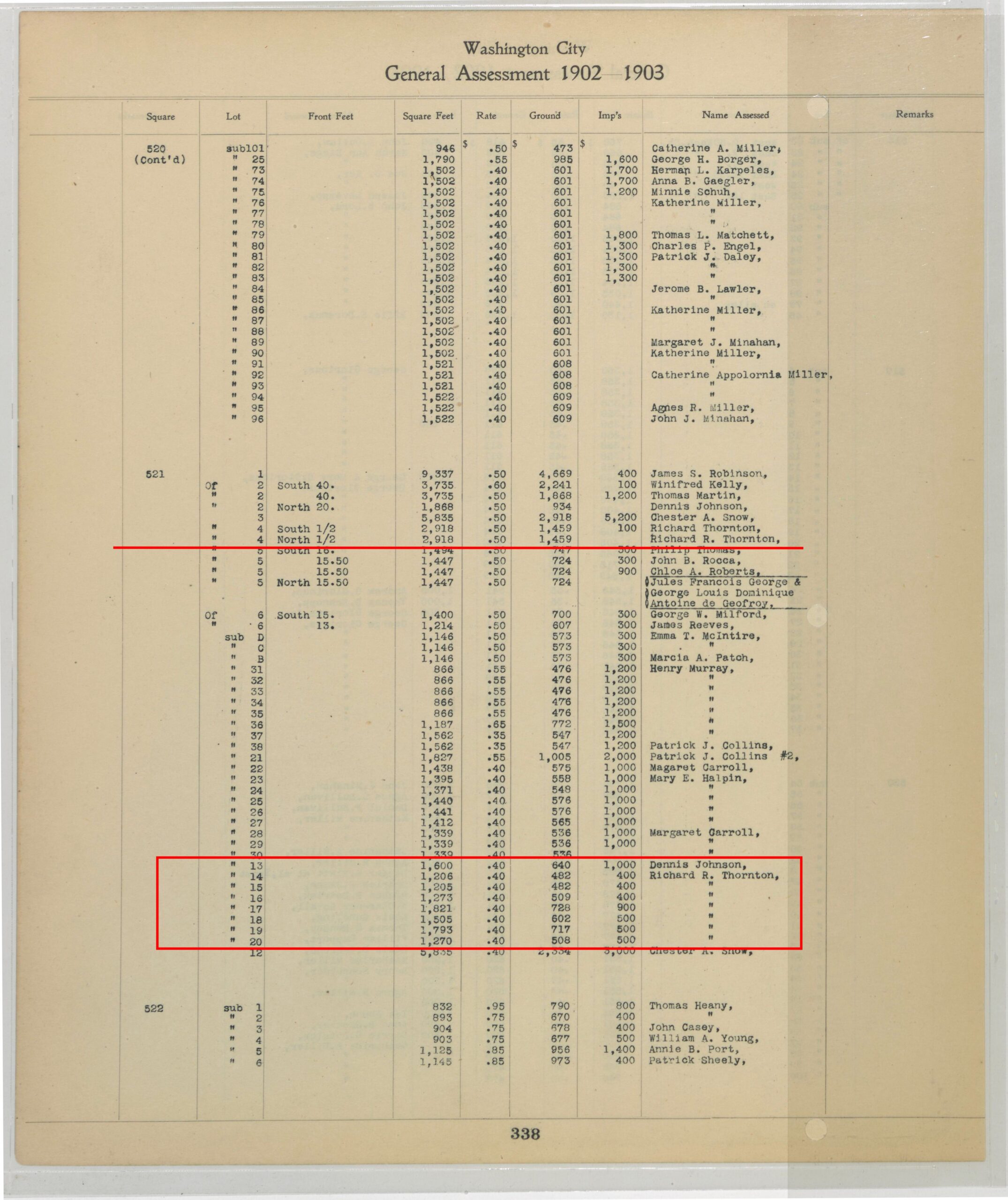 General Assessment 1902-1903, Volume I, Squares 459 to 555, Page 320; General Land Assessment Files, 1902–1938; Records of the Government of the District of Columbia Record Group 351; National Archives Building, Washington, DC. (NAID 145723973)


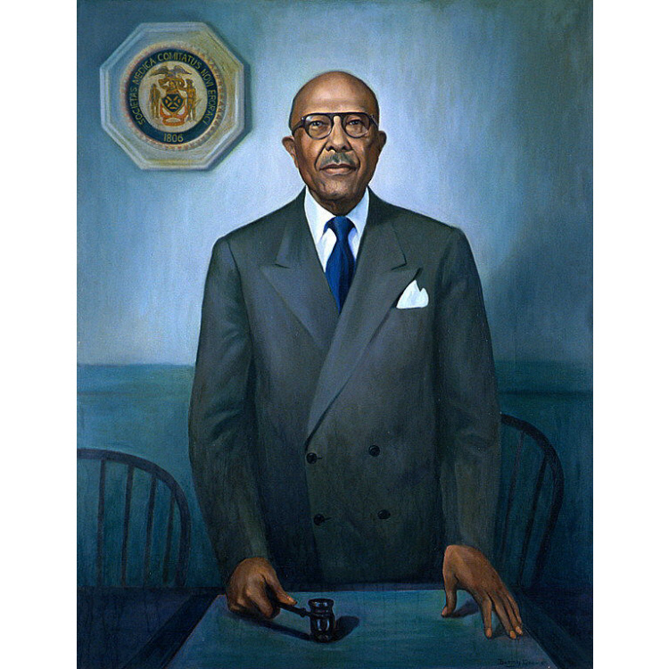 We have Dr. Peter Marshall Murray who was president of the National Medical Association and who lived at