
Back in 2017, I and two artist neighbors set up an exhibit at 410 GoodBuddy called The Triangle Known as Truxton Circle. I have a few things sitting on my computer from the exhibit that I’d like to share. Between no childcare and attempting to telework in less than ideal conditions, yes, I’m not posting much. But I can post this from the exhibit.
Below are two maps I created from older maps. The thing was none of the old fire maps had Truxton Circle on one map. I had to piece the maps together from several maps, just as Dr. Frankenstein pieced together his creature. I sold the older view of the TC and have kept the 1919 map for myself.
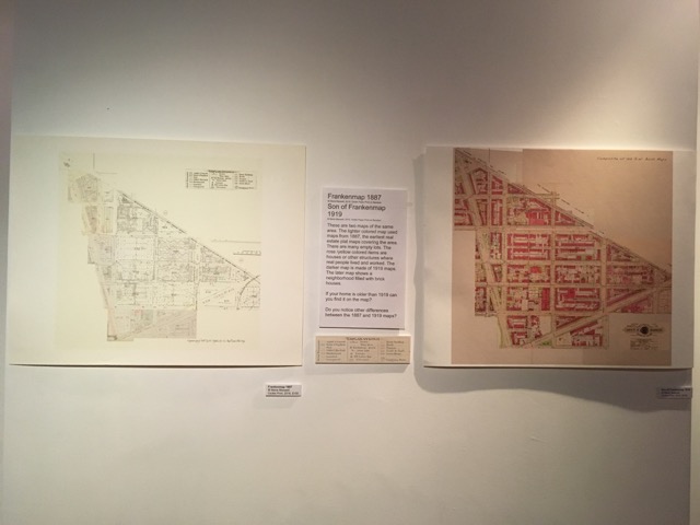
Frankenmap 1887
2016, Giclée Paper Print on Bamboo
Son of Frankenmap 1919
2016, Giclée Paper Print on Bamboo
These are two maps of the same area. The lighter colored map used maps from 1887, the earliest real estate plat maps covering the area. There are many empty lots. The rose /yellow colored items are houses or other structures where real people lived and worked. The darker map is made of 1919 maps. The later map shows a neighborhood filled with brick houses.
If your home is older than 1919 can you find it on the map?
Do you notice other differences between the 1887 and 1919 maps?