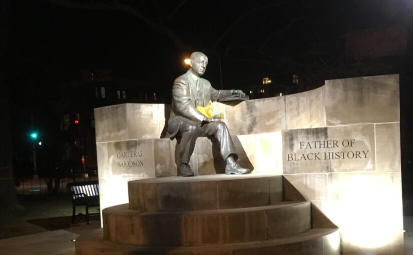
Property owners of Truxton Circle– The Bundys

Just out of curiosity I’m going to revisit an image I used regarding an African American female homeowner. But she created a mental roadblock and I lost my rhythm.

Landowner list of Sq 551

This image is part of the 1933-34 property tax assessment page for part of Sq. 551, which is between R, 3rd, Q, 1st and Florida. Continue reading Property owners of Truxton Circle– The Bundys

Doomed History

There is a saying, that those who do not learn from history are doomed to repeat it. And then there is another saying, “This time it’s different.” Both can be true.

111-LC-52730
Shaw destruction appeared in minute 13 of the original 19 minute clip. This is only 10 mins.

In 1968 Shaw, and some other areas, experienced an uprising, a riot, a civil disturbance, or whatever you choose to call it. Buildings were burnt out, stores were looted, windows were broken and it took 30 years for the neighborhood to come back.

I am concerned about the neighborhood and what may happen after Election Day. I’ve been predicting presidential elections correctly since I was 10. Y’all ain’t gonna like the results, so I’m taking Desctructo-kid and hanging out with friends in the boonies of Maryland for a while. I could be wrong. If so, it’s a little vacation. [UPDATE 11/9/20. It looks like my prediction streak hit a snag. Well as long as the people are happy, so be it.]

Our block fared okay in 1968. It should be okay. However in 1968 businesses on the corner of New Jersey and Rhode Island were damaged.

Most of the damage Shaw experienced in 1968 were along her commercial corridors along 14th, 9th, and 7th Streets. Black businesses were hit as well as white and Asian businesses and property.

Southeast on 7th and M Street, 1969

The destruction brought neither justice or peace. It did hasten building public and affordable housing because it also made neighborhood property cheaper. The thing with urban renewal is that the government buying the property gets to value to the property. And in minority areas, the government doesn’t pay top dollar.

Yes, this time it is different. Shaw isn’t a slum. But this time there are struggling businesses on the edge, as there was in 1968. COVID-19 has made it a sad Darwinist contest of survival of the fittest businesses. I just hope we never see the days of burned out husks of buildings and rows of empty storefronts again.


Black Homeowners of Truxton Circle- The Garretts of 1408 3rd St NW

I’m gong to try a different angle since I am still discombobulated about someone who lied to the Census. This time I just decided to look at my big old Truxton Circle 1880-1940 database and pick one. Since the online records for the Recorder of Deeds starts in 1921, I figured starting with the 1920 Census was safe.

I picked John W. Garrett of 1408 3rd Street NW (SSL:W0553-0810) who was listed as a mulatto (African American)  Engineer and head of household. In 1920, Mr. Garrett was a 70 year old West Virginia native living with his 2 daughters Beatrice E. Garrett and Armetia M. Johnson and 7 year old granddaughter Marjorie Johnson. By the 1930 Census Mr. Garrett had died, Armeta/Armetia was listed as the head and her 1920 sister was now her partner? (head tilt) Both Beatrice and Armeta were dressmakers, probably self employed dressmakers. They could have been in business with each other. In 1940 the inhabitants of 1408 3rd are listed as renters, including Beatrice Jarrott, which sounds awfully like Beatrice Garrett. They could be the same person, but the ages don’t line up. She could have lied about her age, adding on 10 years in the 1940 census.

The Recorder of Deeds has Beatrice Garrett showing up in May 1951. I am not 100% sure how to read deeds and other property documents, so it appears to me that she and Marjorie Ellen Rand sold the property to Violet M. Barbour. Could Marjorie Rand be the same Garrett granddaughter listed in the 1920 census?

1957 Church Survey: Third Church of God

Okay I had to look at the old Shaw map to figure out if this was in Mount Vernon Square or Shaw or both. The answer is both. The Mount Vernon Square historical district overlaps with parts of Shaw.

Commercial Building Map
Map of Shaw for 1970 Commercial Buildings

The the other question was, “Is this the church on New Jersey Ave?”  Yup, 3rd Street, New Jersey Ave, same diff apparently. That little section between Morgan and New York Avenue, has northbound traffic going on New Jersey and southbound traffic on 3rd Street.

The Third Church of God appears to continue on as the Third Street Church of God. In the 1957 survey their address is listed as 1204 3rd Street NW. Looking at their history listed on their website they wrote: Continue reading 1957 Church Survey: Third Church of God

Twinning School of Truxton Circle

This is from the pile of stuff I have on my computer about DC History and while reviewing Church Survey uploads that hadn’t a lot of views, I noticed this one. I got this from the Sumner School Archives, a great resource and it is from DCPS Public School Buildings Past and Present, which appears to be an unpublished manuscript.

The Twinning School used to be a school at 3rd and O Streets NW. It was an 8 room school house built in 1883 and demolished sometime around the time Dunbar expanded. When it served as a school it was a segregated white school. It appears that it served as a school for white students until 1918. It became a school for African American students in 1925. In 1930 the Truxton Circle neighborhood was predominately African-American. It soon got absorbed by Armstrong on the other end of the block and became an auxiliary building. Now there is an empty field where it stood.

Twining School by Mm Inshaw

1957 Church Survey- New Hope Baptist

Some Church Survey posts are chock full of information, and some got nada. And that is New Hope Baptist Church.

CS 49 New Hope Baptist by Mm Inshaw


I looked up the address on Google and according to Streetview, the True Gospel Baptist Church is at that spot now. And just for my own records the SSL now is 0303-0052.  This page barely has any useful information, except the name of the then pastor Rev. Truman Dixon who lived on the premises at 1104 W Street NW.

1957 Church Survey: National City Christian- Random church not in Shaw

I know it has been a good long while since I’ve put out the church surveys, so here’s a quick refresher. So the city and other authorities conducted a survey of churches in the Northwest Urban Renewal Area, which was a precursor to the Shaw School Urban Renewal Area, which is just now known as Shaw. The thing is there was never a survey like this one ever conducted again. The survey included steeple churches, storefront churches and even little house churches. And the churches that did bother to answer most of the survey questions provide a wealth of demographic information.

Today’s church is National City Christian Church at Thomas and 14th Streets NW. It’s just outside the Shaw boundaries.

CS 61 National City Christian by Mm Inshaw

Looking at their survey response, in 1957 they were a large white middle class church with about 2000 members. Now looking at their website, they appear to be more multicultural as they have a 11AM Sunday worship service in Spanish.

It’s hard to say if they were a commuter church in 1957. About 40% lived in the suburbs of Maryland and Virginia, but half of the congregants lived somewhere in DC. Just not in the survey area, that was 10%. That makes sense as they were Downtown, and not a lot of people lived Downtown. Not did many of their congregants live in Shaw. But Dupont and the West End are sorta in walking distance.1957ChurchMap


No Longer Housing for the Poor

So another house on my block is up for sale, however it isn’t listed on the MLS. Zillow allows people to sell their homes without an agent, and so it is a for sale by owner (FSBO) thing going on.

tan-and-blue-townhomes

It’s the blue house and the owner has listed it at $760K, rounding up. Zillow tells me that with a 10% down payment, it would be less than $4,000 a month, 20% then $3216 a month. So one would need to be fairly middle class to afford to purchase this home on this lovely block. Whenever we can get our own house on the market the same would apply as the price point would be in the same neighborhood (get it?).

This was the house Drama Momma used to live in. I suspect when she was there it was a Section 8 house. The owner then was a Black man who owned another house that had a much better, more neighborly and quiet Section 8 tenant. However, 2008 happened and the real estate bubble burst and he was forced to sell the properties.

That owner sold the house to the current owner. Joe, the current owner, lived in the house for a little bit then rented it (market rate I think) to two wonderful neighbors, a married couple. They rented it for years and it was great having them on the block as they added to the awesomeness that is and was the 1600 block of 4th St. But they moved. [sad face]

It has been well over a decade since it was last poor people housing. The current economics and housing market means it won’t be poor people housing again any time soon. The approved rents DC Housing would cover for a 2 bedroom without utilities,would not cover the estimated monthly payments for the owner.

Now going back to the 1880 census, this was poor people housing. Check out TruxtonCircle.org for the data. In 1880 the house was occupied by William Tadd or Todd, a black Laborer, his wife a laundress and their 20 year old son. They lived there along with the Wheeler family, headed by another William, a carpenter. His wife did not work outside of the home as she was caring for their 5 year old son. In 1900 the house was no less crowded, with 8 residents, several laborers, but all one family. In 1910, the 6 occupants were one family with a male breadwinner, a porter, and his mother in law was a “domestic”. By 1920 the number is down to 5 people, but it is headed by a widowed charwoman, who with her nephew had three male roomers, whose jobs were listed as Helpers. But in 1930, the widow was married, but still head of a household of two. The young man listed as her 6 year old nephew became her 17 year old cousin. In 1940 he returns to being a nephew and she returns to being a widow (retired?) and they gain an unemployed female boarder. The nephew in 1940 was a doorman.

Knowing the general history of the neighborhood between 1940-2010, it was more than likely remaining housing for the working class and poor. All the residents between 1880-1940 were renters. So it’s been rental for well over 100 years, with the odd blip of Joe living in it.

The Triangle Known as Truxton Circle: Beans!

Back in 2017, I and two artist neighbors set up an exhibit at 410 GoodBuddy called The Triangle Known as Truxton Circle. I have a few things sitting on my computer from the exhibit that I’d like to share. Between no childcare and attempting to telework in less than ideal conditions, yes, I’m not posting much. But I can post this from the exhibit.

BEANS!
2016, Mixed Media

This picks up where Change 1880-1940 leaves off. Each bean represents a single person. Each container represents a census year. Each year is different.

Compare the different years.

What is going on here?

Why do you think some years have more people than others?

The neighborhood continues to transform.

So hopefully you’ve read the previous blog post Change 1880-1940, which were a set of maps showing patterns of households in Truxton Circle by race. Since the 1950 census wasn’t out (it will come out in a few years), I could not create a map. Brian Bakke, one of the artists in the show, suggested I show (somehow) what happened after 1940. I came up with Beans!

Triangle Known As Truxton Circle

I could figure out easily how to show Black and White individuals. Black beans and white Navy beans. For everyone else, that was a struggle. I had to find a bean that was around the same size as the other beans AND visually different from the Navy beans. That wound up being the Pinto bean.

Change 1880-1940 w BEANS 1950-2010Looking at the various containers of Beans! the neighborhood is almost exclusively African American in 1960. And you may notice the number of residents (each bean represents one person) from 1950 has decreased a little bit by 1960.  In 1970 the number goes down a bit more, but you might not notice. By 1980 the number of residents had significantly decreased in a noticeable way.

I remember being asked why was the population going down. There are various reasons, but the one I mentioned was the role of women changing. In 1950 African American kids were more likely to be raised in a two parent household than not, with mom at home. Here come the late 1960s and the Sexual Revolution and households got smaller. Women have less pressure to get married and have kids, or have kids at all.

There is also another change in the 1980s, a lot more other racial categories than Black or White show up. So more Pinto beans. By 2010 it is a whole bean soup mix melody.

The Triangle Known As Truxton Circle: Change 1880-1940

Back in 2017, I and two artist neighbors set up an exhibit at 410 GoodBuddy called The Triangle Known as Truxton Circle. I have a few things sitting on my computer from the exhibit that I’d like to share. Between no childcare and attempting to telework in less than ideal conditions, yes, I’m not posting much. But I can post this from the exhibit.

I believe this was part of Beans!, which I will get to later. I really love Beans! But you can’t appreciate Beans! until you’ve seen the maps.

Change 1880-1940

Digital print on canvas
I used US Census and city directory information to show changes in the neighborhood from 1880 (the first census with street addresses) to 1940 (the latest open census). The census is taken every 10 years.
Compare the different years, and see how the neighborhood fills in.

When does the neighborhood transform into a majority African American neighborhood?

Please go to BEANS! to see the continuation of the transformation.

Unlike my other Triangle posts I’m going to go a bit more into the images.
Okay the key for all these maps is:
Yellow- Whites
Brown- African Americans
Green- Asians- usually Chinese
Blue- Government facilities, if filled with brown- Black school
Purple- Commercial property
1880 drawing map of Truxton Circle NW
This is where black and white residents lived in the northwest part of what is now known as Truxton Circle in 1880. It is a mostly white and lightly populated neighborhood.

1900 drawn map of Truxton CircleSo these maps are based on the US Census and the 1890 census got burned so, there is no 1890 map. So by the time 1900 rolls around as seen above there have been some big changes. There has been more development, more housing and businesses, and there is a hospital between N St and New York Avenue. Langston and Slater appear over on the unit block of P Street. So students who were not served by the white school on 3rd St, have options. The Black/White population looks kinda even, but it isn’t. The TC is still a majority white neighborhood.

In 1910 the neighborhood has filled many of it’s empty spaces with white households, which is still the majority.

You can’t see it from the map but the African American population is growing. A bit crowded in the units they occupy, but growing. 1920 is the last year the non-Black population is the majority. By 1920 three more schools for African Americans appear. And then Boom.

1930!

This is where the neighborhood finally becomes the historically Black neighborhood we all know and love.

Yes, 1940 looks different. What is brown looks purple. As you can tell this map was made at a different time. It was made quickly and specifically for the exhibit, and thus, not as good as the others. As 1940 was the last open Census available where I could say what racial group lived at what particular address, this is the last map.