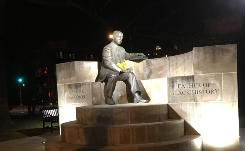
Shaw lockdown

Center City Charter School is going to be closed. It’s the school looking at the rear end of the Convention Center. I wouldn’t be surprised if some nearby businesses decide it’s better to be closed than pretend that the attendees of this shin-dig are going to make up for your regulars who decide the hassle isn’t worth it. Call ahead to any location in the lockdown zone before heading out, but then again that might be more than what you might want to do.
I am taking Monday off to observe the impact of this on the hood. I’m not going to protest as was suggested. The last time I stood on a corner with a sign was 1988. And after observing too many lame lunchtime protests (a noontime protest lasting long enough to document) from my work window, I personally don’t care for that mode of petitioning one’s government regarding grievances. I’m more of the letter writing, calling and blogging type as those modes have been more fruitful and satisfying. Also I’ve been informed that there have been threats and since I find no great romance in getting arrested or mistaken for a threat (can never be too careful, that woman with the cardboard sign could be hiding something!), I’m going to try not to bring any attention to myself as I observe and document.
I noticed as I documented the fencing that’s already in place, some residents were blasting some horrid gangsta rap from the windows. That’s one form of protest. May I suggest a little Jay-Z. Torture them with the inability to publicly sing along.

Ten Days of Truxtun- Fake French War

Day 9. Friendships are funny things, particularly between nations. France was our ally in the Revolutionary War and our revolution inspired the French Revolution, well the revolution part not so much the beheading and turn the world upside down part. Anyway America made peace with Great Britain and in regards to the war between Britain and revolutionary France, the French turned on the Americans. Not officially though, they just sent privateers after American ships. Thus the fake war.
In 1799 (as far as I can tell) Captain Thomas Truxtun had some significant victories over the French. One was the capture of L’Insurgente, which was one of France’s fastest frigates. The other was the severe damage of La Vengeance, a much heavier ship that was bigger and had more firepower that Truxtun’s Constellation. Truxtun’s newfangled ideas about discipline and naval training is credited to his victories.

Ten Days of Truxton- Slavery

I’ve heard of an objection to Truxton’s name because he was a slaveholder. The whole city is named for a big old slaveholder. Worse yet, we’ve got a big phallic symbol on the Mall in honor of Washington, not far from that other memorial from another slaveholder, Jefferson, who also owned a number of humans.
The big biography by Eugene S. Furguson has very little to say about Commodore Thomas Truxton and slavery. Just one paragraph speaking of a period of then Captain Truxtun’s life when he was a on financially shaky ground and his family was growing with 6 girls and two boys. And the family seemed to split their time between Cranbury, New Jersey and Philadelphia:

Their Negro servant, Hannah, was still with the family; but Captain Truxtun, influenced by his late friend Franklin’s stand on slavery, had set her free on condition that he never be called upon to support her, should she leave his employ. Apparently she had chosen to stay on.

The Franklin mentioned is Benjamin Franklin.
Then the question is why did Hannah choose to stay. A couple factors might explain, she’s a woman, possibly alone with no family, possibly no supportive Afro-American community in Cranbury, her age may’ve played a factor, and it’s 1794-95.
So Truxtun’s sin was owning at least one woman who didn’t leave when the opportunity to do so was presented. For some that’s unforgivable and puts him in the same league as worse transgressors such as Washington and Jefferson. Others may not count it against him in light of what he has given to fledgling US Navy.

Next Ten Days of Truxton- Commodore’s Background

Ten Days of Truxton- The Name- The Hood

Okay, I gotta book that I checked out of the library and I’ma goin’ to use it. The book is Truxtun of the Constellation by Eugene S. Furguson.
I am inspired to write for two reasons one is an article from the WP columnist John Kelly, “There is no Washington, DC– but I’m not renaming my column” and an Examiner article about the TC. In the John Kelly piece, if completely accurate supports my suspicion that people in the last few centuries weren’t sticklers when it came to place names. Federal City, Washington City, same diff. When the most accurate official and legal name isn’t high on your list of priorities sloppiness may occur. The punishment for sloppiness is that long after the responsible generation is dead later generations get to nit pick.
Seriously, someone find me PROOF, actual f*ing primary resourced proof that the Shaw neighborhood was named DIRECTLY after Robert Gould Shaw, and not the Shaw Junior High School, which was. Because prior to the 1950s I can’t find a bit of proof that the neighborhood was even called Shaw, as a neighborhood. Mid City and northwest are the only names that seem to pop up prior to the Shaw School Urban Renewal Project. I am not counting the school districting.
So, ’round the turn of the century there was the Truxton Circle (named for Thomas Truxtun) at Florida and North Capitol. I’ve heard talk that the actual circle was in Eckington. But since streets act as borders, I’m going to say it was bordering West Eckington and Old City. Eckington is a suburb of the City (of Washington).Using the journal Washington History Volume 14, No. 2 as a guide, there is Eckington(1887), Center Eckington (1891) and West Eckington(1891). These sub-divisions are on the other side of Boundary Street/ Florida Avenue and the City residents have just as much claim to the traffic circle as the Eckington and Bloomingdale(1889) ones.
So the Truxton traffic circle was a traffic hazard and it went away. But then appeared a Truxton Post Office. On Florida Avenue, NE, not helping my argument. And then sometime in the 60s or 70s it closed. Then in the 60s came the Shaw School Urban Renewal Area project of which the TC is a part of, but it appears there was no reason to call our part Truxton Circle. Then came the Ward & ANC system in the 70s where Shaw was divided, having most of Shaw in Ward 2 and the TC in Ward 5. In the late 80s when the District government was selling houses and bringing in cable, they referred to the area as Truxton Circle.
Next Ten Days of Truxton: Slavery.

Not a charity but capitalist enterprise

When last I left I was writing about the Washington Sanitary Improvement Company (WSIC) which built the houses along Bates Street NW, and some other streets in the TC that are somewhat Bates adjacent, around the turn of the century. You know they are built by the same company because their 2nd story bay window thing.
Anyway, the WSIC’s goal was to replace the slum dwellings in the various alleys, but as a profitable company and not a charity. From The History and Development of the Housing Movement in the City of Washington, D.C. page 61, Article III, section 4:

The company, although organized from philanthropic motives, is not a charity organization, and the executive committee shall take all legal measures to collect rents and to evict tenants who fail to pay their rent, or who neglect to keep the tenements occupied by them in a cleanly and sanitary condition, or who lead a dissolute or criminal life.

Another thing, as part of the pitch to draw interest in the company the author and secretary of the company George M. Kobr writes:

The attention of capitalists should be drawn to the fact that no class of realty pays as well as alley property in this city, and that there is a splendid field for investment in the erection of sanitary and comfortable alley houses on a business and humanitarian basis.
–page 23

Don't blame me for a fuzzy photo


Bates circa 1907
Originally uploaded by In Shaw

This was taken with an iphone in a lowly lit room at the Library of Congress from a book, while I held the pages down with one hand and took the pictures with the other. Now why are you looking at a fuzzy photo of a bunch of houses? This is the unit block of Bates Street, when the houses were somewhat new in 1907.
The photo, as well as some others I took are from The History and Development of the Housing Movement in the City of Washington, D.C. published by the Washington Sanitary Improvement Company, which built the houses. The book starts off talking about unsanitary crappy housing in DC and how the Washington Sanitary Improvement Company (WSIC) was building alternatives to slummy housing, specifically crappy alley housing. Towards the middle of the book they start talking a bit more about the company as an investment. The directors consisted of the following:
David J. Brewer
Charles C. Cole
John W. Foster
Charles J. Bell
George Truesdell
Gardiner G. Hubbard
Anthony Pollok
Walter Wyman
Henry F. Blount
Mrs. George Westinghouse
Crosby S. Noyes
George H. Harries
William J. Boardman
William C. Woodward
Augustus S. Worthington
Henry Y. Satterlee
George L. Andrews
Bernard T. Janney
Mrs. Clara G. Addison
Willliam C. Whittemore
G. Lloyd Magruder
Joseph C. Breckinridge
Marcus Baker
Katherine Hosmer
Charles E. Foster
Simon Wolf
George M. Sternberg
S. Walter Woodward
George M. Kober
John Joy Edson
Maybe more later. Or not.

A plan for Bates Street

I have the 1968-1974 (the dates I’m unsure of) brochure of “A Plan for Bates Street” in PDF form. It’s a big file and because it is so large, I’m not posting here. However, I will mail it to folks who ask (offer expires in 30 days). Basically, like the title says, it was the government’s plan for the two blocks of Bates, to improve the housing.
Houses on Bates Street (well the houses on Bates I’ve been in) are deep and some of them are divided into two units. It seems that when they were initially built by Washington Sanitary Housing (or Washington Sanitary Improvement, I’m still working on the facts of this), they may have all been two unit structures. You can see it in the placement of windows and doors.
The wonderful fellows at Truxton Circle have a few pictures from the brochure. This first one shows the street plan for squares 552 & 615. It appears there was the intention to remove some structures for the creation of small parks, a tot lot, a teen lot and parking. Spaces for adults apparently were to be carved out of existing space. The second picture, shows a typical Bates Street house prior to any renovation. The first and second floor are two separate units with their own living rooms and kitchens. The plan was to combine the two to make one unit, replace 2nd unit doors with windows, move the kitchen to the 1st floor center, and create more bedrooms, going from 1 to 3 or 4, as seen here.
Looking around Bates Street now, there seem to be fewer 2 unit houses than 1 units.

Before there was the Shaw School Urban Renewal Area there was NW pt 2

So I have sworn I’ve seen this storefront church window before, I just can’t remember where. Driving me nuts now.
Anyway, where did I leave off? 1957. Italians.
Next is your favorite and mine, Shiloh Baptist church at 9th & P, then led by Rev. Earl L. Harrison who lived at 1743 Webster St NW, which I believe is in the Crestwood neighborhood. It had a membership of 7200 people, 1,200-1,500 attending worship services any given Sunday, with 3% living in the urban renewal area and 95% elsewhere in DC. There are no stats regarding occupational makeup. In 1957 they had a scouting program made up of participants from the church and the surrounding community, and a Baptist Training Union. It was founded in 1863 at 17th and L Streets and moved to its current location in 1924.
Bible Way Church of Out Lord Jesus Christ is not in Shaw but I find it very interesting. It is one the other side of NY Ave at 1130 New Jersey Ave NW. Their pastor, Rev. Smallwood E. Williams lived at 1328 Montello Ave NE. They had a total membership of 2000 people, and the average attendance exceeded the membership with 2200 (3,200 for all three services), it seems they had a lot of visitors and I gather a lot of non-tithers. Thirty percent lived in the renewal area and 69% scattered throughout the rest of rest of DC. This was a working class church, and that’s why I find it so interesting as 90% of the working people attending were ‘unskilled manual’, with 2% professional, 3% white collar, and another 3% skilled manual labor. They had no mortgage and seemed to have owned a good chunk of land down there.
Last in my review is a church that was a storefront that is now a steeple church and that is Mt. Sinai Baptist Church at 1615 3rd St NW, then led then by Rev. Charles Hayes of 47 M St. NW. It had a membership of 225 people with an average worship service attendance of 125. A insignificant number of members, two percent, lived in the renewal area, 96% were in the rest of DC. Occupationally it was 55% unskilled manual, 40% white collar, and 2% professional. They had a mortgage of $2K. Listed under “Future Expansion Program” they desired to build a new church on the present site. If it became necessary to move (because of the renewal) they wanted to stay in this central area so it would be accessible to all members.
SUMMARY
Shaw had a lot of churches then, has a lot of churches now. There were Italians running around the TC on Sunday. And Marie doesn’t like to spend a lot of time typing.

On this site in 1850, nothing happened

You know I should make better research notes. Or I should leave bibliographic info with the photocopies…. bad librarian. Bad. Anyway, off the top of my head this map is a scanned copy, of photocopy, of a negative copy, of a map that is of the city circa 1850ish. And if I looked hard enough and if it is cataloged by the Library of Congress, I could find the bibliographic info I should have to say who drew the map and so forth. It’s pre-Civil War.
The two light lines are Boundary (Florida) and New York. The squiggly line is a creek. The square numbers are the same square numbers we have today and if you notice…. not a lot of structures. On the negative copy it is easier to see marsh or not-dry-land.
With that in mind I would not even dare call this area, that later became the TC a neighborhood. Heck, I don’t even know if I could call it a community.

Also check out this view of the map.
UPDATE: Better map .

Updated 12/21/23 for bad image links