If it was located around E, F, 20th and 21st Streets NW, it should be in the West End. However, poking around Property Quest, I could not locate a Square 762. I’ll post another page about O’Brien Ct which has a different square number that makes more sense.
Feeling a bit under the weather so the posts are going to slow down a bit.
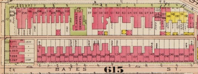
In an earlier post, WSIC- 1930s Ownership of Sq. 615, I wrote: “… the Washington Sanitary Improvement Company owned the following lots on Sq. 615 (bounded by North Cap, Q St, 1st St and P St NW): 65-66, 134-140, 170-179, 195-207, and 236-265.”
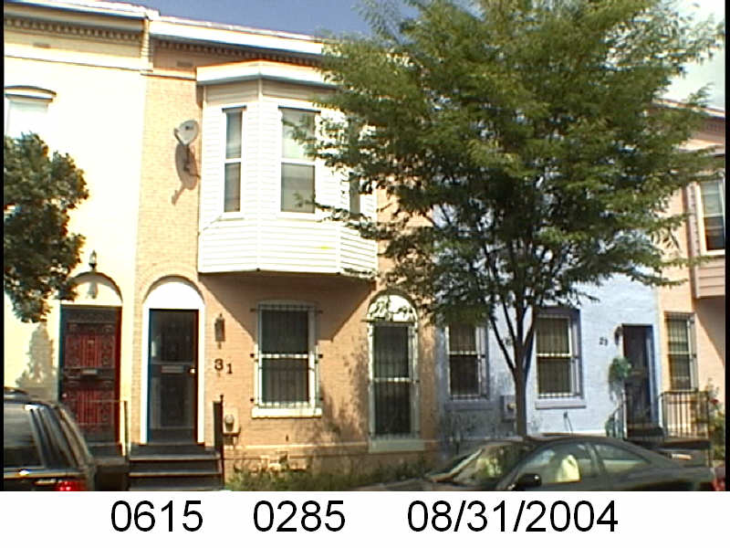
In a previous post I specifically looked at 31 and 33 Bates Street, part of 31- 43 Bates St NW, lots 134-140, now lots 285-291.
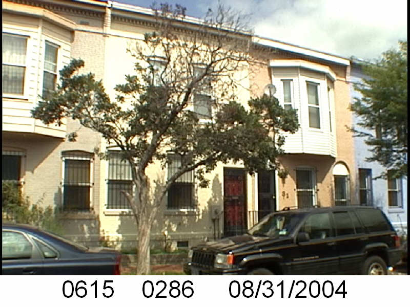
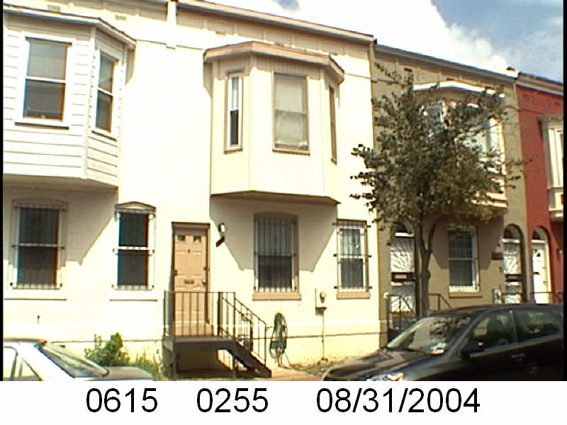
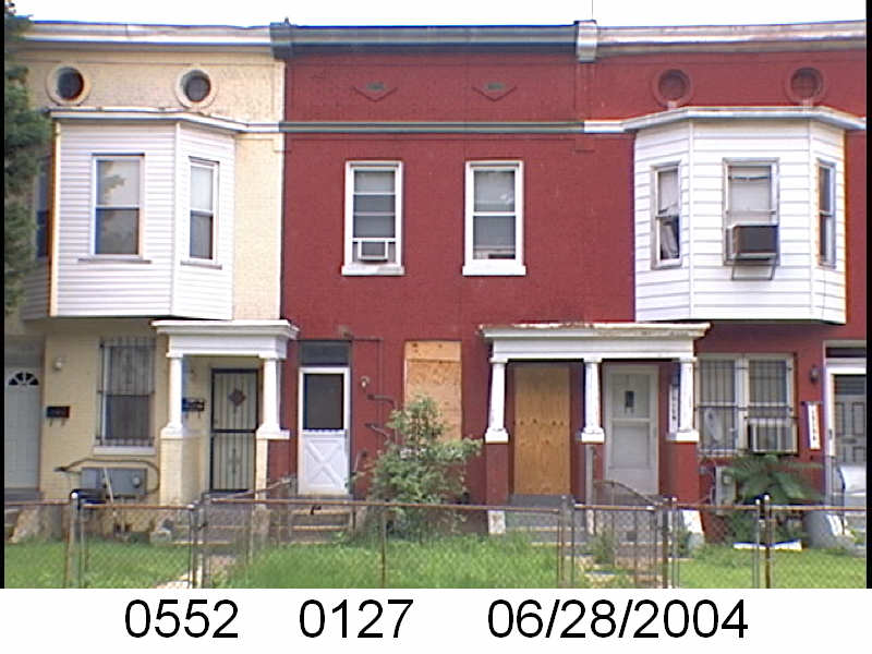
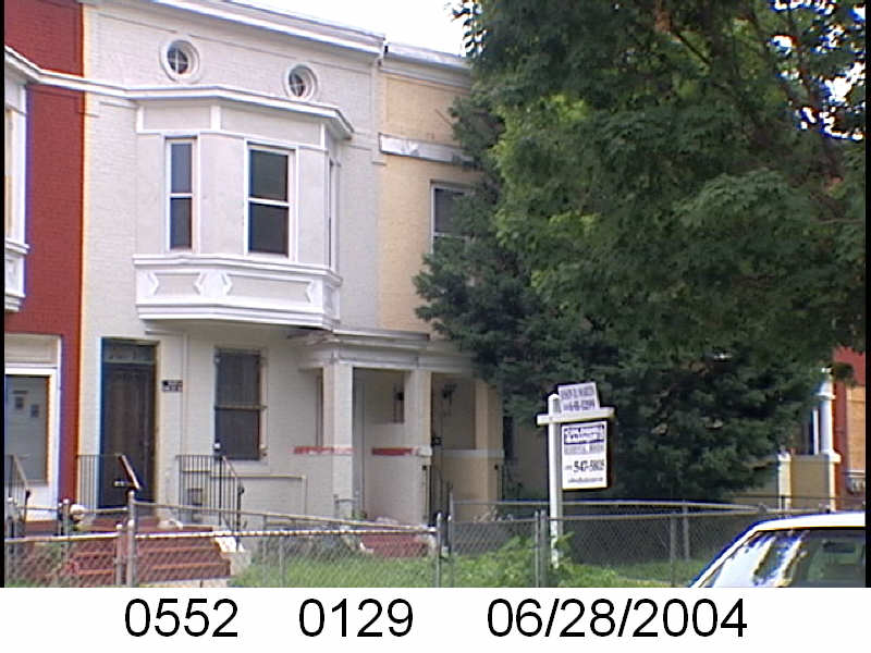
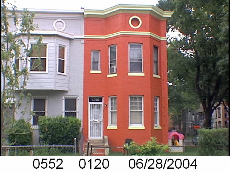
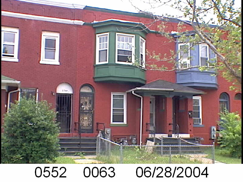
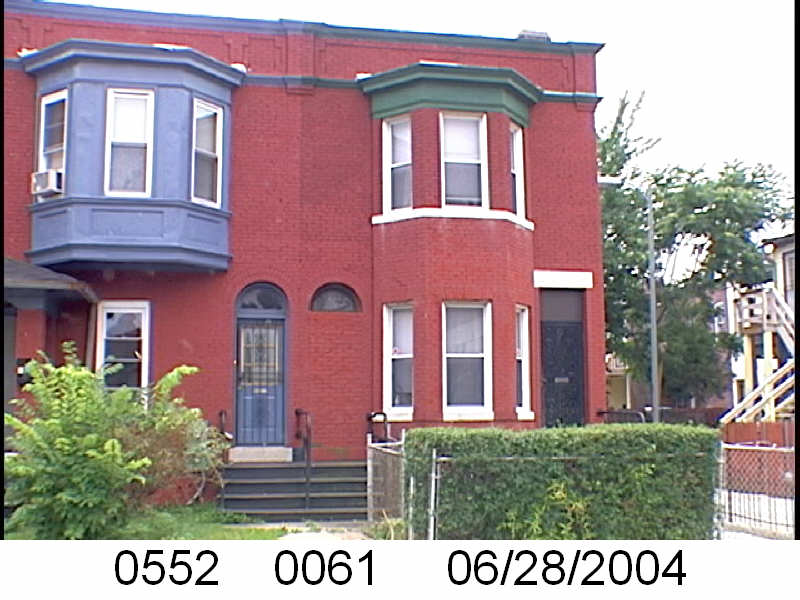
The Washington Sanitary Improvement Company owned the whole of the odd side of Bates Street, NW. And visually, for a bit, they had the 2nd story bay window, then no bay, then bay pattern, starting at 15 Bates to 37 Bates St NW. But 37 and neighboring 35 Bates St. NW are bay-less.
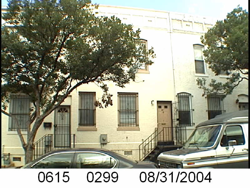
It begins to look like the bay-no-bay pattern will restart with 39-45 Bates St, but then there are a row of the distinctive Truxton Circle 2nd floor bay windows.
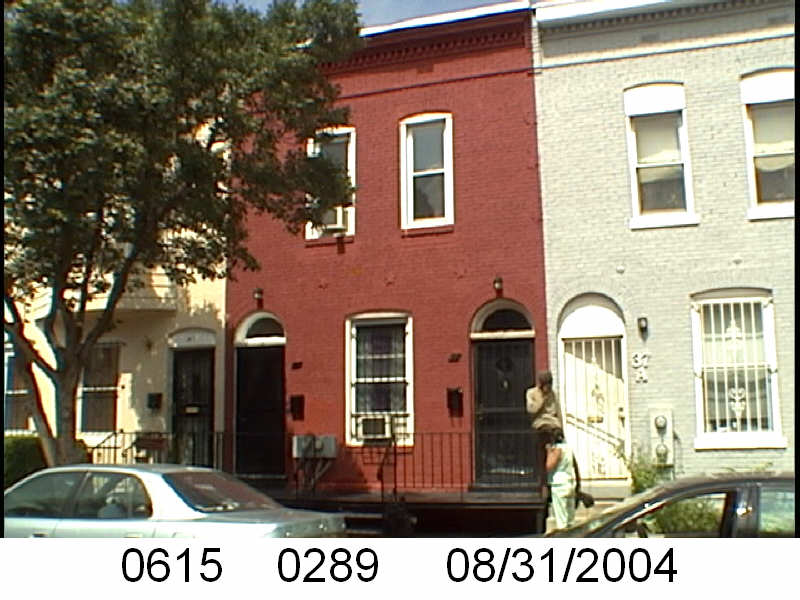
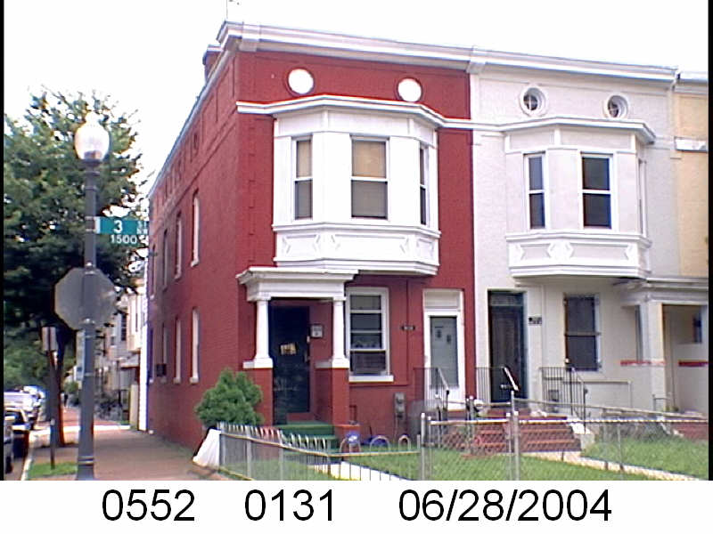
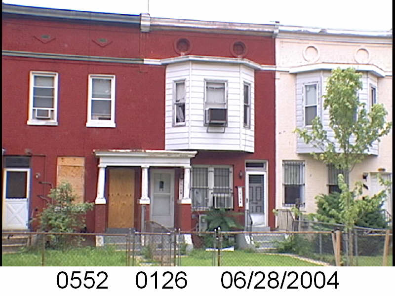
From 55-65 Bates St NW, it goes back to the bay, no bay, bay pattern. Addresses 65-67 Bates NW are bayless together, and then the pattern restarts.
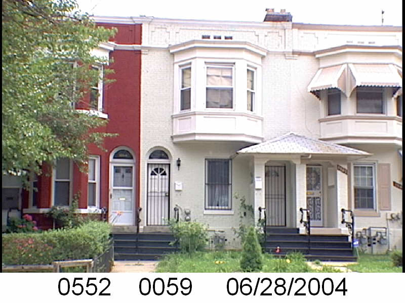
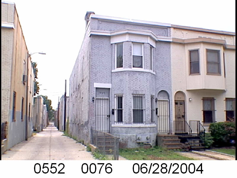
The even side of the unit block of Bates is just as inconsistent. Just a little less so. It starts off with bay, no bay, then bay and keeps it up until 52-54 Bates Street with neighboring bay-less windows.
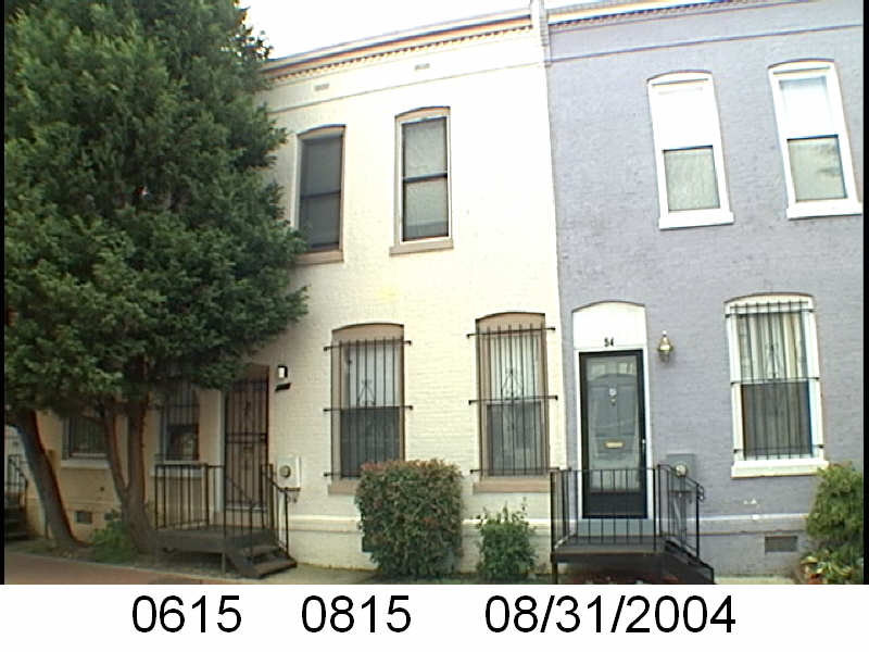
54-58 Bates St NW form a no bay, bay, no bay sandwich before it is nothing but bay windows till 1st St NW.
In a previous post, WSIC- 1930s Ownership of Sq. 615, I wrote: “… the Washington Sanitary Improvement Company owned the following lots on Sq. 615 (bounded by North Cap, Q St, 1st St and P St NW): 65-66, 134-140, 170-179, 195-207, and 236-265.”
I’m going to skip Square 615’s lots 65-66. which are 22 and 24 Q St NW. They do not look different from the other adjoining town homes.
So let’s first look at lots 134-140. And here is where we find our first problem. The lot numbers changed. Lot 140 would be 31 Bates Street NW. That address is now lot 285. I find a lot number changes. Sometimes the property undergoes some sort of conversion or there is another reason for the lot number change. It doesn’t happen too often but it does happen.
31 Bates Street NW, 2004
Next is lot 139, which like 140, no longer exists in the tax rolls. It was 33 Bates Street NW, which is now lot 286.
33 Bates St NW, 2004
So what are we seeing here in these two images of Bates Street NW houses. The image for 31 Bates St NW shows the distinctive 2nd floor centered bay and the two entrances, reflecting the Washington Sanitary Improvement Company’s (WSIC) idea of having a two flat unit. The second door, is a window in the image for lot 285.
The pattern for the row is bay, no bay, bay, no bay.
In my last post about the Washington Sanitary Improvement Company (WSIC) and Square 617 (bounded by 1st, N, North Cap, and O Streets NW) I said the architecture looked annoying. Take a look at the entryway below.
Note the stairs in the photo (0617 0225). The original iron stairs were replaced by brick and there doesn’t seem to be a clear line in the brick.
This works when the owner owns both buildings. This can cause all sorts of headaches when there are two different owners, with different attitudes about maintenance and repairs.
Please forgive me, I am not an architect and have very little interest in focusing on the architecture of Truxton Circle, because that just leads to the Great Satan that is historic districting. But WSIC buildings in the TC have distinctive bays. In the case of the O Street buildings, I think what I am seeing is a bay with adjacent entryways.
For 14 O St NW, this is fine.
It doesn’t have an entryway close to another unit’s entry. In the photo above, taken in 2004, it appears 14 O St NW was two units. Even the second unit is not too close to the neighboring house’s entry.
In 1903 parties (George Sternberg and George Kober) involved with the Washington Sanitary Improvement Company owned the following lots on Sq. 615 (bounded by North Cap, Q St, 1st St and P St NW): 65-66, 134-140, 170-179, 195-207, and 236-265.
Sq. 615 circa 1924
Fast forward to the 1933-1934 General Assessment, and it looks like the Washington Loan and Trust Company was holding or acting as a trustee for the WSIC.
There was a document that the WSIC owned the following lots in 1950. Lots 0134, 0135, 0136, 0137, 0138, 0139, 0140, 0170, 0171, 0172, 0173, 0174, 0175, 0176, 0177, 0178, 0179, 0195, 0196, 0197, 0198, 0199, 0200, 0201, 0202, 0203, 0204, 0205, 0206, 0207, 0236, 0237, 0238, 0239, 0240, 0241, 0242, 0243, 0244, 0245, 0246, 0247, 0248, 0249, 0250, 0251, 0252, 0253, 0254, 0255, and 0256. So basically the same lots, minus lots 65-66.
Next, I need to do a wide search to see if WSIC owned anything else in Truxton Circle, besides Squares 552 and 615. I don’t think so, but I need to check.
February will have a fire hose of Carter G. Woodson’s Mis-Education of the Negro posts, so I’m sneaking in one Washington Sanitary Improvement Company post today and maybe another near the end of the month.
There are so many lots owned by trustees of WSIC. So who was a trustee? Let’s look at George M. Kober’s book The history and development of the housing movement in the city of Washington, D.C. From page 26 the elected directors were: David J. Brewer, Charles C. Cole, John W. Foster, Charles J. Bell, George Truesdell, Gardiner G. Hubbard, Anthony Pollok, Walter Wyman, Henry F. Blount, Mrs. George Westinghouse, Crosby S. Noyes, George H. Harries, William J. Boardman, William C. Woodward, Augustus S. Worthington, Henry Y. Satterlee, George L. Andrews, Bernard T. Janney, Mrs. Clara G. Addison, William C. Whittemore, G. Lloyd Magruder, Joseph C. Breckinridge, Marcus Baker, Katherine Hosmer, Charles E. Foster, Simon Wolf, George M. Sternberg, S. Walter Woodward, George M. Kober, and John Joy Edson. The executive board was George M. Sternberg, as president; S. Walter Woodward, John Joy Edson, Charles J. Bell, George Truesdell, George H. Harries, George L. Andrews, Ms. Katherine P. Hosmer; and Dr. Kober as secretary. Now let’s look at who owned property on Sq. 615, which was the first Truxton Circle block the company developed.
According to the General Assessment, just two of the above . Here we go:
Looking at the Library of Congress page for the 1903 DC Baist map, Plate 39, Kober’s lots 65 and 66 are 24-26 Q St NW. Sternberg (for WSIC) had odd side 31-43 Bates St NW (lots 134-140), even side 46-60 Bates St NW (lots 170-179), even side 53-77 Bates St NW (lots 195-207), and 94 Bates St NW, odd side 15-29 Bates St NW, and even side 30-44 Bates St NW, odd side 45-51 Bates St NW, 12 Q St NW, and even side 62-76 Bates St NW (lots 236-265).
Check back towards the end of the month to look at WSIC’s Sq. 615 ownership in the 1920s and 1930s.
I noticed on Google Streetview this property on my old block is blocked. It’s just a blur. But here is what you’re missing.
and
Back when it was yellow.
It is probably blocked because the builders are throwing on a pop up and a bit of a pop back.
So when it is done. I wonder if it will be a fugly thing, of which there is a 50/50 chance. Or would it be an interesting addition.
The Darth Vader house, 1649 New Jersey Ave NW, is, interesting.
That little part that juts out at the front… that’s allowed now?
And yes, some of you are saying, ‘well that’s what you get for not being in an historic district.’ Remind me, Bloomingdale is a historic district and there are some monstrosities popping up and back on Quincy. And around the corner from Quincy on North Capitol, what’s all that going on? Also when the Wardman Flats (Sq. 519 4th, Florida Av, 3rd and R Sts) became historic the residents were not too thrilled about that.
Anyway, we’ll see. Which reminds me, people of Bates St., you have a history, and I’m going to write about it once I’m done with the Black Home Owners of the 1920 census. Do your pop ups, pop backs, and vinyl window replacing now before I provide the world with enough evidence for a historic anything application.
In 1957 there was as survey of churches in the Northwest Urban Renewal Area, which included Shaw, Downtown, and the area around Union Station. Israel Metropolitan Colored Methodist Episcopal (CME) Church was one of the churches in this area. To learn more about the 1957 Church Survey read my previous posts, The Uniqueness of the 1957 Church Survey and Church Survey Northwest Urban Renewal Area October 1957.
Israel Metropolitan CME was where the Mt. Lebanon Church sits today at 1219 New Jersey Ave NW. The survey doesn’t tell us about the racial or professional make up of the 911 parishioners of the church. Just the basics. From the name CME, it was and is a Black church. The current Israel Metropolitan CME church sits in Petworth.
Quick rundown. It was and still is an African American church. It was a fairly large church with over 3,000 members able to support a full time minister, assistant minister, sexton, assistant sexton and social worker.