WSIC-Square 552- Odd side of 3rd St NW- A Visual pt 1

In the month of April we’re looking at the Washington Sanitary Improvement Company (WSIC) ownership of lots on Square 552, which is bounded by 1st, P, 3rd and Q Streets NW in Washington, DC. WSIC owned lots 49-60 (1529-1551 3rd St NW) and lots 120-131 (1501-1523 3rd St NW).

photo of property
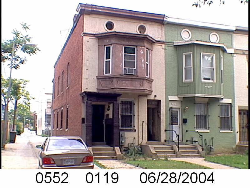
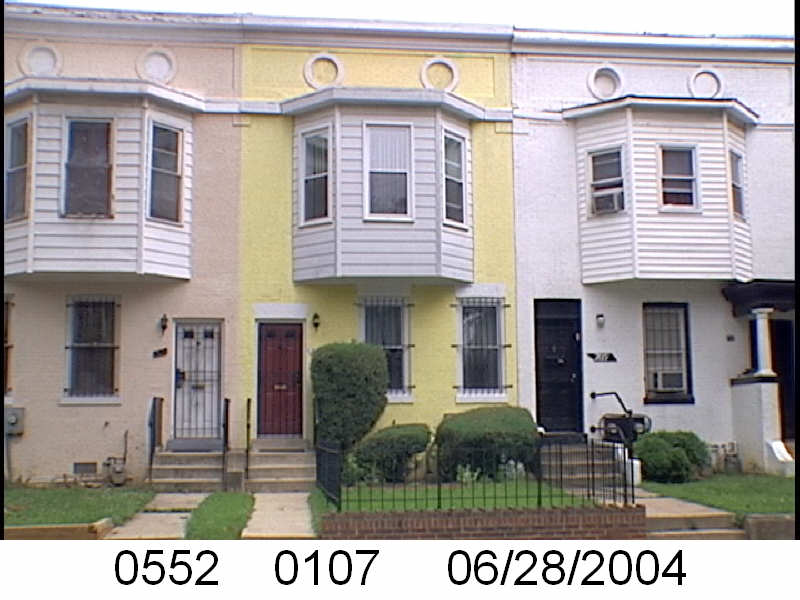
1501 3rd St NW

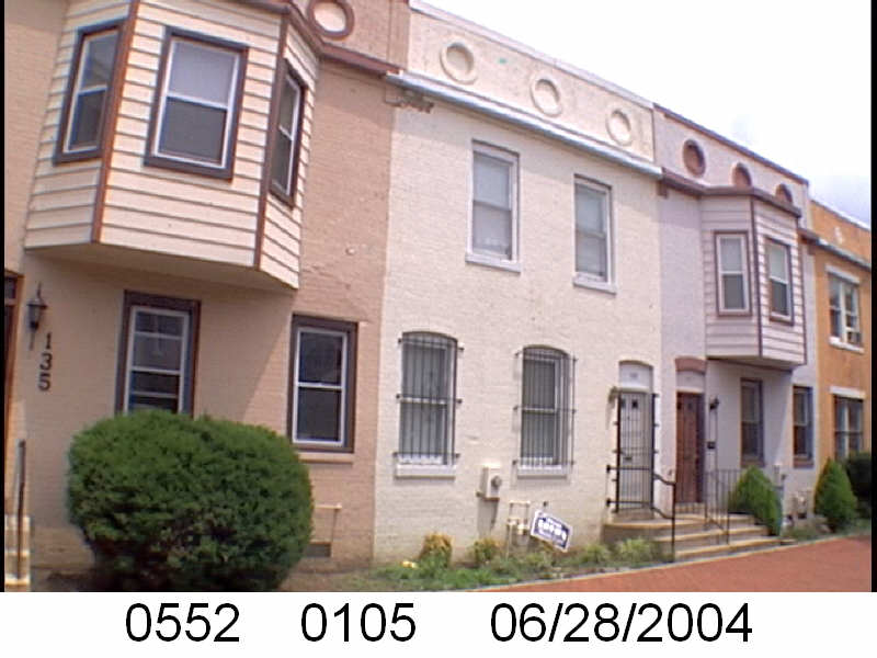
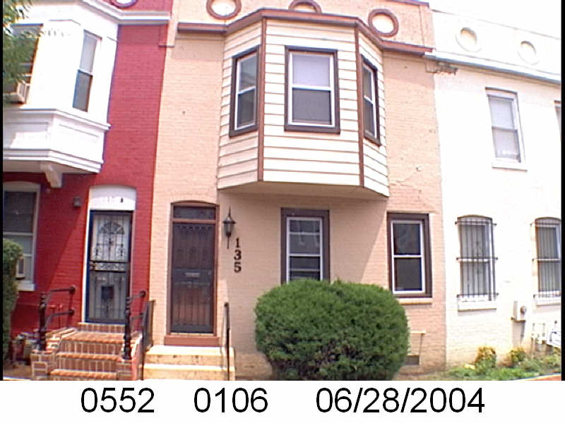
1501 and 1551 3rd St NW are similar to 200 and 230 Q St NW, having a 1st and 2nd floor bay. This differs from the properties with bays between  1501 and 1551, which if there are bays, those bays are just 2nd floor bays. After 1501 3rd St NW going north, there is a short, no bay, bay, no bay pattern until 1511 3rd St NW. And then there is 1513 3rd St NW (lot 126) where there is a bay, after a bay, and a shared porch.

photo of property
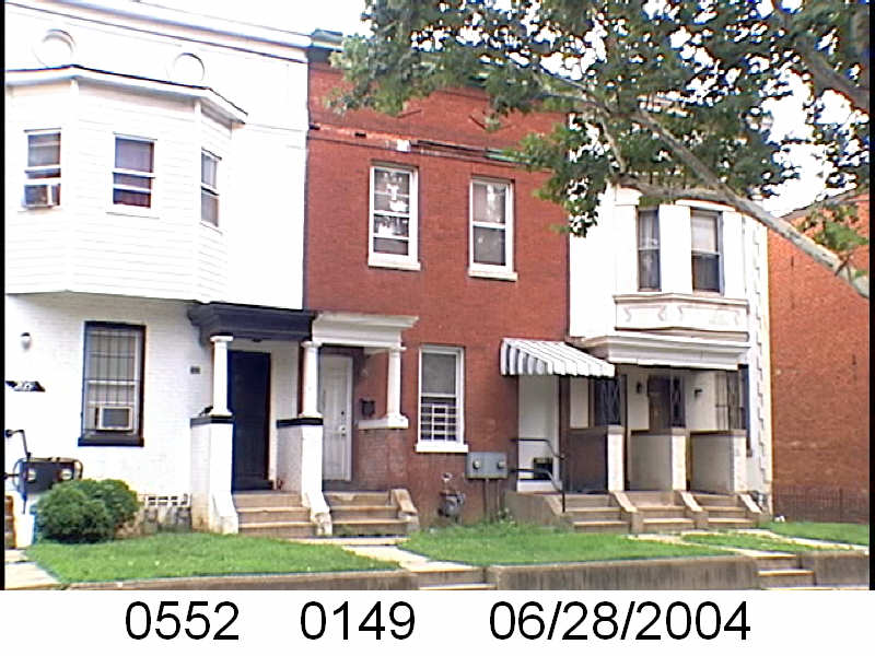
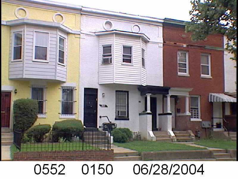
1513 3rd St NW

So the adjoining property (1515 3rd St NW) with the porch is without a 2nd floor bay. 1515 3rd St NW has two entrances, for two separate units. One still had a covered entry, which I’m calling a porch. It appears that it may have had two shared porches. However, the porch pattern seems to hint that this is the start of a new pattern.

photo of property

WSIC- Square 552- Even side of 1st St NW- Not WSIC

In the previous posts, I identified properties on Sq. 552 (bounded by 1st, P, 3rd and Q Sts NW) owned by the Washington Sanitary Improvement Company (WSIC). This post looks at 1st Street.

This is real easy. There were none owned by WSIC.

The even side of the 1500 block of 1st St NW were lots 177-182 (1536-1526 1st St NW), 197-201 (1546-1538 1st St NW), and 163-175 (1524-1500 1st St NW). Looking at the 1933 General Assessment, these were owned by a variety of individuals, not the WSIC.

I guess a parking lot landed on this. Then a Convention Center. Mt. Vernon Square 1968?

This is supposed to be 8th Street NW looking north. Now, in the background you will see the top of Immaculate Conception Church. However, the little house in the middle of the block with the porch looks, awfully familiar. It makes me think this was mislabeled.

If it wasn’t then this is in Mount Vernon Square and was leveled to make a parking lot. Which then became the current Convention Center.

Any thoughts?

WSIC- Square 552- Even side of Q- A Visual pt 2

In the previous post about the even side of Q St NW,  the Washington Sanitary Improvement Company (WSIC) owned 130-230 Q St NW, in addition to other lots on Square 552. Part 1 looked at the 100 block of Q St NW. This will finish with the 200 block of Q St NW.

photo of property
200 Q St NW

There is sort of a pattern for the 200 block of Q St NW. There are 3 bays (200 has 1st and 2nd floor bays) for 200-204 Q St NW. Then 2 bay-less properties. However there is a new style of a shared porch entrance for bay-less 206-208 Q St NW. The bays return for two properties, at 210-212 Q St NW.  214-216 Q St NW are bayless with the shared porch. 218-220 Q St NW have the 2nd floor bays and 222-224 are bayless with a shared porch. But then what looks like what would be a bayed pair in the pattern, has both 2nd floor bay windows and a shared porch at 226-228 Q St NW.

photo of property
226-228 Q St NW

And 230 Q St NW bookends this row with a 2 story bay, just like 200 Q St NW.

photo of property
230 Q St NW

Since I did it for Part 1, below is from the 1917 DC City Directory showing two units per property. Keep in mind this is for the even side of Q St NW. 208 Q St NW, doesn’t appear to have an ‘A’ like the other houses from 200-230 Q St NW. But is does have two households.

From 1917 DC City Directory


1950 Census

Just a quick comment.

Today the 1950 census drops. I have no plans to do anything. I am going to wait and see who indexes this, and who that indexing is formatted. Then I will update my own database.

What I need to do is update TruxtonCircle.org . If anyone can guide me to who I can talk to (I’ll pay a reasonable fee) about updating the site so I can make it more searchable and dynamic (I know it needs a complete over hall while keeping some of the old links) email me at mari ayt inshaw period com.

WSIC- Square 552- Even side of Q- A Visual pt 1

We know that the Washington Sanitary Improvement Company (WSIC) did not own anything on Square 552 (Bounded by 3rd, P, 1st and Q St NW) in 1902. Sometime between 1903 and 1909 most of the block was purchased, developed, and Bates Street created. According to the 1933-1934 General Assessment WSIC owned lots 33-35, 49-94, 98-100, 104-150, 811, and 816-820.

Lots 33-35 would have been 137-141 Bates St NW; lots 49-94 were 1529-1551 3rd St NW, 138-230 Q St NW, 201-229 Bates St NW; lots 98-100 were 132-136 Q St NW; lots 104-150 were 131-135 Bates St NW, 207-231 P St NW, 1501-1523 3rd St NW, 200-230 Bates St NW, and 201-205 P St NW; lot 811 now lot 221 was 130 Q St NW; lots 816-818 being 119-123 Bates NW and lots 819-820 (originally part of lot 25) ?? Bates St NW.

Let’s start with 130-230 Q Street NW.

photo of property
130 Q St NW

The above image is of 130 Q St NW and we see the 2nd floor bays that are similar to the bays of the unit block of Bates St NW. However, these are skinnier than the original style where WSIC started. Another difference, a single entrance for appears to be a two flat property. Whereas with the Bates St WSIC properties, there was a separate entrance.

As we start to go down the row it appears that the single bay properties are also single entrance but maybe single residence homes. However, 142 Q St NW seems to beg to differ.

photo of property

A lot can happen in 100 years. Checking the census for 1910, there are two households for 132, 134, 136, and 138. Although I see two doors for 142 Q St NW, it had only one family in 1910.

Source: 1917 DC City Directory

Looking at the 1917 City Directory the houses from 132-142 have two households or two units.

Rando Thing Not in Shaw- 900 27th Ave NW

This is part of the Rando Alley Not in Shaw series. However, this is not even an alley. This is Square 1. Literally Square 1 in NW DC and 900 27th Ave NW, which no longer exist. What is there now is the off ramp to go from Whitehurst Freeway to I-66.

Dates? Pffft…. Between 1916 and 1936-ish.

Rando Alley not in Shaw- More of O’Brien Court NW/ Stevens School Garden

I’m just throwing this out there. It was in a collection of things I had from the National Archives, Still Picture Division. Why I have these, I don’t know.

I previously posted about O’Brien Ct. Here is another page about O’Brien Ct but regarding the Stevens School Garden Project. Look kids, school gardens are nothing new. The Stevens School was a school for Black children at the time, which was 1936. Now, it is a Pre-K school.

Rando Alley Not In Shaw- Government Alley

Another Alley but not in Shaw.

These photos are from a government agency that was for getting rid of residential alley dwellings.

Looking a this page you may see a familiar local name, Pohanka. I don’t know if they were selling cars, but they were repairing them.

Rando Alley Not in Shaw- O’Brien Court/ Thimble Court NW

If it was located around E, F, 20th and 21st Streets NW, it should be in the West End. However, poking around Property Quest, I could not locate a Square 762. I’ll post another page about O’Brien Ct which has a different square number that makes more sense.

This is from 1935. It mentions a Thimble Court.