Abraham H. Levin- Colonial Mortgage Co.

The Washington Sanitary Improvement Company houses sold by the Colonial Investment Company, made up of Nathaniel J. Taube, Nathan Levin and James B. Evans used trustees Abraham H. Levin and Robert G. Weightman. Early on, I was not aware of a connection between Nathan and Abraham H. Levin. Currently, I am aware that Nathan and Abraham were brothers.

When Nathan Levin died in 1956, he was replaced by Harry A. Badt in the paperwork for further foreclosures and sales of WSIC Truxton Circle houses. In researching Badt, I found the brotherly connection.

According to a 1946 ad, Colonial Investment Co. was established in 1925. So starting there, I looked for him in the papers. In 1933 Abraham Levin passed the bar. The next year he married Naomi Lillian Bersh. He worked for the Census Bureau. In the 1940s he went into real estate, obtaining his license in 1945.

His brother, Nathan Levin, died while in court in 1956. The May 13, 1956 reported that Abraham was in the room when it happened. Nathan was president of the Colonial Investment Company and executive vice president of the Colonial Mortgage Corporation.

According to Abraham’s obituary he returned to federal service in the 1960s, working for HUD. He died in 1998.

Abraham H. Levin was one of two trustees who issued mortgages to African Americans purchasing Truxton Circle homes from the Colonial Investment Company. His name was on countless foreclosures.

Farewell Citizen Atlas

I got a warning months ago but didn’t really understand it. Citizen Atlas is gone. Sort of.

For years I have been using https://propertyquest.dc.gov/ to find information about houses in Truxton Circle and sometimes other parts of DC. I have used photos from Property Quest, which leaned on Citizen Atlas for photos for churches and other places.

But now that’s gone.

It makes sense in some ways. These photos are old enough to buy themselves a strong drink. So I hope they are with an archive or something. That is something I’ll have to look up later because this summer is personally busy for me.

Most places use Google Street View. Real estate websites use it along with the government. Those are the most up-to-date images of a property….. unless the owner or former owner has blocked it.

The photos aren’t completely gone. Not knowing when the photos will disappear, I copied all the ones used for the blog and the URLs (for now) work. Unfortunately, I THOUGHT, I had copied all the photos for Truxton Circle. But alas, no. I only did it for one block.

So I will eventually update the URLs on the blog to a page in the InShaw universe where I am hosting the images I have used. Yes, they are over 20 years old, but as far as I’m concerned they are government created and free to use.


A suitable pop up- 1721 4th St NW

There is a lot of background with this house, but I want this to be a more visual post.

1721-1719 4th St NW. Taken 2008

This was a house that didn’t have a lot of interior space. I don’t think it had a basement. It did not have a 3rd floor.

1721 4th St NW. Taken in 2012.

Now it has a 3rd floor. Notice the difference in the rooftop. The pop up is very subtle. It is currently two condo units.

319 R Street NW

I was going through some of photos and decided to post.

Townhouse
319 R St NW, Washington, DC

Above is what 319 R St NW looks like now.

Developers Plan B

Then there was the alternative reality of what it was supposed to look like.

319 R St NW, 20001
319 R St NW. Taken March 7, 2018

And lastly, 319 R St NW back when the Korean church owned it for mission work.

319 R St NW, Taken July 9, 2016.

Links to my previous posts about 319 R St NW:

319 R St- Off Market sad-face
I provided the gun but I didn’t shoot him: Historic Landmarking of Sq. 519
319 R St NW- There can be a way forward with a turret
319 R St NW- The Turret is Plan B
319 R St NW- Not hoping for the best, but the less ugly with a turret
319 R Street NW- a sign
319 R St NW
319 R Street the plan
Well we need more of this kind of missionary work

First Time DC Government Uses Truxton Circle

Okay firsts are tricky. They are very hard to prove. So with that said, I am going to write that in this advertisement from 1989, this was the first time the District of Columbia government called Truxton Circle, Truxton Circle.

For a mere $80,000 62 Bates St NW was being sold by DHCD. For a paltry $250.00, they offered 22 Hanover St NW.

Advert for houses for sale in 1989 for houses sold by the District Government from $250 to $80,000

Is it the very first time the DC government called Truxton Circle by the name we know it as now? Possibly. This is just the first bit of evidence I located to prove the point.

Affordable Housing of the Past is Illegal

I was listening to an audiobook and was annoyed with one of the prescriptions that authors are forced to tack on to their books. Housing was a background issue. It would have made more sense if the prescription was unionizing, not touting zoning for more multifamily housing, a topic explored at the 11 hour.

What annoyed me was, after working on the history of this neighborhood, that a historical solution that worked was ignored. Boarding houses and taking in boarders. Many people in Truxton Circle, homeowners and renters, had boarders.

Men and women in boarding house room
1943 DC Boarding House

However, this very low rung in the housing is almost illegal. Like mobile homes (another affordable housing product illegal in many municipalities), the laws on the books make such a thing impossible to run legally. There are illegal boarding houses in DC. We find out about them when someone dies in a fire.

We’d prefer someone to live in a tent in a park, then have a house with all sorts of people coming in and out, where people live for cheap.  I’m not going to romanticize boarding houses either. Poorly run ones were a nuisance. But, they were a roof over a person’s head. Four solid walls (maybe thin walls) where they could call home.

Back when I was in elementary school and at an age where we made friends easily, I had a ‘friend’ who lived in a boarding house near the school. Her family, mother, father and maybe a sibling, all lived in a room in the back of this 2 story frame house that no longer exists. I remember the room being poorly lit & junky. This was a working class Black neighborhood, and if you couldn’t afford to rent a whole house or get into the public housing, well you were pretty bad off.

The author, like Jane Jacobs, assumed a type of housing would make it affordable. Jacobs believed older housing was affordable. I’m in my youngest house, built in 1940, cheap is the last word I’d use to describe it. And likewise, there are multi-unit houses, houses carved up into condos, that are out of the price range for most. Even if DC allowed people to live in converted Home Depot sheds on land they rented or owned, the prices will find a way to jack up.

Okay. Rant over.

Memory Lane- NW Co-op on Q St NW- 2007

Taken on June 27, 2007. 100-200 Block of Q St NW.

Northwest Co-op. These are post 1968 riot affordable housing units. The bay window like sections that jut out on the 2nd floor reference the circa 1900 Bates Street houses with a similar type (but less boxy) window.

They are not public housing. They might accept Section 8, but it is not public housing.

Memory Lane- 1640 4th St NW

This is from 2016

I could add context, but I don’t need that headache. I already posted my opinion.

WSIC-1950s sell off- 45 Bates Street NW-Revised

I need to clean up the data on this old post from 2022. This was before I started noticing a pattern with the WSIC houses. I’m just going to focus on the property history and not the individuals.

From my last post, I mentioned I would look at a property that was transfer from the Washington Sanitary Improvement Company (WSIC) to three men, who then sold it to a person marking the exit of WSIC from Truxton Circle in the 1950s.

https://tile.loc.gov/image-services/iiif/service:gmd:gmd385m:g3851m:g3851bm:gct00135a:ca000042/5943,1454,793,955/397,/0/default.jpg
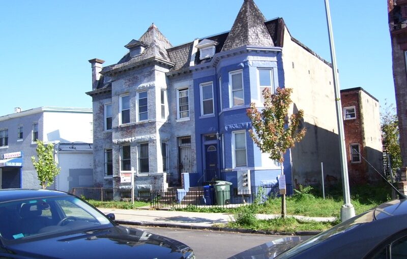
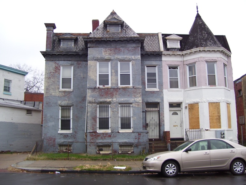
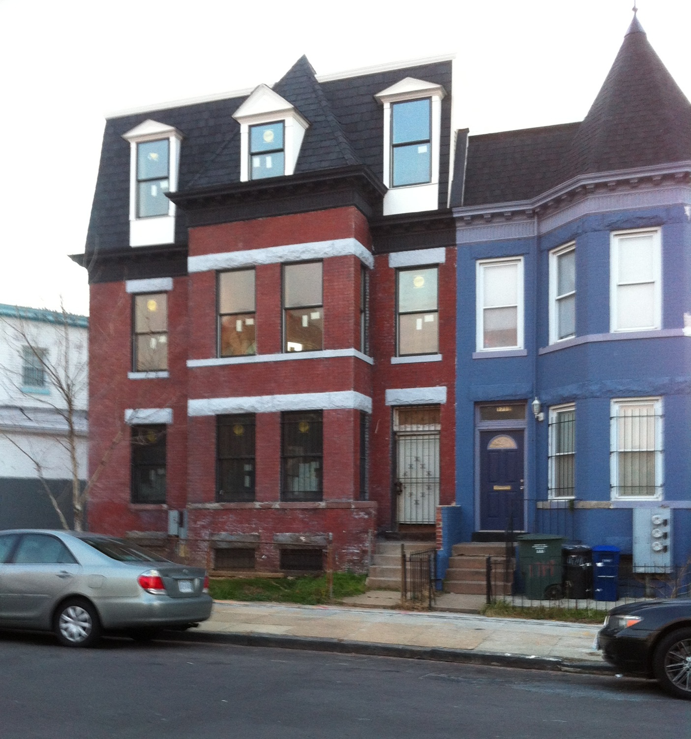
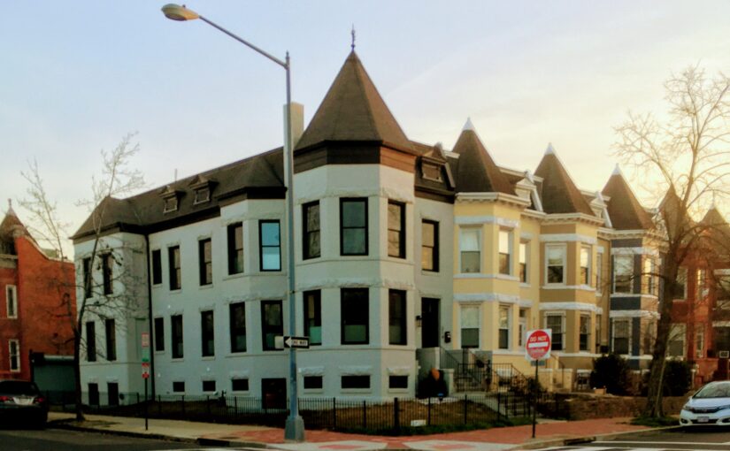
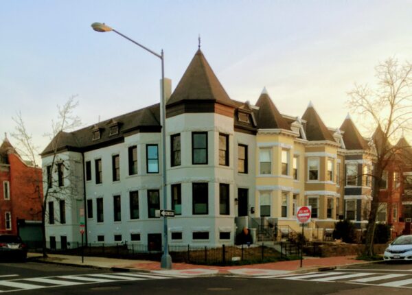
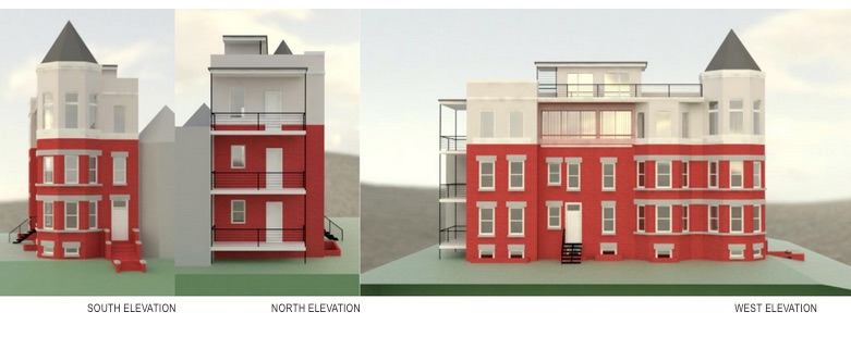
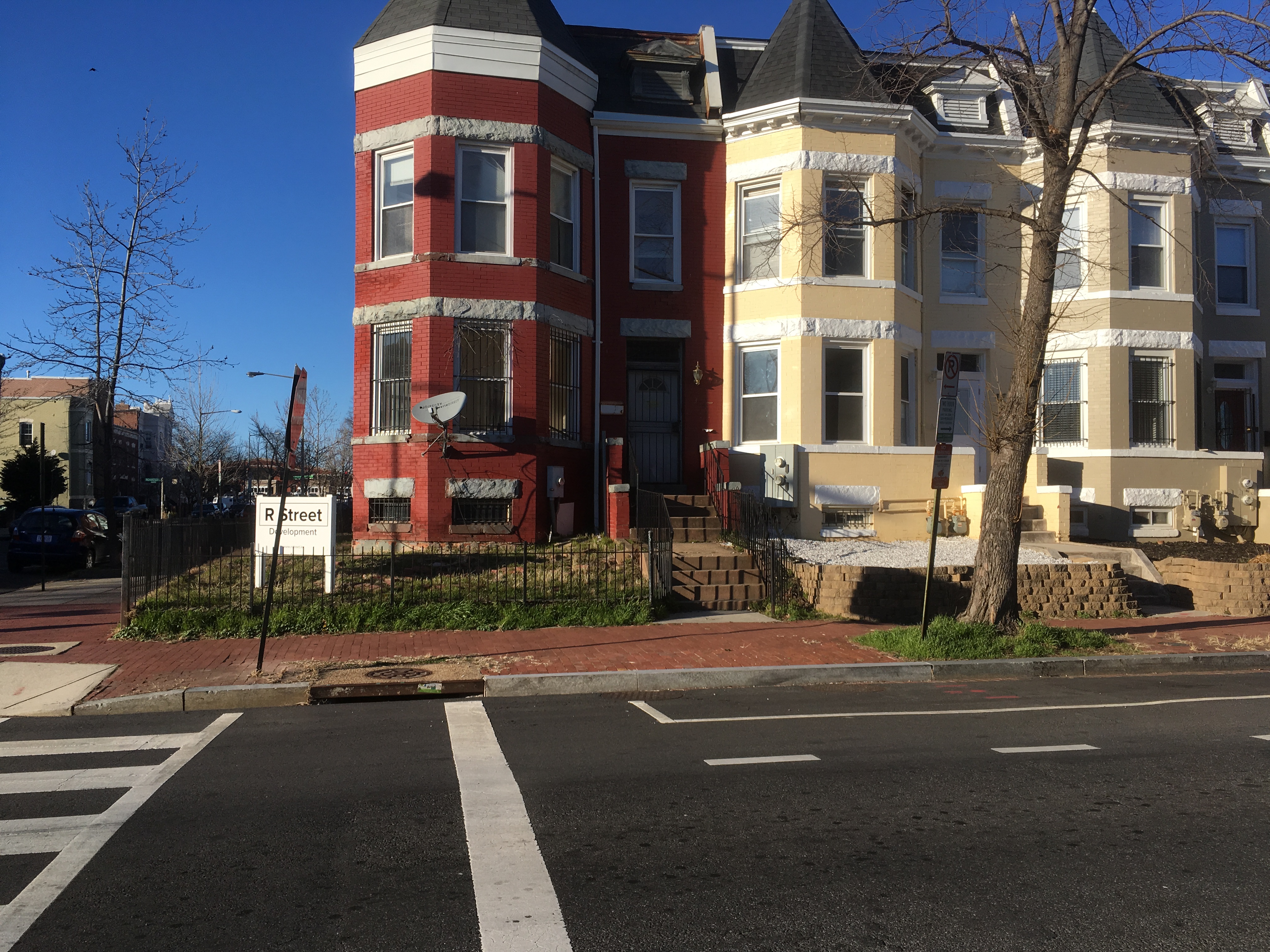
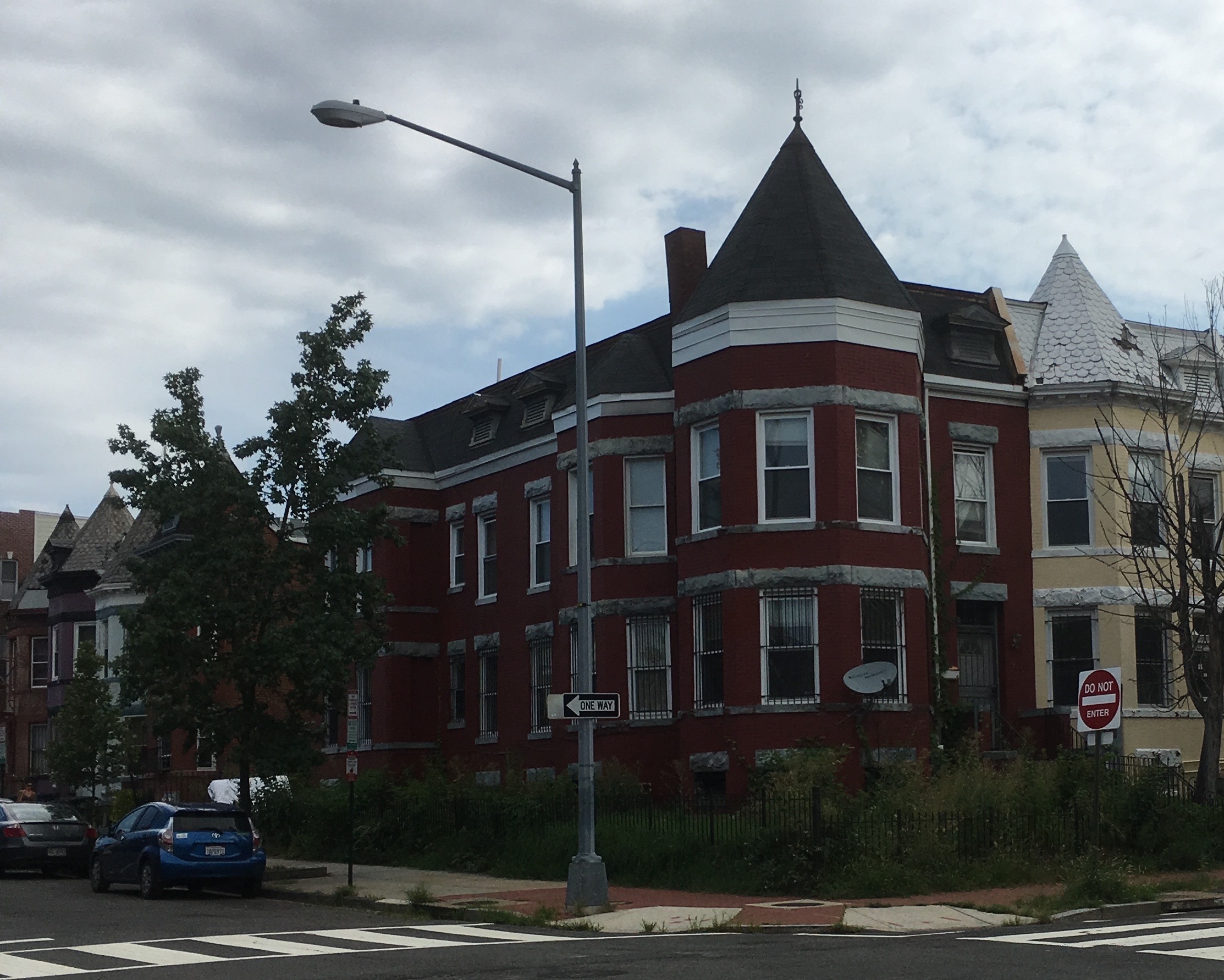
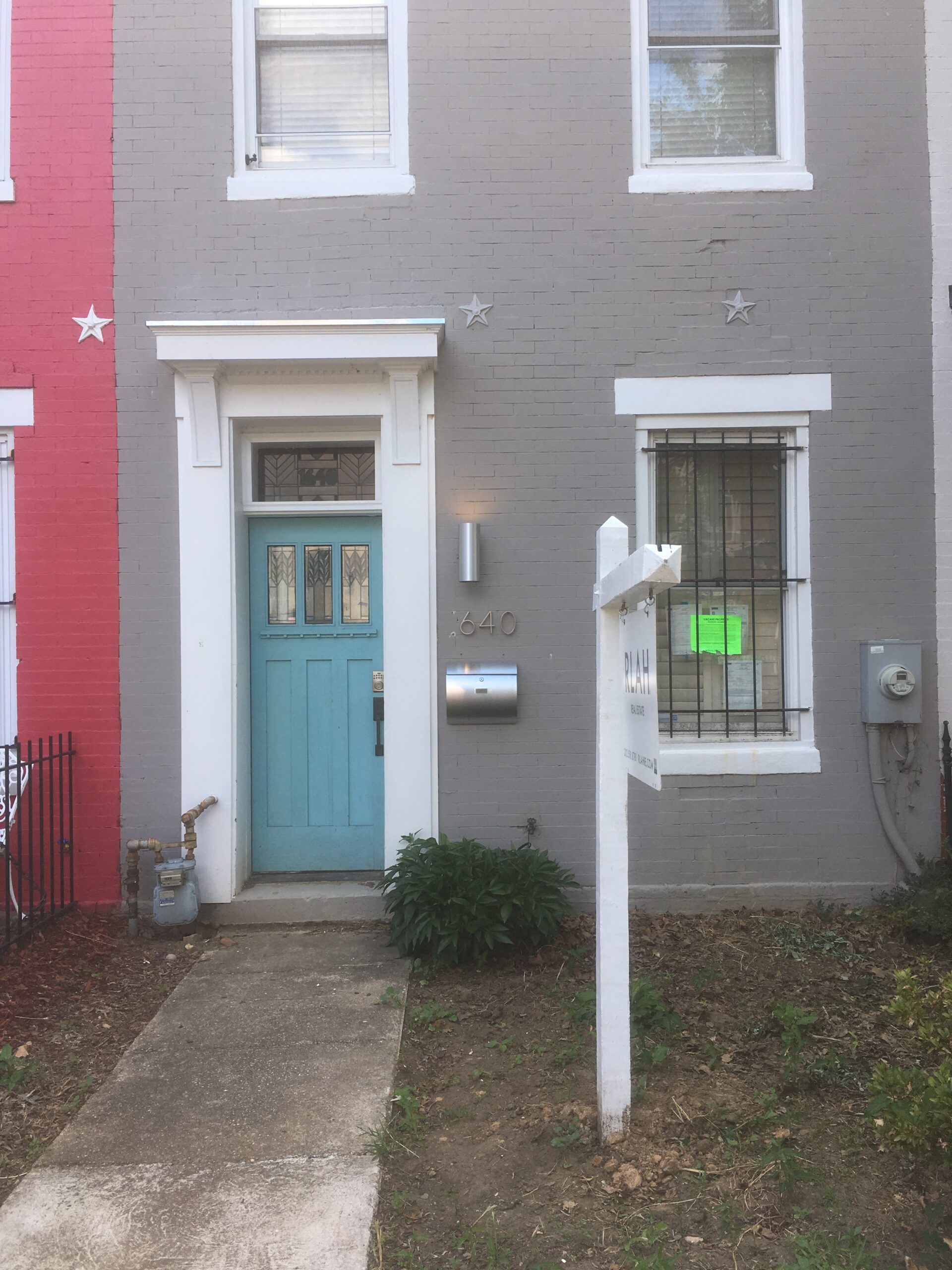
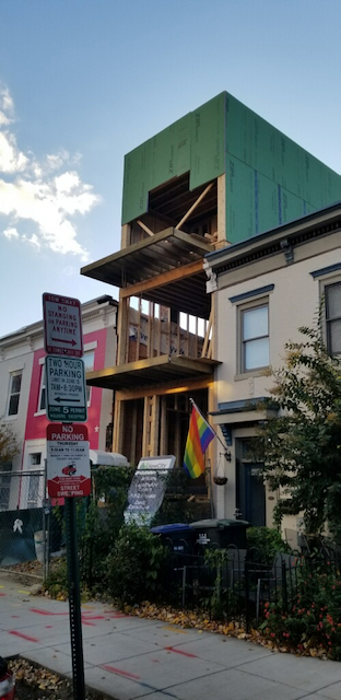
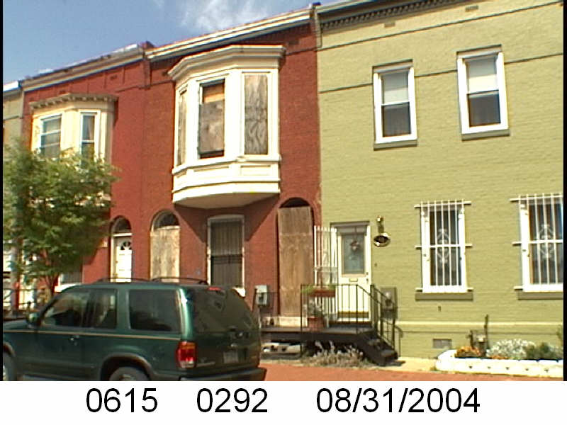
45 Bates St NW is on square 615 in Truxton Circle. During the time of WSIC’s ownership it sat on lot 134. Currently it is now lot 292.

I don’t have the exact date when WSIC came to posses 45 Bates and other homes on the block. In 1903 parties (George Sternberg and George Kober) involved with the Washington Sanitary Improvement Company (WSIC) owned many lots on Sq. 615. So fast forward to June 1950 and the property is transferred from WSIC to the Washington Loan & Trust Company, then from the Washington Loan and Trust Co. to business partners Nathaniel J. Taube, Nathan Levin and James B. Evans. The business partners borrowed $3 million dollars for Investors Diversified Services Inc. of Minnesota.

photo of property

So let’s get onto the property history:

  • December 1950 Colonial Investment Co. (represented by James B. Evans, Nathan Levin, and Nathaniel J. Taube) sold half of 45 Bates St NW to Kathleen S. and William W. Johnson.
  • December 1950 the Johnsons got a mortgage from (not named) Colonial Mortgage Co.’s trustees, Abraham H. Levin (Nathan‘s brother) and Robert G. Weightman for $2,400.
  • December 1950 Evans, Levin and Taube sold the other half of 45 Bates to George M. and Olivia V. Davis.
  • December 1950 Mr. and Mrs. Davis borrowed $2,400 from Levin and Weightman.
  • October 1961 the Davis household was released from their mortgage.
  • December 1961 the Johnsons were released from their mortgage.
  • July 1970 Kathleen transferred the property to William W. who in the next document transferred it to Florence Ann Johnson.
  • 1970-2013 lots of stuff happened that I don’t care about.
  • December, Friday the 13th, 2013 Olivia V. Davis Estate, apparently represented by heir Sterling A. Richardson, who transferred it from the estate to himself.
  • January 2014 Richardson sold his 1/2 of 45 Bates to Cameron Properties of DC, Inc.
  • 2014-2017 lien drama.
  • August 2017, Eric M. Rome, who was representing the estate of Florence A. Johnson-Morrison (who might have died in 2014) and Cameron Properties of DC, Inc, sold the whole property to 45 Bates Street NW LLC.

Detective Stories with AI- the 1700 Block of New Jersey Ave NW- White to Black

Yes, Mari found a new toy. I’m going to take a little break from the deep research while I clean up the data. Playing with AI made me realize that the WSIC posts aren’t uniform in the information they give, so I will need to fix that. In the meantime, here’s an old post, where I had Grok write it in the style of Raymond Chandler. It is a hoot.

The street stretched out like a tired old dame, worn thin by time and the heavy tread of too many soles. New Jersey Avenue NW, a name that carried the weight of a forgotten promise, sat in the shadow of Truxton Circle, where the air hung thick with secrets and the ghosts of yesteryear lingered in the brickwork. It was 1920, and the odd-numbered side of the 1700 block was a pale-faced affair—white renters huddled in their rowhouses, clutching leases like lifelines. By 1930, the tide had turned, and the block was a sea of brown faces, Black homeowners staking their claim on a piece of the American dream. The shift wasn’t no accident, no gentle drift of fate. It was a deal, cold and calculated, with the scent of money and desperation trailing behind it.
I dug into the dirt of it, the way a PI might sift through a dame’s lies to find the truth. The census told one story—white to Black, a decade’s flip of the coin. But the land records, they sang a darker tune. Around July 1920, M. Harvey Chiswell swooped in like a vulture in a cheap suit, snatching up 1707 to 1715 from Charles W. and Amy S. Richardson, then 1717 to 1721 from Ella S. Du Bois. She kept going, greedy fingers closing around 1725 to 1731 and 1733 to 1741 from Mason N. and Ada F. Richardson. The whole stinking stretch of New Jersey Avenue fell under her shadow, a monopoly built on deeds and dust.
Come August, the Evening Star piped up—H.A. Kite was set to patch up 1701 to 1741, a repair job to pretty up the bones of those old houses. But Chiswell wasn’t holding onto her prize for long. She flipped them fast, like a grifter unloading hot goods. September saw 1701 go to Grace L. Jackson for $4,100, a loan stitched up tight with W. Wallace Chiswell and Kite’s names on it. October rolled in, and 1707 went to Susie J.R. Johnson, 1711 to Maria Jones, 1713 to Frank E. Smith, 1717 to Mayo J. Scott and his wife Sarah, 1719 to William H. Randall and Katie. The list ran on—1715 to Fred H. and Hester Seeney, 1709 to Julia G. Holland, 1703 to Amelia Green by December. Every sale inked with Chiswell’s mark, every loan tied to her web of trusts, 6% interest bleeding the buyers dry.
The block wasn’t just sold off—it was carved up and fed to a new crowd, African Americans stepping into homes that white folks had fled. The why of it hung in the air like smoke from a cheap cigar. Maybe the old tenants saw the writing on the wall, the neighborhood tilting toward something they couldn’t stomach. Maybe Chiswell saw a profit in the shift, a chance to cash out before the winds changed again. Whatever the game, the 1700 block morphed into a testament to grit and gamble, a place where dreams were bought on credit and paid for in sweat.
I lit a cigarette and stared down the street, watching the shadows play across the rowhouses. The sell-off was a heist dressed up as progress, a shuffle of papers that rewrote lives. Truxton Circle didn’t care—it just watched, silent as a dame with too many secrets, while the block turned over like a card in a rigged deck.