I’m going to start at the near end of Carter G. Woodson’s book The Mis-Education of the Negro with an essay called “Much Ado About a Name.”
It starts with a discussion with a Lady Simon, the wife of a British Cabinet member who asked what did Black Americans want to be called. Lady Simon did not want to offend African Americans in her writings.
Although a student of social problems, this learned woman cannot fathom this peculiar psychology. Americans, too, must confess the difficulty of understanding it, unless it is that the “highly educated Negro mind” tends to concern itself with trifles rather than with the great problems of life. We have known Negroes to ask for a separate Y. M. C. A. or Y. W. C. A., a separate church or a separate school, and then object to calling the institution colored or Negro. These segregationists have compromised on principle, but they are unwilling to acknowledge their crime against justice. The name, they believe, will save them from the disgrace.
It does not matter so much what the thing is called as what the thing is. The Negro would not cease to be what he is by calling him something else; but, if he will struggle and make something of himself and contribute to modern culture, the world will learn to look upon him as an American rather than as one of an undeveloped element of the population.
So this comes off as critical. I get it. I was not initially on board with the term African-American because it seemed to make my Americaness secondary. But with use, I’ve come to find utility in the term and the related Afro-American and AfAm terms. I like the option for variety. But it is very limited and when writing about other members of the African diaspora, African- British or Afro-Canadian, just looks and sounds clunky.
Later in the essay and what can be hinted at in the above quotes, he is critical of AfAms who seem to be ashamed or wanting to downplay their Blackness. He mentions multiracial people who take pride in their African heritage. “As a rule, however, a European of African Negro blood feels proud of this racial heritage and delights to be referred to as such. The writer saw a striking case of this in London in the granddaughter of a Zulu chief. She is so far removed from the African type that one could easily mistake her for a Spaniard; and yet she thinks only for her African connection and gets her inspiration mainly from the story of her people beyond the Pillars of Hercules.”
Oh and for those of you who caught a whiff of shade he threw at the “highly educated Negro mind”….. yeah. There’s a lot of that. I’ll start at the beginning of his book next time and as we go through.
Now I hope you learned a little bit more about Carter G. Woodson than you knew before.

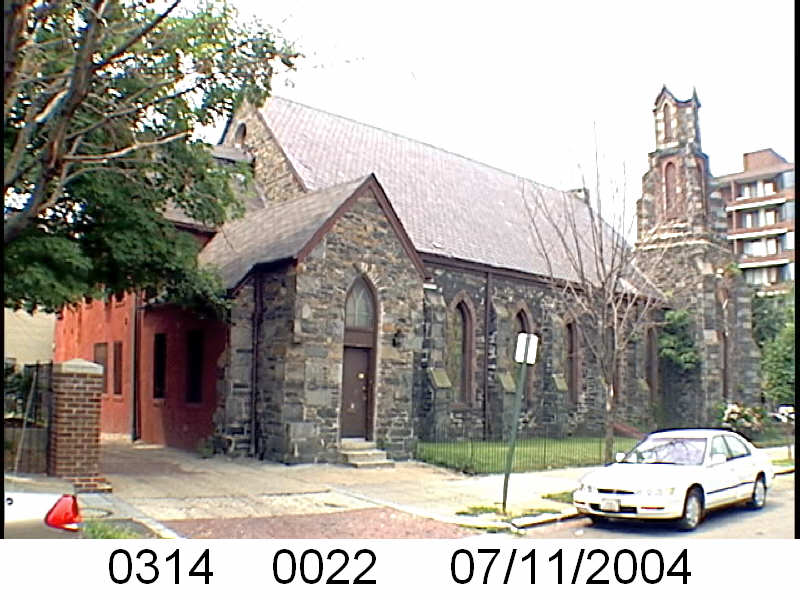 Mt. Zion Pentecostal Church was and still is at 1112 N St NW. It was a tiny church in 1957, with just 70 members. It was and still is an African American church.