I was looking through my old Flickr account because I am going to either shut it down or something where I am not paying a large annual fee to keep it.
So flipping through some old photos, I found this old gem from August 2006. Above is the Waltha T. Daniels Shaw Library in 2006. There is a much prettier library in that spot now.
This is a reposting of an old post from 2007. For some odd reason I was thinking about when historic districting goes south and remembered this case.
Long story short, artist Laura Elkins and John Robbins were getting on the Historic Preservation Office’s (HPO) and DCRA’s bad side and it resulted in a search warrant of their home, where they were living. The incident got some press. It attracted my attention. And it worked its way through the courts. Leagle has a pretty good summary of the case.
Thanks Ray for pointing out an article in the Washington Times [dead link] (as I hardly ever read that paper) of a couple who won a lawsuit against the DC government for a raid on their home, unlawful seizure of papers from said home, regarding perceived Historic Preservation violations.
A little Google search regarding the saga reveals differing opinions on if the couple actually did the HPRB dance correctly, which is not the matter that makes me fearful, it was the police raid of their home that concerns my little libertarian heart. The portion of the 4th amendment the violation in this is “no warrants shall issue, but upon probable cause, supported by Oath or affirmation, and particularly describing the place to be searched, and the persons or things to be seized.”
According to the lawsuit [pdf] a March 26, 2003 warrant was issued to search the home of Ms. Elkins and Mr. Robbins, but the warrant didn’t say anything about seizing papers or the like. The next day DC’s finest and DCRA “officials went throughout the home (including the
bedrooms of sick children home from school), opening drawers, observing, and taking photos.”
Seriously, this is just supposed to be about exterior crap, not worthy of a f*ing raid. One of the few things I agree with the pro-Historic District people on is that HDs are about the outside aesthetics of house, and what can be observed from the street, etc, etc. However, this, is something else. Investigate the case for yourself, decide if DC went too far a violated a family’s privacy and order.
On the bright side, Ms. Elkins, an artist, has turned her experience into art.
In 1957 there was as survey of churches in the Northwest Urban Renewal Area, which included Shaw, Downtown, and the area we’ll call Swampoodle. One of the churches was St. Phillips.
St. Phillips sat at 1001 North Capitol St NE. It was a Baptist church. In 1957 it was a decent sized church with about 1,000 members. It was a mostly white collar mostly African-American congregation.
This concludes the visual look at the Washington Sanitary Improvement Company (WSIC), properties on Square 552. According to the 1933-1934 General Assessment WSIC owned lots 33-35, 49-94, 98-100, 104-150, 811, and 816-820. The 200 even block of Bates St NW were lots 80-94.
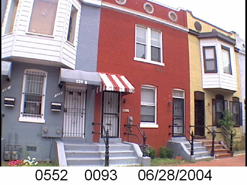
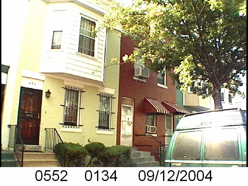
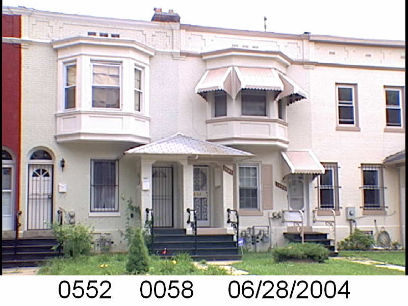
Whereas there were fewer dual entrance properties on the even side of the 200 block of Bates, the odd side had preserved more of them into the early 2000s.
211 Bates St NW217 Bates St NW227 Bates St NW (red house)229 Bates St NW
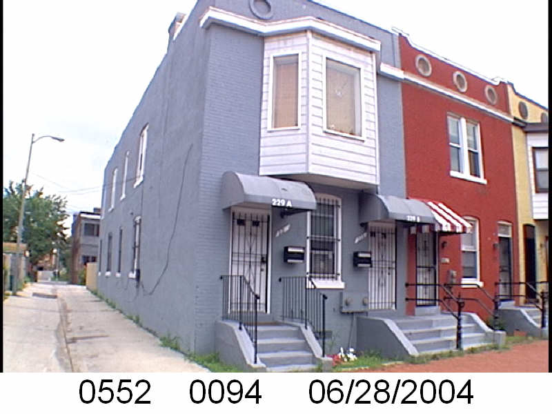
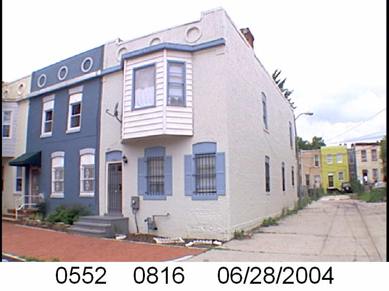
Although it no longer had a second entrance, you can see evidence that there was a door under the window of 225 Bates Street NW.
225 Bates St NW (yellow)
A ‘positive’ of neighborhood disinvestment is that sometimes it works as a preservative. If structures manage not to get torn down, there is little incentive to modernize or gussy up the exterior. When gentrification hits, as it has, there is an incentive to add a third story or change the whole structure. I am thankful for the 2004 photos. It was the start of the 2nd wave of Shaw gentrification, but well before the million dollar houses started showing up. We can still see what the WSIC built and what managed to survive after 100 years.
I’m going to take a little break from WSIC. Just a little.
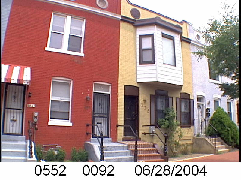
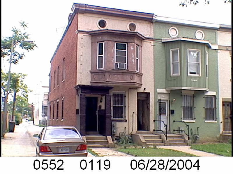
The Washington Sanitary Improvement Company (WSIC), owned, on Square 552, according to the 1933-1934 General Assessment WSIC owned lots 33-35, 49-94, 98-100, 104-150, 811, and 816-820. Previous posts looked at the 100 block of Bates. Square 552 holds both the 100 and 200 block of Bates St NW.
Most if not all of the WSIC properties were built with two flats, as they were intended to be rental properties, not homes for homeowners. Looking at many of the houses on even side of the 200 block of Bates, there is only one property that had two entrances still in 2004.
226 Bates St NW (red house)
A peek at Google street view and 222 Bates St NW, which only had one entrance in 2004. It seems sometime around 2015, 222 Bates St became two condos, with two separate entrances. And it got a pop-up.
222 Bates St NW, before going condo & getting a popup.
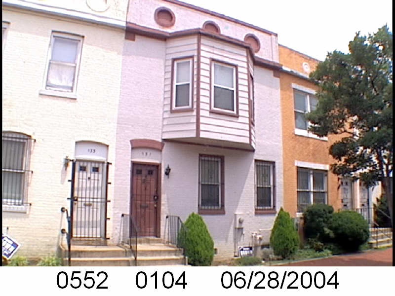
So what’s the bay, no bay pattern? Starting with 200 Bates: 2nd floor bay, no bay, bay, bay, bay, no bay, bay, no bay, bay, no bay, bay, no bay, bay, no bay, bay, and bay. The pattern makes no sense.
Another thing should note about all the Bates Street houses, from the unit block on Sq. 615 to the 200 on Sq. 552, is there is no yard. It very much like a lot of Baltimore row houses. One steps out their door and the sidewalk is right there. No need for a lawnmower.
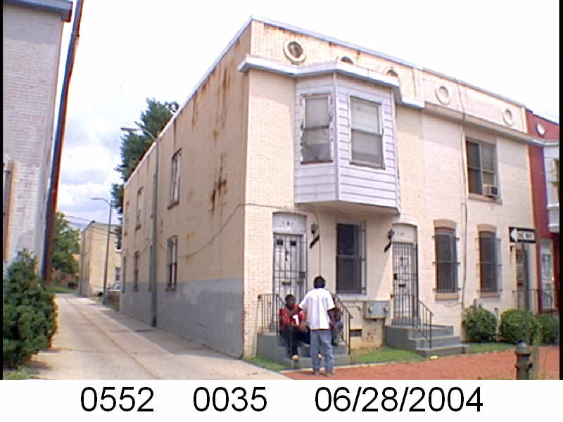
The Washington Sanitary Improvement Company (WSIC), owned, according to the 1933-1934 General Assessment WSIC owned lots 33-35, 49-94, 98-100, 104-150, 811, and 816-820. Previously, we looked at the even side of the 100 block of Bates where there were no WSIC owned properties. Now, the odd side.
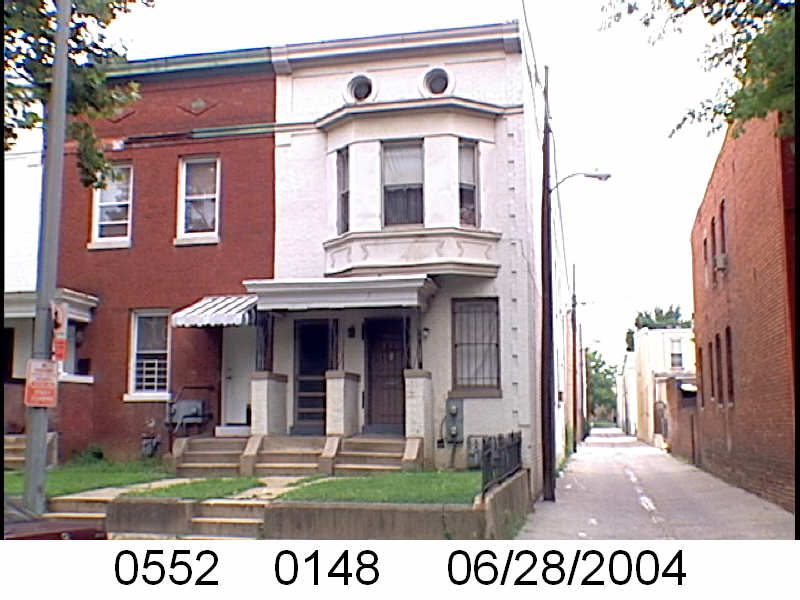
Lots 816-820, which are 119-123 Bates St NW, are not the first set of houses on the 100 odd block of Bates. The other houses, on lots 183-185 (107-111 Bates St NW) have a noticeably different style.
WSIC house.Not WSIC built properties
A WSIC house has a particular style. There is the 2nd floor bay and there are the design details, sometimes two or three, near the top of the building over the windows.
I should note that lots 816-820 were lots 101-103 in 1919.
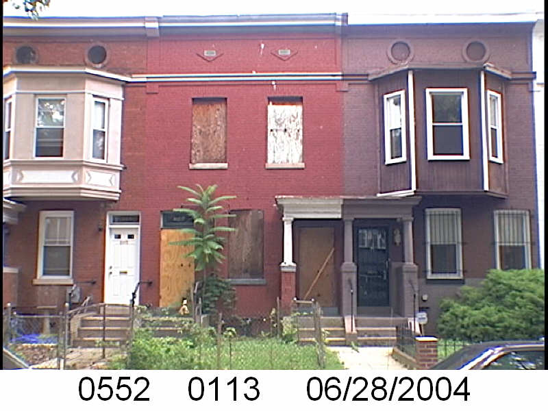
Old lot 25, became lots 803-805 (and other lots), is 125-129 Bates St NW. Lot 805 remains, and 803-804 became lots 821-822. These are not WSIC properties. You can see by the style of these properties they are not WSIC houses.
Not WSIC properties
If you remember from other WSIC posts, lot 25 owners were hold outs.
Lots 104-106 are 131-135 Bates St NW. Here we return to the WSIC style of 2nd floor bays, or no bays between bays.
Lots 33-35 are 137-141 Bates and it continues the WSIC pattern of houses.
The Washington Sanitary Improvement Company (WSIC), owned, according to the 1933-1934 General Assessment WSIC owned lots 33-35, 49-94, 98-100, 104-150, 811, and 816-820. Previously, we looked at the surrounding streets. Now we get to the creamy caramel center that is Bates St.
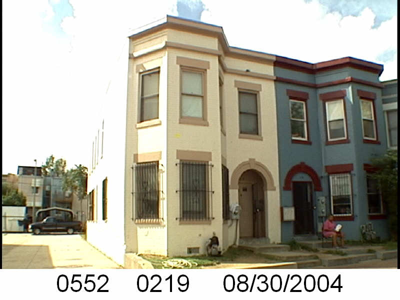
On the square that is 552, Bates Street intersects the center and has a 100 block and a 200 block. The even side of the 100 block of Bates St NW are lots 192-194, 202-212, and 217-219. Aaaaand none of those numbers match what was owned by the WSIC in 1933.
118 Bates St NW
A number of Sq. 552 lots were owned by a guy named Charles J. Walker in 1933. On the even 100 block of Bates he owned lot 193, which is 112 Bates St NW. Along with lots 217-219, or 118-122 Bates St NW.
110-112 Bates St NW
I should look into Mr. Walker, when I’m done with WSIC.
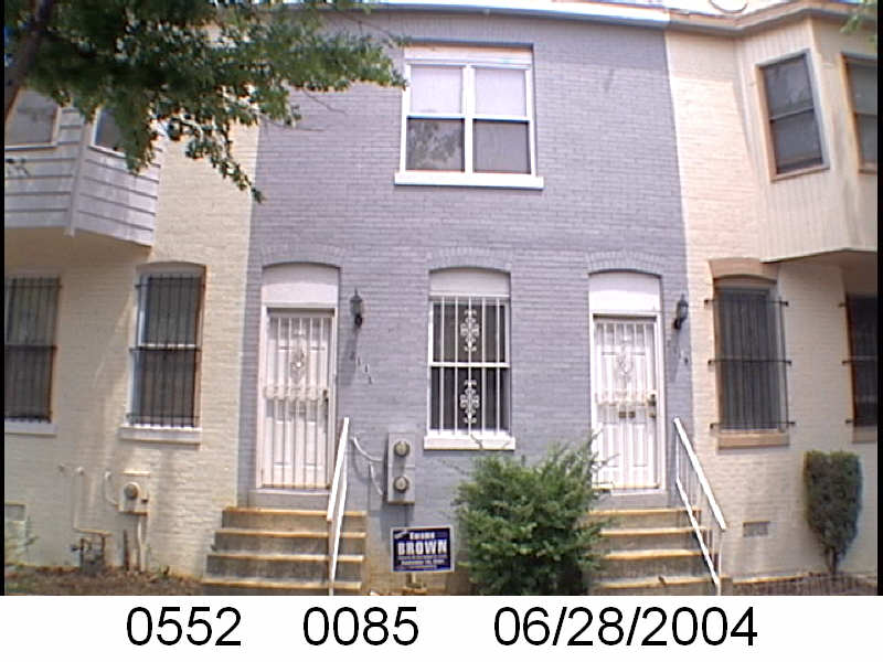
In the month of April we’re looking at the Washington Sanitary Improvement Company (WSIC) ownership of lots on Square 552, which is bounded by 1st, P, 3rd and Q Streets NW in Washington, DC. According to the 1933-1934 General Assessment WSIC owned lots 33-35, 49-94, 98-100, 104-150, 811, and 816-820. In this post we’ll look at P St NW, which are lots 107-119, 148-150.
So houses west of the alley between 139 and 201 P St NW are WSIC houses. Those are 201-231 P St NW. The other houses, east of the alley, 105-139 P St NW, are not.
I feel I need to state that the images are from 2004. Truxton Circle was a little rough around the edges then. It’s been 18 years now and most of the properties have been renovated. Several homes that were vacant, are now someone’s home. So the images do not reflect their current state. Go on to Google Street View for that.
Several of the WSIC houses have the classic 2nd floor bay and or have the covered entryway.
221, 219, and 217 P St NW, 2004
There are several houses in this row that have kept their two door entries. I believe, and I will look into this later, that almost all the WSIC properties were originally built to house two or more households.
As seen with Q St and 3rd Street, the WSIC bookended their row with a bay that was two stories, as opposed to a 2nd floor bay. They did not do that with P Street.
201 P St NW, 2004231 P St NW, 2004
The two ends of the WSIC row on P Street NW are not identical. 201 P St NW has something unusual, two entry doors, for the same property next to each other and covered. Typically, the two doors are separated by a window. Maybe this was done because of the alley? But if so, this is not replicated on Q St or on Bates.
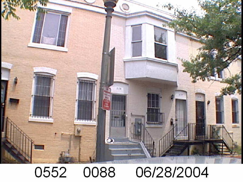
In the month of April we’re looking at the Washington Sanitary Improvement Company (WSIC) ownership of lots on Square 552, which is bounded by 1st, P, 3rd and Q Streets NW in Washington, DC. The company, WSIC owned 1529-1551 3rd St NW (lots 49-60 ) and 1501-1523 3rd St NW (lots 120-131). This is the last part covering lots 49-60.
In the last post I skipped to what was 1551 3rd St NW (lot 60), which is now 240 Q St NW, and condos.
240 Q St NW
So the pattern is 1529 3rd St NW as a 2 story bay, then 2 second story bays, 2 non-bays, 2 bays w/ entryway porches, 2 non-bays with entryway porches, 2 bays with entryway porches, then 1551 with a two story bay.
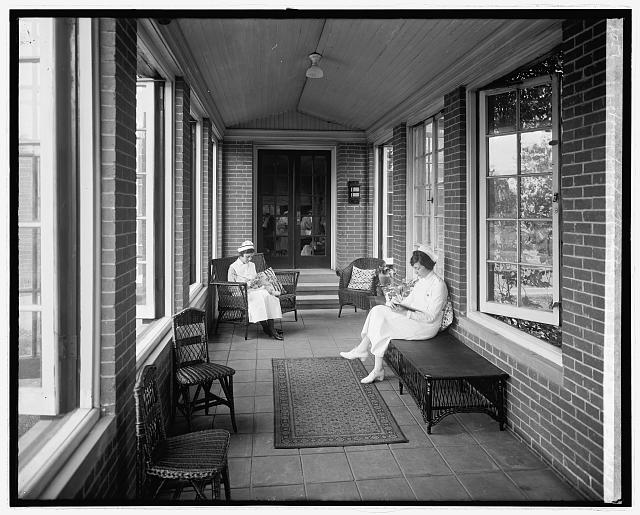
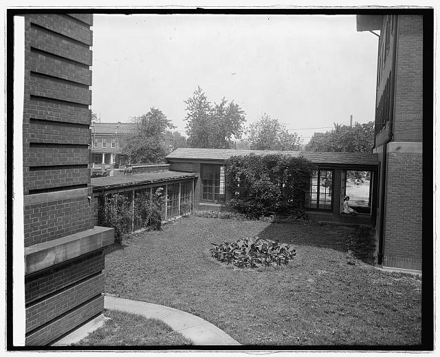
I tend to not write about institutions in Truxton Circle, mainly because I am interested in individuals and their stories. But a recent ‘discussion’ with a co-worker, homeopathy came up, which I saw a great excuse to mention the National Homeopathic Hospital. There’s a 2009 post with comments from people who had a connection with the hospital. The hospital sat at Kirby/2nd St NW and N St NW.
I have nothing new to write about the Homeopathic Hospital, but I have images from the Library of Congress:
Part of the National Homeopathy Hospital in Truxton CircleNurses. Homeopathic Hospital. Washington, DC, 1910

 I was looking through my old Flickr account because I am going to either shut it down or something where I am not paying a large annual fee to keep it.
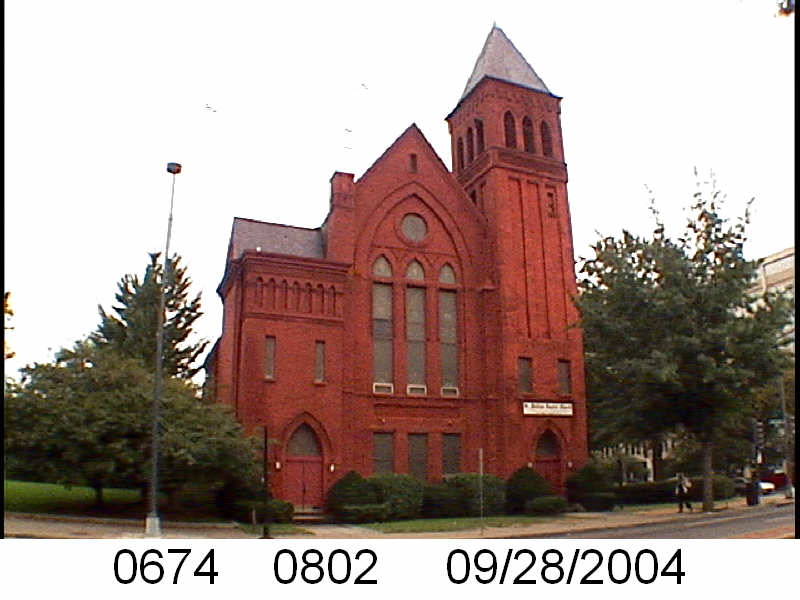
 St. Phillips sat at 1001 North Capitol St NE. It was a Baptist church. In 1957 it was a decent sized church with about 1,000 members. It was a mostly white collar mostly African-American congregation.