I’m only posting this because I see a comment I made on DCist about CaBi usage is pending, and I’m not 100% sure what I wrote that would warrant a flag. Maybe saying race and income doesn’t explain everything but around here (DC) it is used to explain everything. In the case of the Capital Bikeshare race and income aren’t the major reasons in light of other information.
Looking at this image
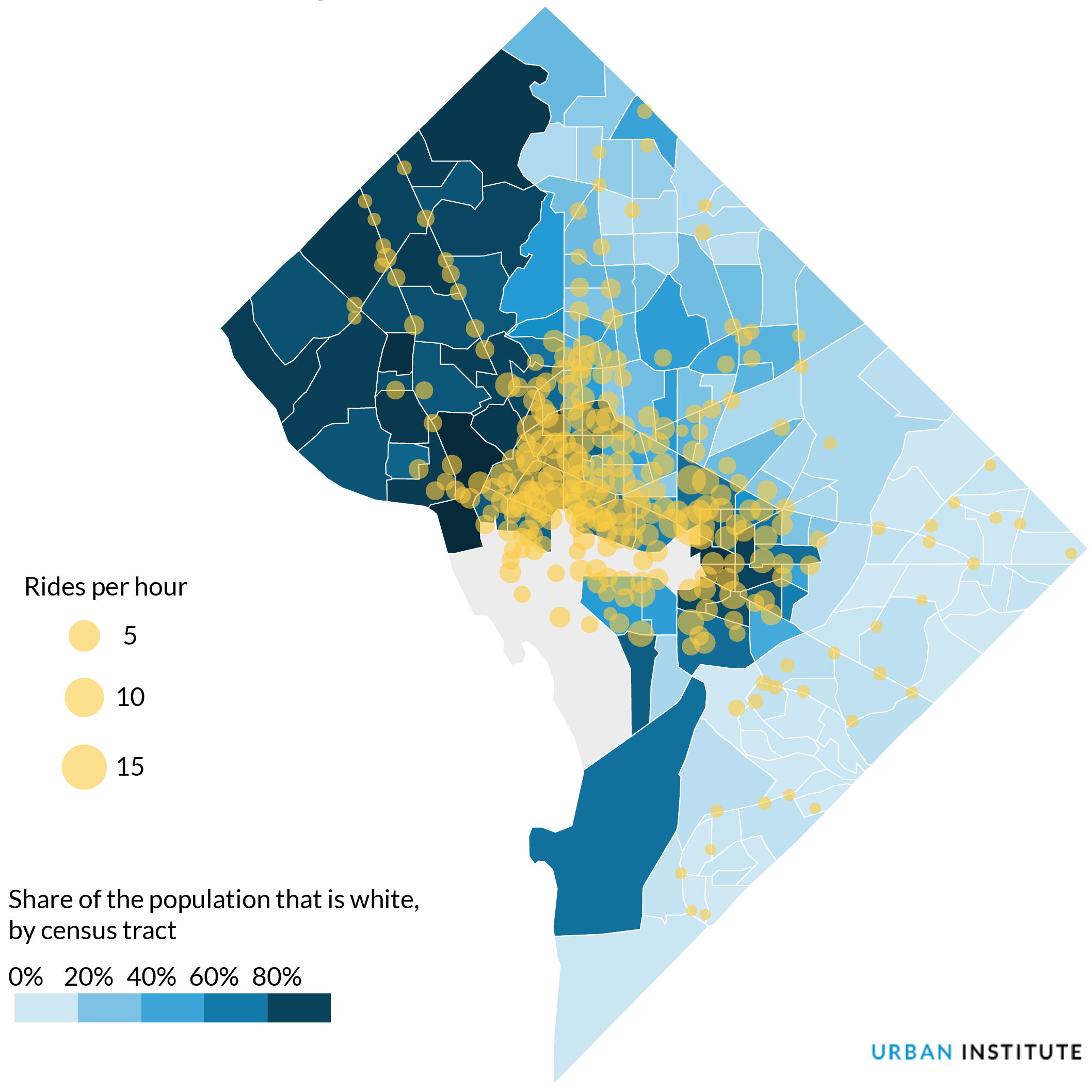
So there are rich white areas of DC way west of the park where there are 0 ride per hour yellow dots. The DCist story interprets this as Capital Bikeshare failed to be available to all users because there are so few rides in Wards 7 & 8.
There are more stations in “areas with higher shares of white residents, lower poverty rates, higher income, and higher college attainment,” according to the report. CaBi’s user survey, which it undertakes every two years, bears this out. The 2016 survey found that 80 percent of Capital Bikeshare users were white, with Asian and Hispanic/Latino riders both at 7 percent, and African-American riders at 4 percent.
Yes.
As one of the 4% African American CaBi users, I’ll say there are more stations because there is more demand in my now predominately white, formerly predominately black neighborhood. I know there is lots of demand because if the morning weather is nice I need to get my butt out of the house before 7:30 or else all the working bikes nearest me are gone. And there is lots of demand for slots near where I work, because I will encounter a full dock and try to figure out where is the closest empty dock may be.
Also if you look back at the map, the cluster of yellow is in a highly dense area with lots of retail/ jobs. The yellow along Massachusetts and Wisconsin Avenues NW into the areas of Upper Caucasia also are in dense-ish areas with retail. What do we know about Wards 7 & 8? Not enough retail. Not enough grocery stores. Also it lacks density of say Ward 1.
If memory serves me I think I wrote that I would prefer to see an overlay looking at age and retail rather than race.