1960s MICCO Parade Pix

1967 parade in Shaw. MICCO float.

This was probably the 1967 parade featuring Dr. Martin Luther King.

I do not know who these ladies are, beyond that they are probably on the MICCO board. What is MICCO? It is the Model Inner City Community Organization an organization that was around during the period of Shaw’s urban renewal. It helped get federal funds to black middle class professionals such as architects and builders.

What I do know is that the float passed R Street NW. I suspect Rhode Island Ave is just a bit behind it. They might be heading north on 9th Street. I have the parade route somewhere, but I do not know where.

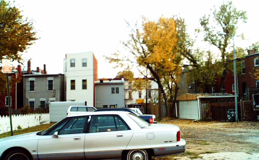
Don’t leave stuff in your car

Street diamondsDon’t leave stuff in your car, lest you be rewarded with street diamonds. Glistening blue or black diamonds that shine in the sun on the sidewalk and on the street. The thief who steals the $2.00 charging cord and the $1.85 from the console does not think about the hundreds you shell out to replace the window they broke. Worse is when you do keep everything out of sight but somehow they knew you had something worth taking hidden. Or when the chemically altered brain mistakenly thinks he can sell that radio he pulled from your car, later to find out he wasted his time, and your peace.

Barbara Bush in Shaw

So when I heard that the former First Lady Barbara Bush had died a couple of days ago, I thought. I have some photos of her, in Shaw.

I have a big stack of photos my aunt took in either 1991 or 1992 (I’ve been too lazy to bother to get the dates) of a funeral. The deceased then was Rev. Henry C. Gregory III, who I gather was the pastor for Shiloh Baptist Church at 9th and P Streets in Shaw. Rev. Gregory was apparently important enough to get the then President, the Mayor, and some other important looking people I cannot identify to come to his funeral. It doesn’t help that the photographer didn’t care to go through the photos to identify people. So below are the pictures. If you can tell me who is in them, beyond the dead guy and the Bushes, that would be helpful.
BarbaraBush-1992-1

BarbaraBush-1992-2

BarbaraBush-1992-4
BarbaraBush-1992-3

That is one pretty salad

Fishscale Romaine SaladSo for lunch I ventured out and was hankering for a Halfsmoke dog but they were closed on Tuesday for lunch, so I walked back in the direction of Truxton Circle to fix myself lunch when I was drawn into Fishscale at 637 Florida Ave NW.

See that salad. That sure is one pretty salad. I did not order that salad. I ordered a fish burger with the sunflower slaw. It was good. Was it $15 worth of good (incl tax)? Unsure, but it was good. I liked it. I may come back to check out the salad to see if it tastes as good as it looks.

Scripture Cathedral is no more

Nighttime view from 8th St NW
View from 8th St NW. Scripture Cathedral is no more.

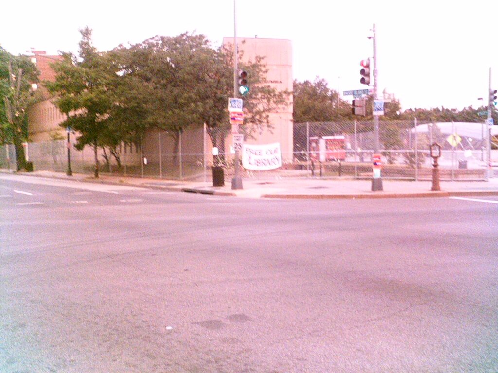
Walking to mass Saturday I noticed that a building was missing from the corner of 9th and O Street NW. The Scripture Cathedral that shared a parking lot with Immaculate Conception Catholic Church is now gone. It emptied some time ago, but now it is no more. Probably, luxury condos will go there.

I figure Roadside Development will get around to putting a building on the parking lot space whenever the other developer finishes putting a building on the Scripture Cathedral space.

Commerce was part of our history

In the past couple of weeks I have been in contact with people in the commercial sphere about history, and this had me thinking. If you were raised in a place, maybe a suburb, where commercial buildings and activities are segregated from residences, you might be under the impression that this is the way things are supposed to be. It might even cloud your view of history.

The wonderful things about cities, older East Coast cities, is that there was mixed use before things like zoning. People lived in close proximity to their jobs and the businesses they used. A building could house a family and a store, or a one time be a store and then maybe later a residence.

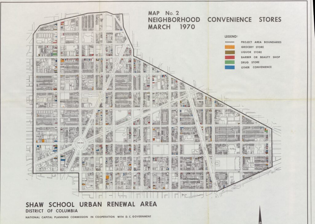
The map above is just of stores. It does not point out the warehouses around Hanover Street and the working dairy where Mt. Sinai and the Northwest Co-op sit, but you can see their outlines. The other thing to take into account is this is 2 years after the 1968 riots, many businesses did not rebuild or return, depressing the neighborhood even further.

When I moved into the neighborhood in the early aughts, there was annoyance at the types of businesses that were filling the commercial corridors of Florida Avenue and North Capitol and spaces in between. Those businesses were liquor stores (brown on the map) and beauty parlors (red on the map). Those were pretty much the only things taking up spaces left empty 30 years prior.

Reading post-riot reports where business owners had an opportunity to say something, the area had problems before the riots. The riots just made a bad situation worse, and businesses, along with residents began to leave. Now contrast that with today, where businesses want to come to Shaw. The number of  sponsors for the Shaw Main Street’s Art All Night was an embarrassment of riches, a testimony of how far the 7th, 9th and U Sts commercial corridors have come.

Shaw’s rising from the ashes of the riots was not just from people moving in and fixing up houses, it was also businesses coming in and taking a chance on the neighborhood.

A bit of DC 60s anti-Freeway expression

The thing I like about primary sources in history is that it occasionally reminds us of the things forgotten. We know of Emmet Till, the Birmingham Sunday school children, Medgar Evers, and Malcolm X, however those other people require Googling. Yet, the people who this flyer/poster was aimed at knew who was Col. Lemuel Penn.

I don’t want to add too much to this, except to say that neighborhoods like Shaw were in real danger of being destroyed by freeways/ highways. Read the poster and tell me what you think in the comments.