The goal of this exercise is to pull the names of Black home owners from the 1920 census and explore what I could find.
Sadly, the name in the census doesn’t match up with the name in the DC Recorder of Deeds on-line records site. I double checked the census page, tried variations of the spelling and just searching for the surname. Nothing.
Normally, I pick the name of a Black home owner from the 1920 census who lived in Truxton Circle, and try to find something interesting, or semi-interesting.
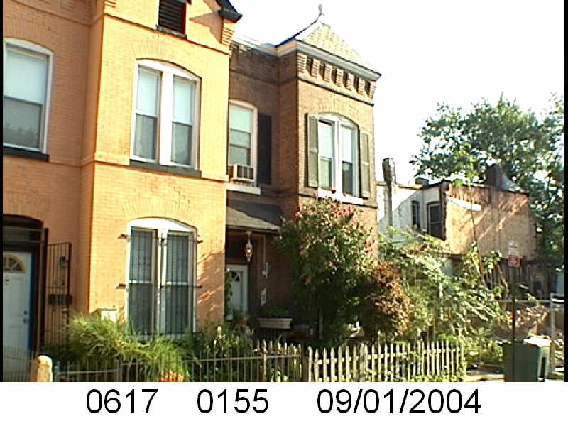
Thankfully George Robert Brown had a Family Tree description done in Ancestry.com because Brown and George are very common names. His tenure on 4th St goes back to the 1900 census, but he, a day laborer and his wife Ella Elizabeth (nee Wright), a dressmaker, and their 18 year old daughter Lulu/Lula/Lucinda lived at 1119 4th St NW. Besides the houses on that side of the 1600 block of 4th St NW, weren’t built until around 1900.
The Brown family does not appear at 1639 4th St NW until the 1910 census. Then George Brown is listed as a hotel waiter, Ella was still a dressmaker and Lulu was 2 years younger than what she should have been (26 years old as opposed to 28) and working as a public school teacher. The family had lodgers living with them, Charles E. Fuller, a picture hanger, and Patience Willis, a domestic.
In 1920, the family was still at 1639 4th St NW with some small differences. Ella E. Brown was still a dressmaker, but George was a GPO messenger, and Lulu, still a teacher, but had married. She married William Miner in 1917 and they had a 1 year old son George W. Miner. The family retained one of the lodgers from 1910, Patience Willis.
The family had moved to 1433 R St NW where government clerk William Minor was the home owner by the 1930 census. Lucinda/Lulu was still a public school teacher and her father George Brown was a widow. According to an Ancestry family tree Ella E. Brown died August 31, 1928.
Ella E. Brown’s death is confirmed in the DC Recorder of Deeds’ records. The on-line records provided go back to 1921. A deed from May 8, 1929 stated that George R. Brown was a widow. There are two deeds for that date, and two deeds for February 14, 1950. I know they are serving the purpose to do something, but I don’t know what. What I do know is that one of the 1950 deeds tells us George R. Brown died October 10, 1936.
The Miners, which includes Lucinda, William, their son George and his wife Charlotte Bell Miner held on to the property until June 2000. George and Charlotte sold the property to Adeola and Mufutau Sanni. For the time the property belonged to the Browns it wasn’t mortgaged. The Miners took out a loan with Riggs Bank (for Jefferson Federal Savings and Loan Assoc.) in 1978 for $20,000. This time I’m sure it was for actually that much.
As part of this series, I pick the name of a Black home owner from the 1920 census who lived in Truxton Circle, and try to track their life in this DC neighborhood. This is another sad story where someone loses their home.
One little note, I have the man’s name as Philip M. Murray from the 1920 census. But other records have him down as Peter M. Murray.
Let’s hit the land records and take a look at what happened.
The DC Recorder of Deeds’ online records start around 1921. The first record for 1645 NJ Ave NW (E0509 0020) is a trust, which means money was borrowed, between Peter M. and his wife Charlotte M. Murray and trustees on June 10, 1925 for $5500. The debt was paid or released and recorded on May 28, 1931.
This was followed by a release, the next month on July 3, 1925. A release is usually a document to show the debt was paid. This release was for a debt taken out on January 21, 1921.
May 21, 1931 the Murrays were forwarded 30 shares from the Oriental Building Association which amounted to $6000. In November 1932 there was a trustees deed filed. It appears the Murrays defaulted on their loan. The Oriental Building Association ran a notice in the Evening Star and so the Murray’s lost their home.
So who were the Murrays? Peter Marshall Murray (must be logged into AncestryLibrary.com for link to work) was born in 1888 in Houma, Louisiana to John L and Lavinia Murray. Charlotte was born Charlotte M. Wallace in 1885 South Carolina. They married in Washington, DC July 2, 1917 when she was 32 years old.
In 1920 they lived at 1645 New Jersey Ave NW with Charlotte’s mother, her 23 year old sister, and a live in domestic servant. Peter Murray was a physician, Charlotte and her sister Sametta were teachers. In July 1921, the Murrays had a son John Wallace/Walker Murray (d.2001).
According to the 1930 census the Murrays had departed DC and were living in a 7th Avenue apartment building in New York City. According to his World War II registration card Dr. Murray and his family lived at 2588 7th Ave Apartment 2P in central Harlem. So by the time they lost their DC house they were settled in New York.
One of the last records of him and Charlotte was a 1952 trip to the United Kingdom on the Queen Mary out of NYC to Southampton England. Dr. Murray died in December 1969 in New York. Charlotte died much later in 1982.
From Gerald D. Dorman, “Presentation of the Academy plaque to Peter M. Murray, MD.” Bulletin of the New York Academy of Medicine 45, no. 8 (1969): 729.
There is more information about Dr. Murray after he and his family left DC.
Normally, I pick the name of a Black home owner from the 1920 census who lived in Truxton Circle, and try to track their life in this DC neighborhood. Sometimes, if there is something interesting, I’ll
1607 New Jersey Ave NW, March 2013
look at what happened after they moved and where they went.
Sometimes looking for the one person works, but sometimes things are so muddy I have to look at his or her surrounding family members. Wallace J. and Madge V. Broadus had a son named Arvid (sometime Arvide)… it was easier to find him in the following 1930 census. The 1930 census had the family still at 1607 New Jersey Ave NW, but Madge was missing and Wallace was a widower and working as an elevator operator for the US government.
I had to search for Wallace Broadus’ daughter Evelyn to locate the family in the 1940. Wallace J. was working as a skilled laborer for a printing office. He also remarried. Maybe the Government Printing Office? A number of Truxton Circle residents worked there. I found Arvid W. Broadus’ World War II draft card showing him at 1607 NJ Ave NW. But the events of World War II would have this son leaving home, marrying a gal named Mary Louise Jackson, then divorcing her in 1950 in Walton, Florida, where she remained.
Unfortunately for me, there is another Wallace Broadus or Broaddus floating around Washington, DC around the same time. So I’m not clear when he passed away. But like so many, it appears that he left the house to more than one family member. People. In your wills, leave a single piece of property to one relative. You want to leave more property to another relative, than go on and get yourself another property. sigh.
So it appears according to Wallace J. Broadas’ will, (probate in US District Court admin # 115,960) the property was left to Arvid Wallace Broadus, who was then not married. It says unmarried, but he’s divorced at this point and it doesn’t seem like he remarried. AND Evelyn Louise Shears (nee Broadus) and her husband Harry J. Shears, and Wallace’s sister Bessie Elizabeth Mack (nee Broadus), her husband William Mack and someone Bernice Occulane (aka Oculaine) Mynatt, who I believe might be his sister or other relative. Mynatt’s maiden name was Bernice O. Broadus before she married Bernard Ross Mynatt in DC in 1938.
Anyway, in 1966 the family sold 1607 New Jersey Ave NW to SOVEREIGN INC . Before there were plenty of trusts (borrowing money) and releases (paying it back) between 1922 and 1954 and I just don’t feel like covering it.
UPDATE 11/14/2022: The family owned 1607 New Jersey NW for longer than Wallace’s lifetime. Arvid owned it up until his death in 2009.
Normally, I pick the name of a Black home owner from the 1920 census who lived in Truxton Circle, and try to track their life in this DC neighborhood. Sometimes, if there is something interesting, I’ll look at what happened after they moved and where they went.
William H. Rose was a professional driver with many years of experience. In 1900 he lived at 113 Pierce St NW with Annie, working as a coachman, for a government insane asylum. In 1910, he and Annie had moved to 7 Hanover and he was working as a driver. According to the 1911 city directory he was a coachman.
He probably died around 1927, as his will was probated (is that a word?) that year. According to the will, his wife Annie had died, leaving him a widower. The will was signed in April 1924, he directed that the 7 Hanover St home be sold and monies to be distributed to people and institutions. His brothers Abraham G. Rose, living in Richmond, brother George S. Rose were supposed to get $500 each. His sister in law Julia E? Scott, was to inherit $400 from the sale, and nephew William Robinson $300. Should any of those person should have died before him, then money would have been directed to Mount Carmel Baptist Church, where he was a member to create a fund. According to land records, Frank K. Boggin was the executor of his will and sold the home in September of 1927 to Mabel and William Robinson, who then lost the house in 1936.
His will stated that he owned lots in the Takoma neighborhood and Douglas Park, VA . The his brothers, Abraham and George would get one lot each in Virginia. His sister in law was to remain in the house, where she was living on 22 Spring Place, which no longer exists.
Today’s Black home owner from the 1920 census who lived in Truxton Circle is William E. Davis Jr of 1605 NJ Ave NW. DC native William E. Davis was the son of William A. Davis, and later the husband of Annie M. Henderson, it is with these two people, and his sister Nannie Bellows, I am hoping that I have the right William Davis out of the couple of dozen William Davis living in DC at the time.
Because his name was so common, it is hard to piece together a history and be sure it is him. But here is what I think I know.
In 1908 William E. Davis married Annie M. Henderson at St. Augustine’s rectory. In the 1910 census he and Annie lived with his father William A. Davis home owner of 1605 New Jersey Avenue NW, along with his sister Nannie Bellows, his niece Pauline Bellows. The younger William was working as a coffee roaster. Moving on to the 1920 census, William Sr. is assumed dead and William Jr is the head and owner of 1605 NJ Ave NW, living with wife Annie, sister Nannie Bellows and his niece Pauline. He moved from coffee roasting to being a houseman for a hotel. And then he seems to disappear from the record.
So let us turn to the land records which are available after 1921. Sadly they don’t provide much insight about William Davis. The earliest record is from 1937 trust where Nannie Bellows borrows $1800 through the Northern Liberty Building Association. This is followed by a release for a debt taken on in January 1917 by William Davis (the senior), William Davis, Annie Davis, and Nannie Bellows. This is followed by a March 1949 deed labeled as a trust, which informs us that Nannie Bellows was deceased and Pauline borrows $500 from trustees. There was a release for this debt the following year and we are alerted to another property under Pauline’s control, 654 E St SE.
There are many more trusts and releases, but I will focus on the last two transactions involving Pauline Bellows, the sole owner of 1605 NJ Ave NW, borrowed $700 at 6% interest from trustees on February 4, 1958. A year later in March 1959, a trustees deed was issued to Cora Mae Pope, because Pauline had defaulted on her loan and lost the house.
I don’t know what happened with Pauline. I looked her up in Ancestry and discovered she made a social security claim in 1966. Her father’s name was Thaddeus Bellows. Like the other family members, she faded into obscurity.
Normally, I pick the name of a Black home owner from the 1920 census who lived in Truxton Circle, and try to track their life in this DC neighborhood. This assumes the person at the house when the census enumerator came by was telling the truth or gave correct information. In this case I can’t confirm ownership or even if Ida Becher existed.
The land records for 1625 4th St NW start in 1938 and the owners are Edwin H. Silver and Ida Phelps Silver. I checked the 1933-1934 General Assessment, and it still had the Silvers were the owners. Then I checked the 1902-1903 General Assessment, and William Ruppert was the owner.
The city directory for 1921 has JW Stauback as the resident there. I’m not going to hunt the other city directories. I’m going to call this a dead end and a day.
This is part of a long series of posts about African Americans who were home owners in the Truxton Circle neighborhood.
In the 1920 census Mary Armistead is listed as a doctor. According to the census she lived at 1223 New Jersey Ave NW with her cousin Mary E. Griffin, a widowed teacher, Sarah Tolliver, another widowed cousin, and boarders, the Martin family and Ester AB Popel.
There aren’t a lot of land records for this property. The first record is a release from 1923, listing Mary E. Armistead and her cousin Mary E. Griffin as joint tenants. The release was for an August 1917 debt with a trustee. The next record is a 1951 trust. From the document we are told Mary E. Griffin was deceased (and we can assume so is the unnamed Mary E. Armistead) and Mabel A. Griffin Lewis was the owner. Ms. Griffin-Lewis borrowed $3000 from the National Savings and Trust Company. Griffin-Lewis died and her executor Beulah J Murphy sold the property in 1978.
According to the 1919 city directory, Mary Armistead was a midwife and the widow of Howard M. Armistead (former Government Printing Office worker). According to FindaGrave her obit read as:
Evening Star
Washington, DC
30 Aug 1934
ARMISTEAD, MARY E. On Tuesday. August 28, 1934, at her residence, 1223 New Jersey ave, n.w.. MARY E. ARMISTEAD, widow of Howard M. Armistead, devoted sister of J. Randolph Minor and James L. Minor, cousin of Mary E Griffin. She is also survived by many other relatives and friends. Remains resting at the John T. Rhines funeral chapel. 3rd and Eye sts. s.w., until Thursday evening: thereafter at her late residence. Funeral Friday, August 31, at 1 pm. from Israel C M E. Church, New Jersey ave. and Morgan st..n.w. Interment Woodlawn Cemetery.
In the 1910 census she was working in the medical field in Obstetrics and living at 1320 Montello Ave NE (Sq. 4064 lot 0037) in a house she owned. So back to the land records to see what other properties she owned and I found 317 10th St SE (Sq. 0945 lot 0823/007) in the Eastern Market area.
Normally, I pick the name of a Black home owner from the 1920 census who lived in Truxton Circle, and try to track their life in this DC neighborhood. Why? Because I have picked Truxton Circle as a place to study and I’m going to study this ‘hood into the ground. This post looks at Alfred J. Tyler, who according to the 1920 census lived at 67 N St NW.
Sometimes, I decide to do a Google or ProQuest search if I think the person may have been more than a normal citizen. Search and ye shall receive. Rev. Alfred J. Tyler is mentioned in Mount Horeb Baptist Church’s history: “Reverends Alfred J. Tyler (1902-1903), Marzy V. Morris (1904), and J. T. Clark (1904–1916) served as the fifth, sixth, and seventh pastors of Mount Horeb. ” He also shows up in a church history for Mt. Airy Baptist Church: “On June 1, 1906, Rev. Alfred J. Tyler, formerly of the Bethlehem BaptistChurch of McKeesport, PA, was installed as Pastor.He found the churchagain in need of larger quarters and led the congregation in a building program.Groundbreaking for a new edifice occurred in September 1925, and “AMonument to Jesus” was erected.After 30 years of toil and preaching,Rev. A. J. Tyler went to his rest.”
[Mari head tilts] I wonder if Mt. Airy knew of his very short stint with Mt. Horeb?
Little matter. The next paragraph reads: “On February 18, 1937, one of the sons of the former Pastor, Rev. EarlK. Tyler, was unanimously elected Pastor.This young preacher quicklybrought new congregants into the church and good works continued.Rev. E. K. Tyler organized new clubs, sponsored a Sunday School ofover 350 children, and formed a “Junior Church,” attesting to his love ofyoung people.Rev. Tyler licensed and ordained various sons of thechurch who went on to extend the influence of Mount Airy Baptist Churchthroughout the city.Rev. Earl K. Tyler was called to his reward on May 13, 1955, after a pastorate of approximately 19 years.”
From the church histories we know Rev. Tyler was in DC in the early 1900s. In the 1900 census the Tyler family was living in Allegheny, PA, where Alfred was already working as a preacher. He shows up at 67 N St NW in the 1910 census and the 1911 city directory. In the 1910 census he was shown as renting and living in the house with his wife, Sarah A. (nee Slaughter), his 69 year old mother Elizabeth, daughters Sadie B, and Annie E, and sons Allin J. and Earl K. He listed his occupation as a minister.
The earliest land record from the DC Recorder of Deeds online site (1921-Present) is an agreement from 1925. The agreement is between Alfred J. Tyler and the American Security and Trust Company where it appears Tyler had requested an extension on a note. The document notes that the initial promissory note dated back to September 1908. The next record is a September 1928 trust where Alfred and his wife Belle ( apparently Sarah is Belle) borrow $4000 through the Columbia Building Association. The next month they are two releases, both for 1908 debts, including the one with the American Security and Trust Company.
In the end the Tylers lost the property due to the $4000 1928 debt in 1940. Rev. Tyler died in 1936, so this appears to be a failure of his estate. I will note an owner or two later in 1966, George Basiliko became an owner.
Welcome back to the Black Home Owners of Truxton Circle, where I pick the name of a Black home owner from the 1920 census who lived in Truxton Circle, a NW neighborhood in Washington DC, and research them.
The Thomas don’t lend themselves to easy tracing in the Census and the land records don’t really help either. Buck doesn’t show up at all in the land records. The on-line land records starts around 1921, and the first thing for 65 N St NW is a 1928 trust between Lizzie Thomas and a trustee for $299.00 at 6% interest. This debit is paid off in 1936 and that is the last document with Lizzie’s name on it. The next document after that is a quit claim deed from 1944. In the deed it is claimed that his sister Birdie Anthony is the heir of Edgar Thomas (a son of Buck and Lizzie) according to his 1939 will. So she and her husband Percy Anthony transfer the property to Ruth Lucille Trent. This is followed by another deed in 1957 when the executor of Birdie Inez Anthony, Lottie Anthony Fambro, transfers the property to Ruth Lucille Trent.
Edgar Thomas was easier to locate in Ancestry. Through him I learned Lizzie was Lizzie and not short for Elizabeth. What I learned was Buck Thomas is too common of a name in Georgia.
The Thomas’ lived in the Atlanta Georgia area and are found in the 1900 census with their five children, Birdie, Willie, Ruth, Edgar and George. At that time they had been married for 21 years. It’s hard to make out Buck’s occupation but it looks like cashier in a dead letter office. In the 1910 census they are living at 65 N Street NW with 4 of their children (Willie is not there), with Buck working as a messenger for some government department. By the time the 1920 census rolls around the Thomas’ are both 60 years old, living with only one son, George.
Edgar wound up living back at 65 N Street NW. On his WWI draft card, circa 1917/1918, he was living at 217A V St NW in Washington, married with child and working as a messenger for the State Department, which could have been the undecipherable government department where his father Buck was working. But by the Second World War, his draft card showed him back on N St, living with his sister Birdie Anthony, still working for the State Department. In between, in the 1920 and 1930 census he was living with his wife, Bessie C. and step-son, Arthur Brooks, at 1126 Girard St NW in a home he owned.
I couldn’t really locate Birdie Thomas Anthony, instead I searched her husband, Percy Paul Anthony. Percy was also from Georgia and in 1910 he was living with Birdie, and their 2 year old daughter Dorothy Inez, working as a tailor in Atlanta in a house he owned. In 1920 the Anthony’s moved up to DC and were renting from the Thomas’ at 65 N St with their 10 year old daughter, Lottie. In 1930, the Anthony family is living with the widow Lizzie and her adult son George (who is also working for the State Department), his wife and daughter Lottie I. For some reason Birdie is listed as Bertha. In 1940, Lizzie Thomas was 74 years old and still the head of the household. George was still single but didn’t appear to be employed. Edgar Thomas was working as a messenger for the government, as was Percy. However the Anthonys were downgraded from relatives to just lodgers in the 1940 census. I’ve seen this in other BHOoTC series posts, I don’t know why that was.
Yes, a lot of different people in this post. You may have needed a score card to keep track of them all. Thanks for sticking with me.


 So it appears according to Wallace J. Broadas’ will, (probate in US District Court admin # 115,960) the property was left to Arvid Wallace Broadus, who was then not married. It says unmarried, but he’s divorced at this point and it doesn’t seem like he remarried. AND Evelyn Louise Shears (nee Broadus) and her husband Harry J. Shears, and Wallace’s sister Bessie Elizabeth Mack (nee Broadus), her husband William Mack and someone Bernice Occulane (aka Oculaine) Mynatt, who I believe might be his sister or other relative. Mynatt’s maiden name was Bernice O. Broadus before she married Bernard Ross Mynatt in DC in 1938.