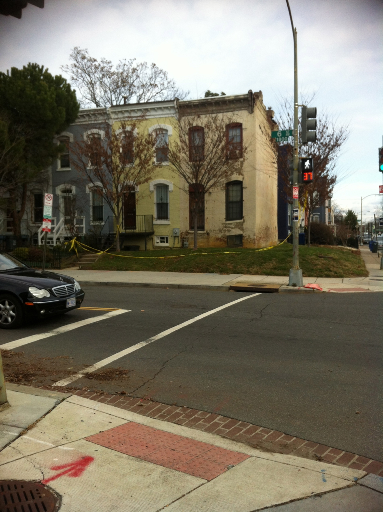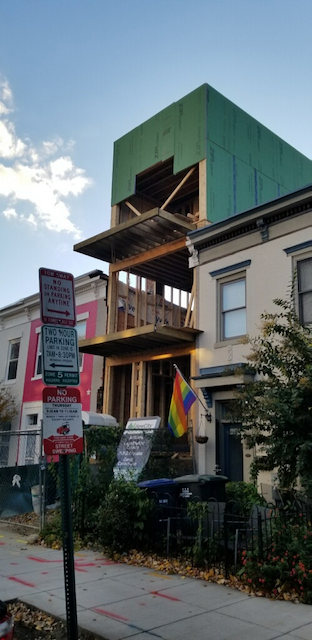
There is a lot of background with this house, but I want this to be a more visual post.
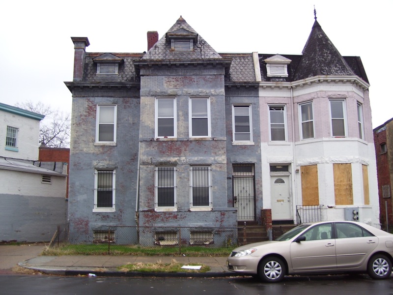
This was a house that didn’t have a lot of interior space. I don’t think it had a basement. It did not have a 3rd floor.
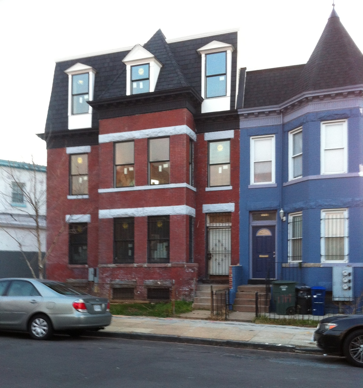
Now it has a 3rd floor. Notice the difference in the rooftop. The pop up is very subtle. It is currently two condo units.