
I’ve been looking at the Library of Congress’ photo collection online for Truxton Circle related images. I found a slew of Armstrong High School photos, and some Dunbar High School images, some of them outside. Looking at them I noticed buildings in the background that no longer exist and tried to figure out where the photos were looking.
The LC photos were from March 1942. Below is an aerial photo from 1951 or 1952 taken by the US Geological Survey.
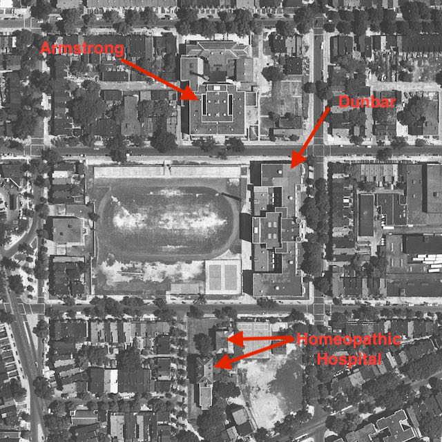 Armstrong as a building still exists.
Dunbar exists, but not the original building. The 3rd building for Dunbar High School exists on that block.
The Homeopathic Hospital no longer exists either.
A lot of buildings shown in the above aerial photo no longer exist. Currently there are no buildings on the east side and southwest side of Armstrong, as there were in the 1951 photo. Dunbar now takes up the whole block but in 1951 had structures on its western side. The Homeopathic Hospital got absorbed by the New York Avenue playground.
In later posts I will compare the 1942 photos to the 1951 aerial photo and try to match up the buildings or structures.