
People in academia tend to like to tell research adventure stories. The problem with archives and libraries and other places digitizing everything is taking the romance out of these tales. No need to get a grant, rent a crappy motel room during the middle of summer, nah. Tippy-tip tap, an email here, a subscription to a certain website and there’s your document. Of course, not everything has been digitized. And because of that, a person could still have a research adventure.
My research adventure takes place at the National Archives in College Park, MD. Those who know me are probably rolling their eyes, but bear with me. So my goal was to find the lost redlining map of Washington DC. I can call it lost, ’cause it was a b!tch to find. For one, the Mapping Inequality site showing off redlining maps doesn’t have Washington, DC. The DC Policy Center and Mapping Segregation had a map on their sites that approximated or was very similar to a DC version of the redlining map.
The DC Policy Center just said it came from the National Archives. Ok. NARA has a bunch of stuff and it’s catalog can be a PITA when you’re trying to actually find something. Clicking source just brought a person to the Mapping Segregation site. Digging into the resources there would send you back to the DC Policy Center and round and round I went. I eventually found the citation at the end of http://mappingsegregationdc.org/assets/residential-sub-areas-for-website-rev.pdf. It narrowed it down to the record group (RG) and the box, but not the entry. More poking around and it was entry A1-6.
I got the box. I was in the research room scanning area. I was at a desk next to a dear friend who is a professional researcher showing me the ropes and I managed to scrounge up an SD card for the camera. But the monitor was acting funny. And the SD card was ‘corrupt’. I managed to fit just 2 images on the card before giving up. And below was what I was able to capture.
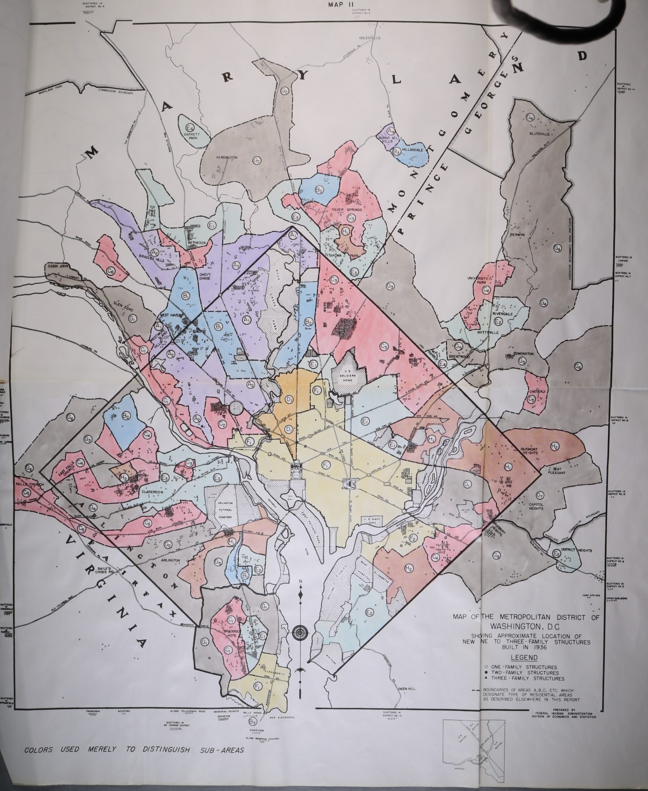 Source: Map 11. Housing Market Analysis Washington DC. Records Relating to Housing Market Analyses, 1940–1942. National Archives, College Park, MD RG 31, entry A1 6, (NAID 122213881)
A description of the letter based residential sub-areas.