
Back in 2017, I and two artist neighbors set up an exhibit at 410 GoodBuddy called The Triangle Known as Truxton Circle. I have a few things sitting on my computer from the exhibit that I’d like to share. Between no childcare and attempting to telework in less than ideal conditions, yes, I’m not posting much. But I can post this from the exhibit. First is the image then the exhibit text. Enjoy.
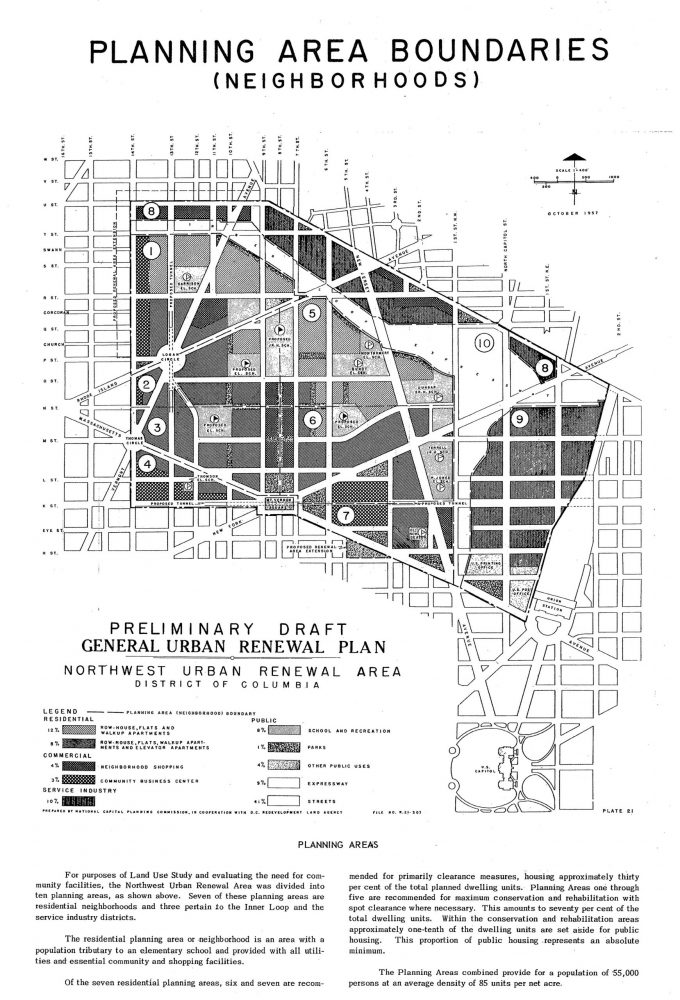
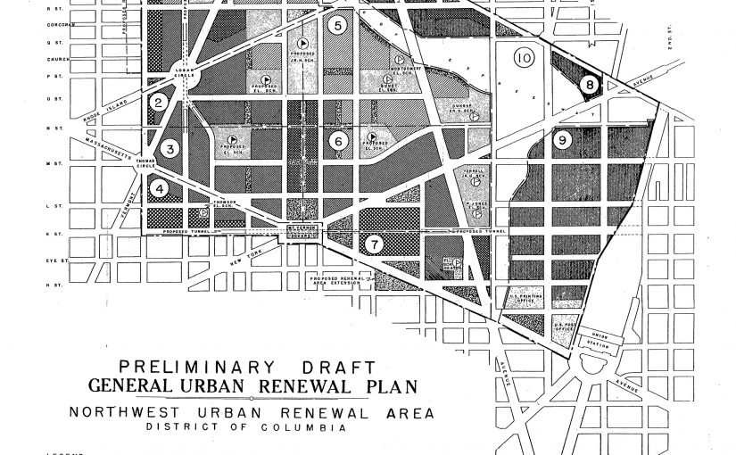
Freeway Plan circa 1957-1960
2016, Digital Print on Foamboard
This is a map of what could have been. It is an undated planning map from the National Capital Planning Commission. Truxton Circle is the upper green area of the map. In this version I-395 does not stop at New York Avenue but continues north to meet with a planned east-west freeway between P and U Streets.
Do you know why I-395 ends where it does?
Who would these freeways serve?
If the freeway didn’t stop at New York Avenue, would your house still exist?