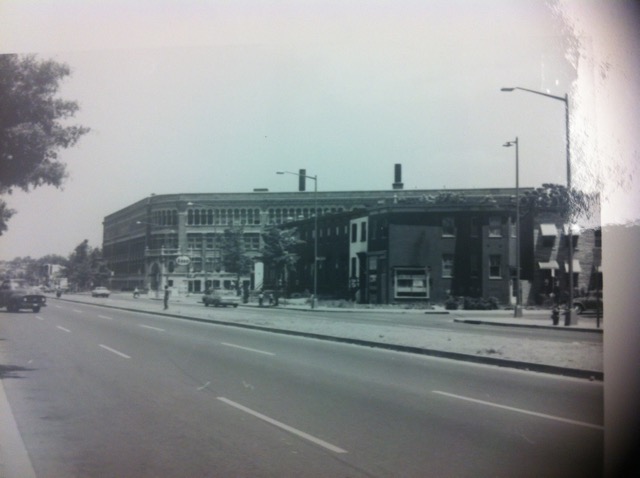
900 Block of Rhode Island Ave NW 1968
The Washington Sanitary Improvement Company (WSIC) was a late 19th century charitable capitalism experiment that ended in the 1950s. This blog started looking at the homes that were supposed to be sold to African American home buyers, after decades of mainly renting to white tenants.
Looking at WSIC properties they tend to have a pattern where the properties were sold to a three business partners, Nathaniel J. Taube, Nathan Levin and James B. Evans as the Colonial Investment Co. for $3 million dollars. Those partners sold to African American buyers. There was usually a foreclosure. Then the property wound up in the hands of George Basiliko and or the DC Redevelopment Land Agency (RLA). Then there was the odd lucky ones who managed to avoid that fate.
Let’s see what happens with 227 P St NW:
Alright looking at the WSIC bingo card we have property sold as two separate halves to two different households, check. At least one foreclosure, check. Purchase by George Basiliko, check. And also sold to the DC Redevelopment Agency, check.
In the previous postings for parts 1-4 we looked at buildings south and north of the Dunbar High School field in 1942. Now let’s look west.
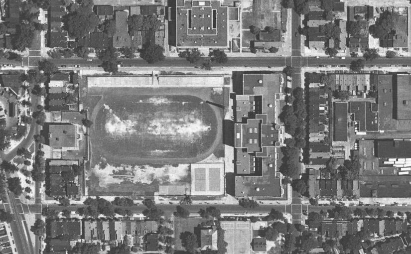
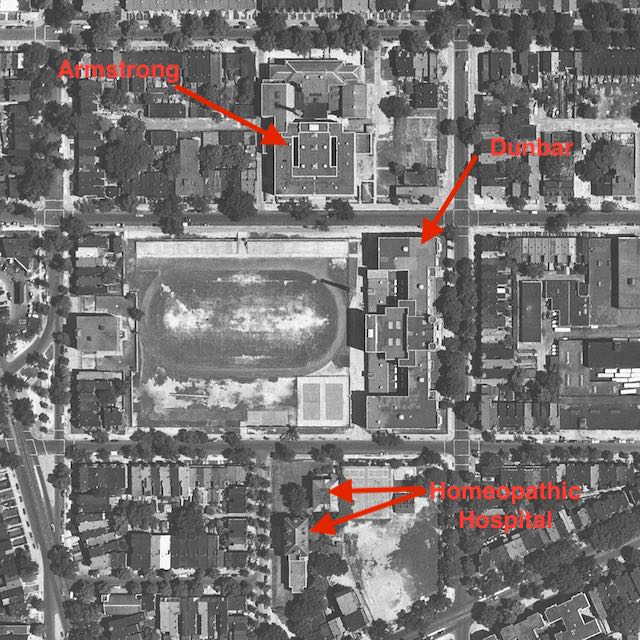
Just to orient you, here is a USGS aerial map from 1951.
And now a look on the west (left) end of the field.
Those buildings no longer exist. It is now just part of the Dunbar track. I wonder it that taller 3 story detached building was the old Twinings school?
This is more of a continuation of part 3.
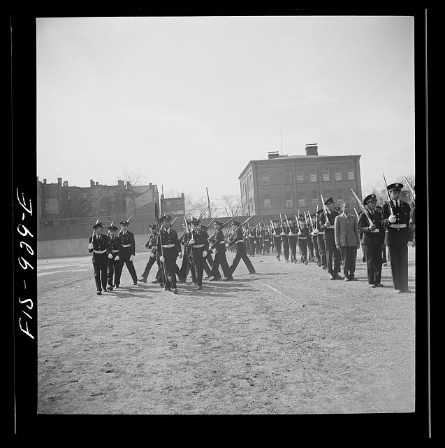
We are looking north from the Dunbar High School field. We see the bleachers. We do not see Armstrong in the background which means we see more buildings that no longer exist on the 200 block of O St NW.
Below, more of the same.
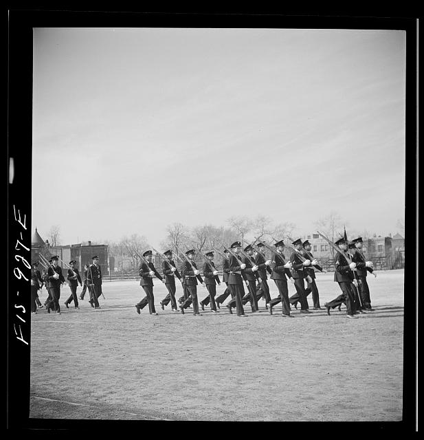 Swinging to the other end of the bleachers looking along O Street, we see another part of the field with female Dunbar students.
Here we clearly see Armstrong High School in the background.
In part 3 we look on the other side of the Dunbar High School fields in 1942, towards the bleachers.
In the above 1951 aerial of the neighborhood, find Dunbar and its field with what looks like tennis courts in the lower right hand corner of the campus. Now on the opposite side of the field see a long light colored or white stretch of something, those are the bleachers.
In the background you can see Armstrong Technical High School and a little corner of old Dunbar High School.
In the above photograph, we see more of Armstrong on the 100-200 block of O Street NW.
The Washington Sanitary Improvement Company (WSIC) was a late 19th century charitable capitalism experiment that ended in the 1950s. This blog started looking at the homes that were supposed to be sold to African American home buyers, after decades of mainly renting to white tenants.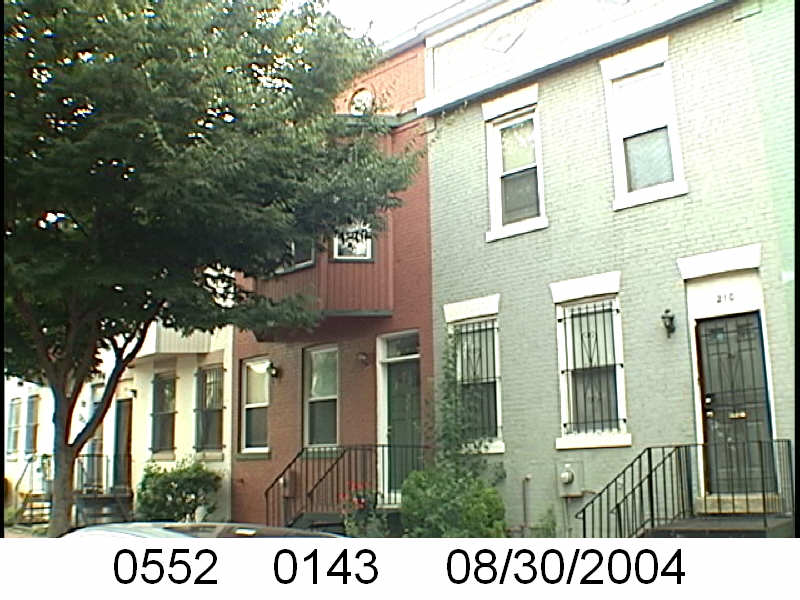
Looking at WSIC properties they tend to have a pattern where the properties were sold to a three business partners, Nathaniel J. Taube, Nathan Levin and James B. Evans as the Colonial Investment Co. for $3 million dollars. Those partners sold to African American buyers. There was usually a foreclosure. Then the property wound up in the hands of George Basiliko and or the DC Redevelopment Land Agency (RLA). Then there were the odd lucky ones who managed to avoid that fate.
Let’s see what happens with 208 Bates St NW:
This was a quick one. Not too long after the foreclosure, the Basilikos took ownership. I can’t seem to find info about Mrs. Gibson so I can’t say what happened on her end. This differs from the usual story in that the DC Redevelopment Land Agency was not involved.
Continuing on from Part 1….
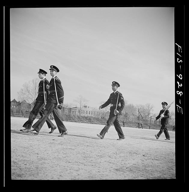
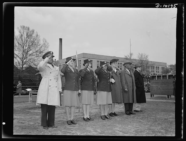
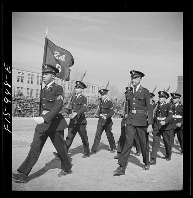
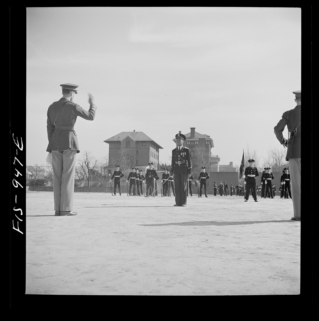
Look at this photo taken in 1942.
Now same day in March 1942, same event.
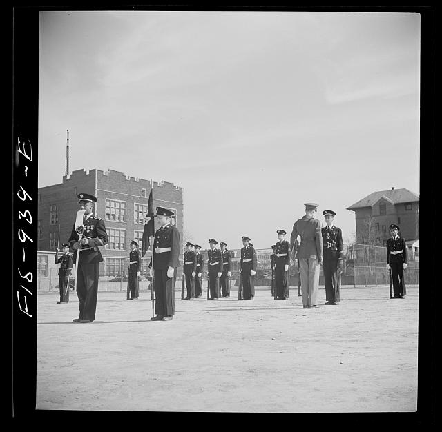
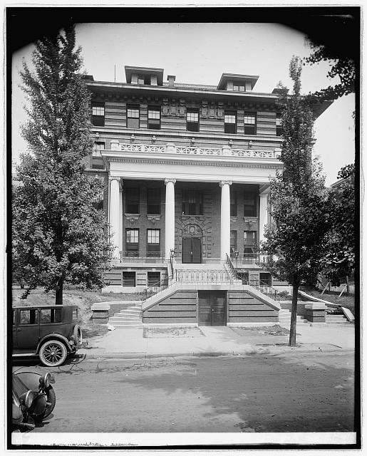
Behind them appears to be the National Homeopathic Hospital. Below is a photo of the hospital from 1910.
You can see the front of the hospital in the top photograph. In the second photo you can see part of the old Dunbar High School building. Despite it being an event for Armstrong High School boys, it appears they are on Dunbar’s campus.
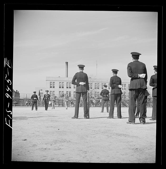
Below is an aerial photo from 1951 or 1952 taken by the US Geological Survey. Keeping in mind where the two tallish buildings of the hospital sat, and the corner of old Dunbar, you can see where the boys were parading.
The Washington Sanitary Improvement Company (WSIC) was a late 19th century charitable capitalism experiment that ended in the 1950s. This blog started looking at the homes that were supposed to be sold to African American home buyers, after decades of mainly renting to white tenants.
Looking at WSIC properties they tend to have a pattern where the properties were sold to a three business partners, Nathaniel J. Taube, Nathan Levin and James B. Evans as the Colonial Investment Co. for $3 million dollars. Those partners sold to African American buyers. There was usually a foreclosure. Then the property wound up in the hands of George Basiliko and or the DC Redevelopment Land Agency (RLA). Then there was the odd lucky ones who managed to avoid that fate.
Let’s see what happens with 215 P St NW:
The lesson learned here is that if your foreclosure is with someone other than the Colonial Investment Co. partners, then it does not fall into the hands of George Basiliko. But it wound up being owned by the DC RLA.
The Merediths had a not so common name so I will look into their history. In the 1950 census James Junior Meredith was an African American truck driver living at 1115 8th St in an apartment with his wife Lucille, a maid, their 1 year old daughter Carolyn and his mother in law. August 23, 1960 James died. They were living at 208 Bates Street at the time of his death, as renters. I’ll give my regular readers 1 guess at who their slumlord was. He left behind his wife Lucille, and children Carolyn, Kenneth and Patricia.
The Williams were so close to beating the normal fate. Unfortunately, Williams is too common of a name to research. Yes, Sudell is an uncommon first name, but her maiden name was Sudell Myrtle Jones.
I’ve been looking at the Library of Congress’ photo collection online for Truxton Circle related images. I found a slew of Armstrong High School photos, and some Dunbar High School images, some of them outside. Looking at them I noticed buildings in the background that no longer exist and tried to figure out where the photos were looking.
The LC photos were from March 1942. Below is an aerial photo from 1951 or 1952 taken by the US Geological Survey.
Armstrong as a building still exists.
Dunbar exists, but not the original building. The 3rd building for Dunbar High School exists on that block.
The Homeopathic Hospital no longer exists either.
A lot of buildings shown in the above aerial photo no longer exist. Currently there are no buildings on the east side and southwest side of Armstrong, as there were in the 1951 photo. Dunbar now takes up the whole block but in 1951 had structures on its western side. The Homeopathic Hospital got absorbed by the New York Avenue playground.
In later posts I will compare the 1942 photos to the 1951 aerial photo and try to match up the buildings or structures.
The Washington Sanitary Improvement Company (WSIC) was a late 19th century charitable capitalism experiment that ended in the 1950s. This blog started looking at the homes that were supposed to be sold to African American home buyers, after decades of mainly renting to white tenants.
 Looking at WSIC properties they tend to have a pattern where the properties were sold to a three business partners, Nathaniel J. Taube, Nathan Levin and James B. Evans as the Colonial Investment Co. for $3 million dollars. Those partners sold to African American buyers. There was usually a foreclosure. Then the property wound up in the hands of George Basiliko and or the DC Redevelopment Land Agency (RLA). Then there was the odd lucky ones who managed to avoid that fate.
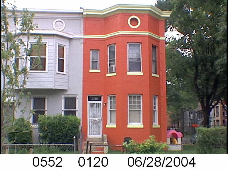
Let’s see what happens with 1501 3rd St NW:
This is a different story than the usual WSIC house stories. Here a man bought a house. He paid off the house. He was able to leave the house to his family and they lost it.
If I have the right person, Frank Alexander was born February 16, 1918 in Cabarrus County, North Carolina, one of seven children to James and Anna Alexander. His father died when he was young. He was enlisted in 1944 and discharged in 1945. We know in 1951, he purchased 1501 Third Street NW in Washington, DC. He died June 5, 1988 and left the property in a will to people I assume are his family members.
It’s a happier story. The original buyer did not experience foreclosure, the DC Redevelopment Agency or Landlord George Basiliko had no opportunity to take over the property.