So in our last entry regarding the Brungers there was the issue of Sq. 551 Lot 17, which was also lots 844 and 845. Sometimes, I imagine that I will make a corresponding spreadsheet of addresses by also linking them to their SSL (square and lot) numbers, but then I have to deal with this problem of lot numbers changing. It happens now too with condos. The owner I’m looking at today is Michael Joseph McInerney Sr., owner of lot 845, which appears to be 208 R St NW. And for those of you just joining in this series, this house no longer exists.
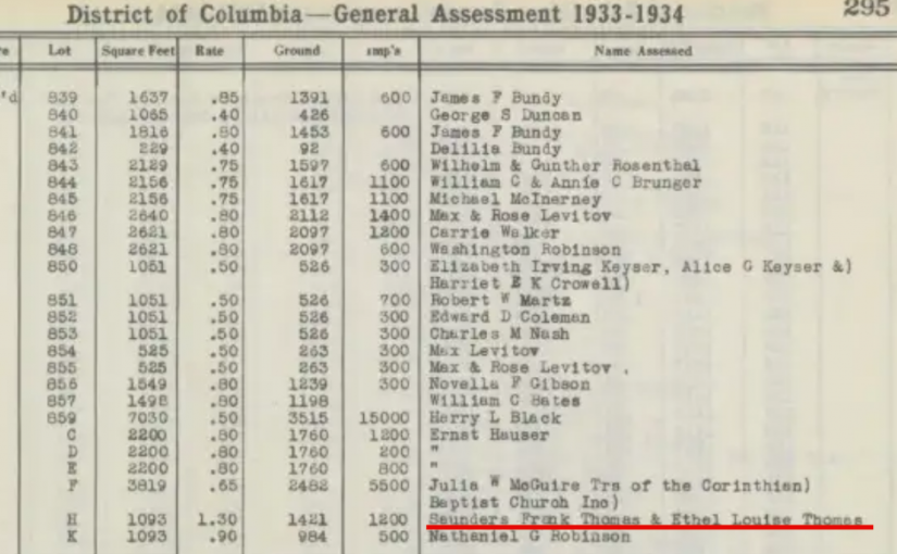
Another issue I keep coming across are landowning dead people. The source that I am using is the Washington City General Assessment 1933-1934 for a section of Square 551. So these were the names the city went after to pay property taxes. And like my aunt in SE who’s been dead for about 10 years, she’s still paying property taxes. Well, her estate is, but her name is still on the property, just like Michael McInerney in 1934, who died in 1925. Continue reading Property Owners of Truxton Circle- Michael J. McInerney