
Okay maybe I’ve been unfair. So I’d like to try to be a bit more positive. Not all Suzane Reatig projects in Shaw are ugly. Since figuring out how to spell the name correctly and finding the architect firm’s site, the firm has done some lovely things in the hood. I also learned historic district- smistoric district, but more of that later.
So. The multi-unit on S Street, across from the Wonderbread, not pretty in my eyes. But you know the row of townhomes near New York Ave, on L, with the colorful doors that look so cute? Suzane Reatig! I know, I found it surprising too! The firm does a little of the same on 5th St and there is supposedly more color in the back.
 So the firm can take a townhome and spiff it up a bit.
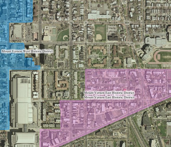
Now, historic districts. There are a few SR projects within the borders of the Mt. Vernon East Historic District, that’s the pink on the map. First thing is the Metropolitan Community Church. Being a traditionalist, my first impressions of MCC was ‘oh they’ve taken a gym and turned it into a church’. Okay, the SR site says different. Another project in the Mt Vernon East area are those lovely glass houses on N Street. I really like the back of them. The front looks very euro-something. The L Street condos previously mentioned also sit in the borders. So modernism can be in an historic district (also noticed a pretty cool Georgetown project too).
The townhomes on the corner of 5th & O look nice, in the pictures. On the ground, a little less so, but the theme of this post is positive about modernism. So there you have it, local Shaw architectural firm, some cute stuff, some not so cute stuff. Some stuff in historic districts, some stuff just sitting across the street from the HD.
Category: History
Squares 519 & 520
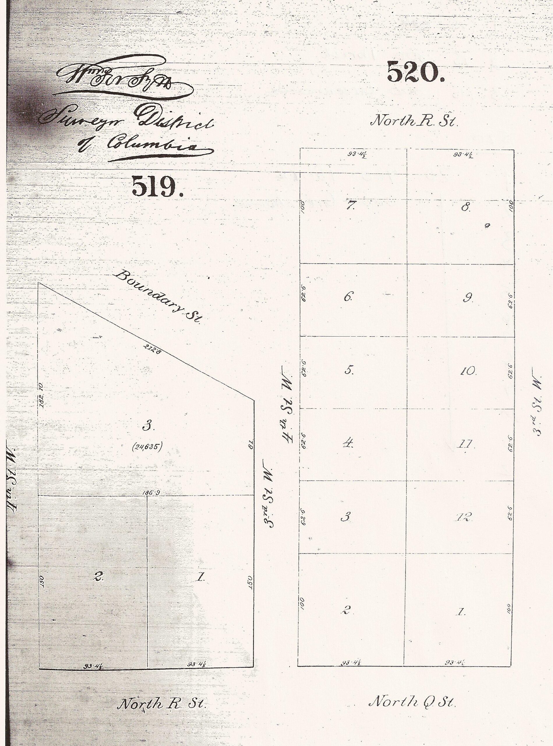
More from the 1870ish to 1880ish DC tax assessment maps. These I believe are on microfilm at the MLK library’s Washingtonia Div.
Note the large plots. In 1880 square 519 was home to a florist’s greenhouse. Remember this was the edge of town.
On this site in 1850, nothing happened
You know I should make better research notes. Or I should leave bibliographic info with the photocopies…. bad librarian. Bad. Anyway, off the top of my head this map is a scanned copy, of photocopy, of a negative copy, of a map that is of the city circa 1850ish. And if I looked hard enough and if it is cataloged by the Library of Congress, I could find the bibliographic info I should have to say who drew the map and so forth. It’s pre-Civil War.
The two light lines are Boundary (Florida) and New York. The squiggly line is a creek. The square numbers are the same square numbers we have today and if you notice…. not a lot of structures. On the negative copy it is easier to see marsh or not-dry-land.
With that in mind I would not even dare call this area, that later became the TC a neighborhood. Heck, I don’t even know if I could call it a community.
Also check out this view of the map.
UPDATE: Better map 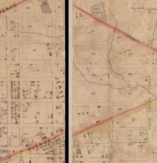 .
.
Updated 12/21/23 for bad image links
Square 507 circa 1880 map
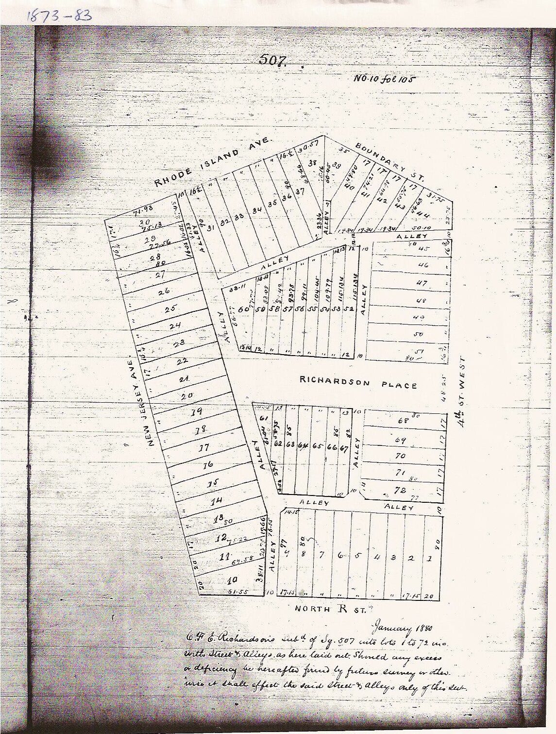
This I found at the MLK Library’s Washingtonia Division on microfilm, from the tax rolls, or tax survey, whatever. There was another frame with assessments that said what had a structure on it or if it were brick or a framed structure, but I was too cheap to make a copy. Cheap, or in a hurry or the copy part of the microfilm reader was screwed up. Any of those is possible.