Not a charity but capitalist enterprise

When last I left I was writing about the Washington Sanitary Improvement Company (WSIC) which built the houses along Bates Street NW, and some other streets in the TC that are somewhat Bates adjacent, around the turn of the century. You know they are built by the same company because their 2nd story bay window thing.
Anyway, the WSIC’s goal was to replace the slum dwellings in the various alleys, but as a profitable company and not a charity. From The History and Development of the Housing Movement in the City of Washington, D.C. page 61, Article III, section 4:

The company, although organized from philanthropic motives, is not a charity organization, and the executive committee shall take all legal measures to collect rents and to evict tenants who fail to pay their rent, or who neglect to keep the tenements occupied by them in a cleanly and sanitary condition, or who lead a dissolute or criminal life.

Another thing, as part of the pitch to draw interest in the company the author and secretary of the company George M. Kobr writes:

The attention of capitalists should be drawn to the fact that no class of realty pays as well as alley property in this city, and that there is a splendid field for investment in the erection of sanitary and comfortable alley houses on a business and humanitarian basis.
–page 23

Don't blame me for a fuzzy photo


Bates circa 1907
Originally uploaded by In Shaw

This was taken with an iphone in a lowly lit room at the Library of Congress from a book, while I held the pages down with one hand and took the pictures with the other. Now why are you looking at a fuzzy photo of a bunch of houses? This is the unit block of Bates Street, when the houses were somewhat new in 1907.
The photo, as well as some others I took are from The History and Development of the Housing Movement in the City of Washington, D.C. published by the Washington Sanitary Improvement Company, which built the houses. The book starts off talking about unsanitary crappy housing in DC and how the Washington Sanitary Improvement Company (WSIC) was building alternatives to slummy housing, specifically crappy alley housing. Towards the middle of the book they start talking a bit more about the company as an investment. The directors consisted of the following:
David J. Brewer
Charles C. Cole
John W. Foster
Charles J. Bell
George Truesdell
Gardiner G. Hubbard
Anthony Pollok
Walter Wyman
Henry F. Blount
Mrs. George Westinghouse
Crosby S. Noyes
George H. Harries
William J. Boardman
William C. Woodward
Augustus S. Worthington
Henry Y. Satterlee
George L. Andrews
Bernard T. Janney
Mrs. Clara G. Addison
Willliam C. Whittemore
G. Lloyd Magruder
Joseph C. Breckinridge
Marcus Baker
Katherine Hosmer
Charles E. Foster
Simon Wolf
George M. Sternberg
S. Walter Woodward
George M. Kober
John Joy Edson
Maybe more later. Or not.

A plan for Bates Street

I have the 1968-1974 (the dates I’m unsure of) brochure of “A Plan for Bates Street” in PDF form. It’s a big file and because it is so large, I’m not posting here. However, I will mail it to folks who ask (offer expires in 30 days). Basically, like the title says, it was the government’s plan for the two blocks of Bates, to improve the housing.
Houses on Bates Street (well the houses on Bates I’ve been in) are deep and some of them are divided into two units. It seems that when they were initially built by Washington Sanitary Housing (or Washington Sanitary Improvement, I’m still working on the facts of this), they may have all been two unit structures. You can see it in the placement of windows and doors.
The wonderful fellows at Truxton Circle have a few pictures from the brochure. This first one shows the street plan for squares 552 & 615. It appears there was the intention to remove some structures for the creation of small parks, a tot lot, a teen lot and parking. Spaces for adults apparently were to be carved out of existing space. The second picture, shows a typical Bates Street house prior to any renovation. The first and second floor are two separate units with their own living rooms and kitchens. The plan was to combine the two to make one unit, replace 2nd unit doors with windows, move the kitchen to the 1st floor center, and create more bedrooms, going from 1 to 3 or 4, as seen here.
Looking around Bates Street now, there seem to be fewer 2 unit houses than 1 units.

Wifi, and farmers, and bears! Oh my!

Over on the Eckington Listserv there is a flutter of hope about the corner of 1st and R Sts NW. Hopefully in a few weeks ANC Stu will open up Big Bear Cafe. ANC Stu also wants wi-fi. But the big thing that has everyone aflutter is the drive to get a farmers market on that little strip of R St that is between 1st and Florida. It would be a perfect staging area for an open air market, when the cafe opens.
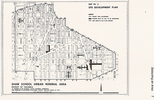
This interests me and probably folks in the northern end of the TC because this is right on the border between Eckington and the 1973 boundaries of Shaw.


The chatter on the listserv is contacting the Stu crew about helping with the market. Apparently some emails got lost, or more than likely buried (with me its the spam filter, which is why you should have a decent subject line). So if you want to help ANC Stu contact him at his gmail account at studavenport@ .

Modern in Shaw

Okay maybe I’ve been unfair. So I’d like to try to be a bit more positive. Not all Suzane Reatig projects in Shaw are ugly. Since figuring out how to spell the name correctly and finding the architect firm’s site, the firm has done some lovely things in the hood. I also learned historic district- smistoric district, but more of that later.
So. The multi-unit on S Street, across from the Wonderbread, not pretty in my eyes. But you know the row of townhomes near New York Ave, on L, with the colorful doors that look so cute? Suzane Reatig! I know, I found it surprising too! The firm does a little of the same on 5th St and there is supposedly more color in the back.
So the firm can take a townhome and spiff it up a bit.
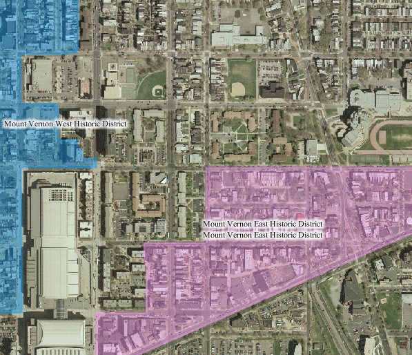
Now, historic districts. There are a few SR projects within the borders of the Mt. Vernon East Historic District, that’s the pink on the map. First thing is the Metropolitan Community Church. Being a traditionalist, my first impressions of MCC was ‘oh they’ve taken a gym and turned it into a church’. Okay, the SR site says different. Another project in the Mt Vernon East area are those lovely glass houses on N Street. I really like the back of them. The front looks very euro-something. The L Street condos previously mentioned also sit in the borders. So modernism can be in an historic district (also noticed a pretty cool Georgetown project too).
The townhomes on the corner of 5th & O look nice, in the pictures. On the ground, a little less so, but the theme of this post is positive about modernism. So there you have it, local Shaw architectural firm, some cute stuff, some not so cute stuff. Some stuff in historic districts, some stuff just sitting across the street from the HD.

1900 Census: 414 Richardson Court NW

My methodology of collecting the data is to note the stats of the head of household, and a bit of head’s spouse then make note of how many people in the house are 16 and over and how many are 15 and below. So I only noticed this when I was gathering the numbers of those 16 and over.
In 1900 at 414 Richardson Court, Julia Williams, a single black woman aged 30 lived with her 3 sisters, her 7 year old son, a boarder and her grandmother. Her grandmother, Hester Jackson, a widow was 101 years old when the census was taken. Mrs. Jackson was listed as being born in 1799 in Virginia. Which a good guess tells me she was very likely to have been born a slave, and worked as a slave. I had to meditate on that for a moment.
The other pauses for thought were the other households on Richardson Court, now Richardson Place. Those houses are small. I’m seeing households of 7 or more people, sometimes with more than one household in a Richardson house.

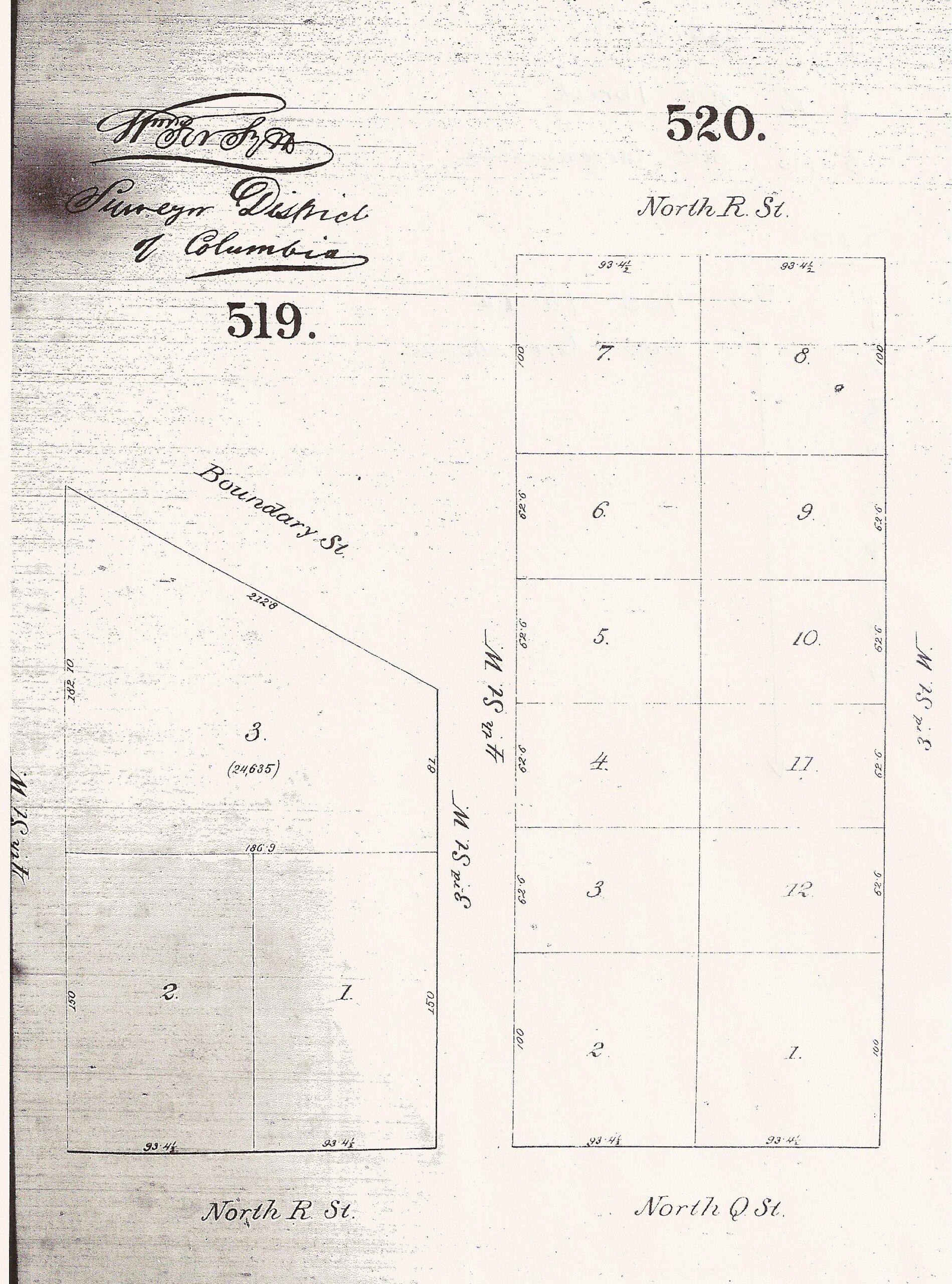
Squares 519 & 520

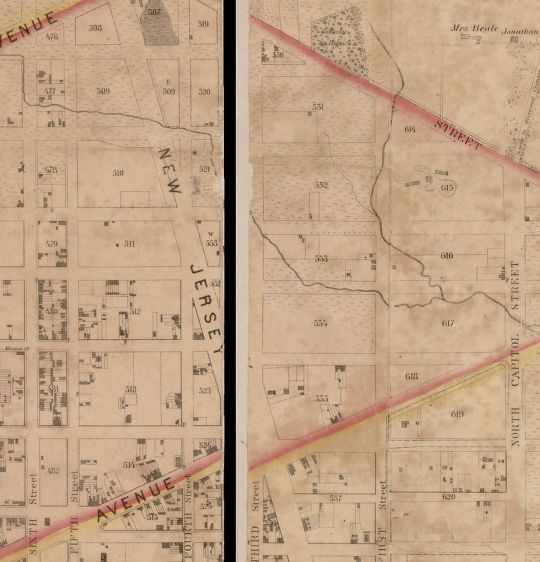
Tax map showing squares 519 & 520 circa 1873-1883 from microfilm in MLK Washingtonia Division

More from the 1870ish to 1880ish DC tax assessment maps. These I believe are on microfilm at the MLK library’s Washingtonia Div.
Note the large plots. In 1880 square 519 was home to a florist’s greenhouse. Remember this was the edge of town.

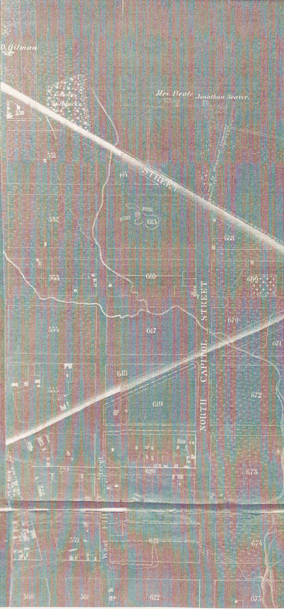
On this site in 1850, nothing happened

You know I should make better research notes. Or I should leave bibliographic info with the photocopies…. bad librarian. Bad. Anyway, off the top of my head this map is a scanned copy, of photocopy, of a negative copy, of a map that is of the city circa 1850ish. And if I looked hard enough and if it is cataloged by the Library of Congress, I could find the bibliographic info I should have to say who drew the map and so forth. It’s pre-Civil War.
The two light lines are Boundary (Florida) and New York. The squiggly line is a creek. The square numbers are the same square numbers we have today and if you notice…. not a lot of structures. On the negative copy it is easier to see marsh or not-dry-land.
With that in mind I would not even dare call this area, that later became the TC a neighborhood. Heck, I don’t even know if I could call it a community.

Also check out this view of the map.
UPDATE: Better map .

Updated 12/21/23 for bad image links

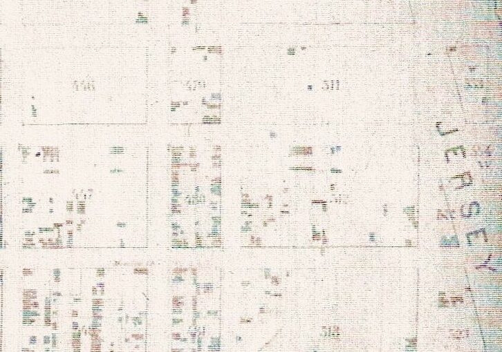
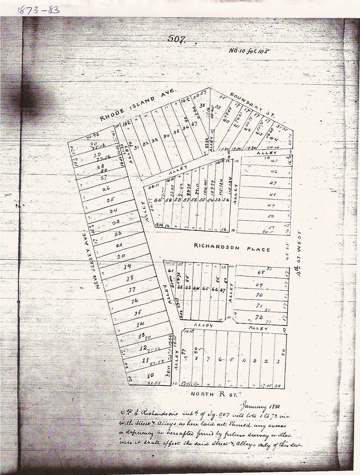
Square 507 circa 1880 map


This I found at the MLK Library’s Washingtonia Division on microfilm, from the tax rolls, or tax survey, whatever. There was another frame with assessments that said what had a structure on it or if it were brick or a framed structure, but I was too cheap to make a copy. Cheap, or in a hurry or the copy part of the microfilm reader was screwed up. Any of those is possible.

Come and listen to the world’s most boring history paper

I’m presenting my paper at the Wash DC Historical Studies conference this Saturday. I’ve read my paper and the middle portion is boring. Dullsville. I’m working on making an exciting speech, based on the boring paper.
Why boring? I have a lot of so-in-so lived next door to so-in-so who was black/white/ Irish. Going individually, house to house is more exciting when mapping it out and seeing the neighborhood as a whole. The Truxton Circle of 1880 was a sparsely populated area. I say this because there were blocks with no one on them, or sections of blocks that are empty. This changes by the 20th century, but the 1900s+ aren’t covered in this paper. Gonna have to wait a few more years for the 20th century.
I’ll probably post the paper and all the images that don’t want to print on the &^%! printer, after the conference, on the web. If anyone with any editing skills wants to read it, e-mail me and tell me what kind of editing you do.