Black Home Owners of Truxton Circle: William S. Daniels- 133 P St NW

Once again, I’ve picked the name of a Black home owner from the 1920 census who lived in Truxton Circle neighborhood in Washington, DC. It helps if their name isn’t took common. There were several William Daniels in Washington DC.

photo of property

So it looks like the Daniels moved to P St NW around 1917/1918. William Samuel Daniels’ World War I registration card which is about 1917 or 1918 has the family at 18A O St NW, also in the Truxton Circle neighborhood.

The first document from the Recorder of Deeds site is a release (debt was paid) from July 1942 of an August 1918 debt William S. and Sarah S. Daniels. Sarah is Sara S. Daniels in the paperwork, spelled differently than what is on the census roll.

She took on more debt in 1947 and 1949 from the Washington Loan and Trust Company, alone. William is not mentioned. So we are left to assume he died or they separated. The 1948 city directory said Sarah was a widow. So dead. She borrowed money twice again from the Washington Loan and Trust Company between 1949 and 1954. Sara (nee Huskins) was dead and left a will that I cannot find.

Since I cannot find Sara S. Daniels’ will, I can’t say how Mary Jane Mathews and others were related to her. If I read the deed transferring it away from the deceased Sara Daniels to Joseph P. and Rose Simon. It does tell us that Frances C. White was married to John J. White.

Black Home Owners of Truxton Circle: Hamilton Rucker- 42 O St NW- not exactly a dead end

Image of plat map
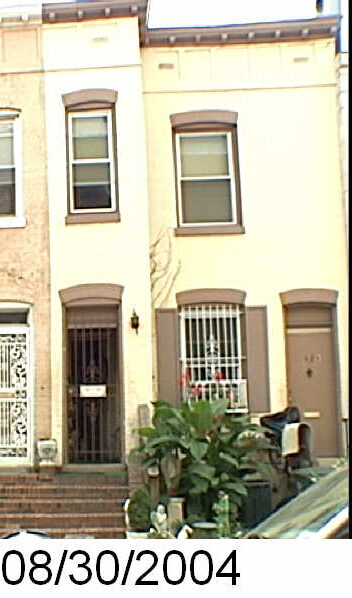
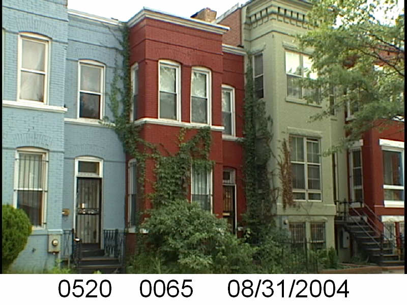
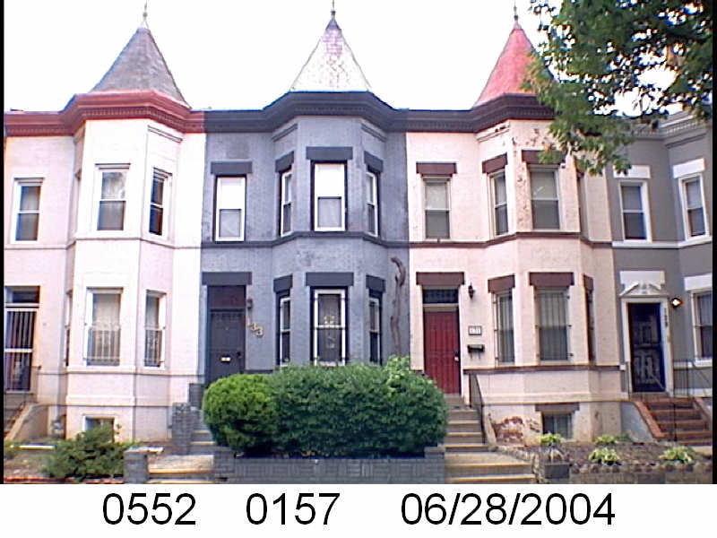
In this segment of Black Home Owners of Truxton Circle we have a house where the lot number has changed. I went to look for one of those DCRA photos of the house from 2004, there was none. When I plugged the square and lot number (SSL: 0617 0224) into the DC Recorder of Deeds database, it doesn’t go any further back than 1951. So then I need to hunt down the original lot number, and it appears to be lot number 169. That only goes as far back as 1950 and it appears the property actually belongs the Washington Sanitary Improvement Company.

Okay.

I just looked up Hamilton Rucker and could not find that name associated with any property.

So I looked at the 1902-1903 General Assessment. Lots on square 617 (bounded by O, 1st, N, North Cap and NY Ave) from 169 to 183 and more were owned by George M. Sternberg et al and trustees, which was the Washington Sanitary Improvement Company (WSIC). Doctor Brigadier General Sternberg was on the board of the WSIC.

40-O-St-NW-WDC-20001WSIC owned a great number of properties in Truxton Circle. That’s another post. But did Hamilton Rucker own 42 O St NW, Imma gonna say no. This was not exactly a dead end because I got to talk about the Washington Sanitary Improvement Company and it only plays a part in my eventual deep dive into the WSIC, as I have warned.

Black Home Owners of Truxton Circle: William F. Turner- 107 P St NW

In this post of Black Home Owners of Truxton Circle I go all over this great United States of America, chasing down William Foster Turner and his wife Minnie Lee Turner. Okay I just go out West, but I had to wander pass the Mississippi.

In 1920 William F. Turner was an African American government clerk who lived and owned 107 P St NW with his wife Minnie. He was born on October 2, 1874 in the state of Arkansas. In July 1899 he married Minnie Lee Slaughter, the daughter of James and Sarah Slaughter, a barber and laundry woman in White County, Arkansas. They lived with a lodger, another clerk, named Joseph H. Goldsby.

photo of property

The farthest back I can find the Turners is in the 1900 Census where the twenty something couple was living in Indian Territory. Seriously, where the form says state, the census has Indian Territory. They lived in a town called Wagoner, and maybe that’s Wagoner, OK. William was a teacher. They lived with Minnie’s brother, Edward (Eddie) Slaughter, a 21 year old day laborer.

In 1910 they were living back in Searcy, Arkansas with Minnie’s widowed mother and her 35 year old brother Will H. In Arkansas, William was a government clerk. It’s not clear if he was working for the Census Bureau or the Commerce Department.

The earliest record I can find of the Turners in Washington, DC at 107 P St NW, is William’s World War I registration in 1917/1918. At the time he was working as a clerk for the US Patent Office.

Something happened.

Yes, that’s history, something happening. But something happened and it appears William Turner moved to Denver, CO without Minnie. In the 1930 census William F. Turner lived with his sister Lulu, brother Forrest W., their father Benjamin, and the Pinkett niece and nephews. He was working as a salesman for a publishing company. He is reunited with Minnie by the 1940 census, where they are living in Denver, CO together alone.

Was losing the house the thing that happened? Because that happened. The on-line land records go back to 1921 and the earliest record is a 1923 trust between the Turners and the Columbia Building Association for $3000. I’m just going to skip to the end. In 1930 the Turners borrowed $715.00 at 7% interest, through trustees Raymond D and F Thomas Evans. In 1931, the Evans foreclosed because the Turners defaulted on the loan. They advertised in the Washington Herald that they would sell to the highest bidder.

The Turners died in 1966 in Colorado. They are buried with William’s brother Forrest W. Turner in Denver.

Black Home Owners of Truxton Circle: Charles Cummings – 105 P St NW

Welcome to the Black Home Owners of Truxton Circle series. In this series, I pick the name of a Black home owner from the 1920 census who lived in Truxton Circle, and try to track their life in this DC neighborhood.

photo of property

The 1920 Census poses a question, because there is the main Charles Cummings, a sailor, who lived at 105 P St NW with his wife Sallie, his brother-in-law Roger B. Griffin, and lodgers, Mr. James and Mrs. Ollie Brown. And another Charles Cummings, a 42 year old married cook on a US Naval ship, in the Navy Yard, of a name I cannot make out. Are these the same guy? It is very possible he was counted twice. It wouldn’t have been the first person I found who was counted twice.

Doesn’t matter much because he died August 6, 1927.

The DC Recorder of Deeds land records go back to 1921. When looking at 105 P St NW (Sq. 552 lot 186) the records don’t have a lot of Chuck in it. The first record is a trust (borrowing money) from August 28, 1928, between Charles’ widow Sallie R. Cummings and trustees associated with the Columbia Building Association for the sum of $1,500. It is in that document that it is mentioned that and when Charles Cummings died. This debt was paid in 1940.

The following document was a September 1928 release acknowledging payment for a debt taken out by Charles and Sallie R. Cummings in 1918.

Sallie borrowed money again in 1939 from trustees for the amount of $960.00. This debt was paid off in 1943.

In a 1967 trust the document mentioned that Sallie R. Cummings had passed away and Clarence E. Smith inherited the property. Who was Clarence E. Smith? No idea. In the 1967 document he owed $2,125 to Century Investors Inc.

I’m not sure what happened because the next document is from May 1971 and it transfers the property from the American Security and Trust Company to George Basiliko. Two months later there is a release for Clarence E. Smith for the 1967 debt. Once again. I’m not sure what just happened.

But that is not the last time the Cummings and Mr. Smith appear.

In November of 1971 Clarence E. Smith, a divorced man, signed a trust document, for the consideration of $14,000 to transfer the property to the DC Redevelopment Land Agency (RLA). In this document we’re given Sallie’s death date, September 2, 1964, as well as Charles’ death date. Like before, I’m not sure what was going on there.

The following document for the property is a contract for a whole slew of Truxton Circle properties written up by RLA. I should investigate it. But not now. Because I’d need to do some research about what the hell the city was up to in the late 1970s and early 1980s.


Rando Truxton History- Love & Marriage September 16, 1952

So I was looking for other bits of information an came across page 20 of the Evening Star for 9/16/1952 and found an article “Marriage License Applications” on some rando website. A safer website would be the Library of Congress’ site Chronicling America for the page.

There are two Truxton Circle addresses in there. And as part of my effort to research the bejezus out of the TC here they are-

Isiah Thompson 50, 3432 Warder St NW to Susan Craven, 45, of 1431 New Jersey Ave NW.

David Tyson, 18, 1618 4th St NW to Willie West, 17, 2022 4th St NW.

So I went digging. DC native, Willie Mae West Tyson (link only works if you are logged into AncestryLibrary) was the daughter of William Henry West and Grace Jenkins, born January 13, 1935. In the 1940 census her mother was listed as a widow seamstress working for the WPA project. They lived at 2022 4th St NW. According to her social security info, she was also known as Willie Mae Ebb. I couldn’t find anything on her husband David.

Nor could I find anything I felt worth noting about Susan Craven or Isiah Thompson.

1957 Church Survey: Bible Way Church of Our Lord Jesus Christ- Church not in Shaw

I’ve been holding off on publishing this one because I figured I would do more research. But I never seemed to get around to doing that. The reason is because Bible Way, near the mouth of I-395, did a great thing. The fed and local government’s “plan” was to run that interstate up through what was my 4th St house and over on to Florida Avenue. Bible Way played a part in stopping it. I figured they deserved more research on the matter.

Bible Way Church was one of many urban churches surveyed for this DC inner city survey. Anyway, to learn more about the 1957 Church Survey read my previous posts, The Uniqueness of the 1957 Church Survey and Church Survey Northwest Urban Renewal Area October 1957.

CS-34-Bible Way of Our Lord by Mm Inshaw

In 1957, Bible Way Church at 1130 New Jersey Ave NW was headed by Rev. Smallwood E. Williams.  The Washington Post wrote of Rev. Williams,  “In 1963, he used his political connections to save his church from being torn down. Interstate 395 was scheduled to go through his building. With the help of Democrat Hubert H. Humphrey, then a senator from Minnesota, Williams got the plans redrawn so that the highway would skirt the site.”

Bible Way’s own website tells me they began in Shaw in a storefront at 1409 9th St NW. Looking at the 1957 survey, it was a large church with 2,000 members, a Sunday attendance over 3,000, and several paid staff members. It was also an African American church as the body reported that 99% of members were Black. Looking at the occupational distribution, I’m going to guess this was a blue collar church, as in line with Pentecostal type churches. Most of the membership, 69%, lived outside of the boundaries (see below) of the Northwest Urban Renewal Area (part of which became Shaw) in other parts of DC.

1957-Church-Survey-Map

Black Home Owners of Truxton Circle: Walter R. Carter- 111 P St NW

Sometimes when I take a name of an African American homeowner from the 1920 census for Truxton Circle, I go down a fun little rabbit hole that has me staying up way past my bedtime. This is not one of those incidents.

Walter R. Carter doesn’t have a lot of interesting info in Ancestry about him.

photo of property

There are a lot of Walter Carters in DC in the time period I’m looking. In 1910, according to the city directory, Walter R. Carter was a clerk at the ??? Post Office Department? (whatever p o d is) and living at 214 D St NW. In 1916 he was a clerk in the Treasury department, living at 110 F St NW. But in 1917, same address, same department but a messenger instead of being a clerk. But in the 1919 city directory there were 2 Walter R. Carters, the clerk on F St with the IRS and a messenger at 111 P St NW with the Treasury department.  Too many Walter R. Carters.

So let’s go to our source. In the 1920 census, Walter R. Carter, 40, born in Alabama and working as a clerk, lived with his 24 year old wife Beatrice H. Carter, who also worked for the government (but I can’t tell what she did) and a 21 year old lodger a seamstress from Texas,  Minta McGill.

The 1930 census just confused things. There was another Walter Carter in 1930, who lived on P St with his wife Beatrice, however, it was a completely different Walter, because back at 111 P St NW, Walter R. Carter was a divorced man, living with a couple from North Carolina, the Sanders, as his renters. The other Walter Carter, married to a different Beatrice (different ages), was from Virginia and worked as a chauffeur for a private family. The other Walter lived on the next block at 53 P St NW. I wonder if they knew of each other.

So what say the land records? Well we can see the Carters’ divorce reflected, though they don’t say it in so many words. The online land records start around 1921, the first records related to this property start in 1931 with a release. There should be a record of the 1927 trust (or debt) taken with trustees Melvin F. Bergmann, Louis C. Dismer and Charles W. Schafer, but I don’t see it. I see the name Bergmann appearing often in these land records… I should follow up on that one day. Beatrice H. Carter’s name appears on a few releases, acknowledgement of payment of debts, from 1934. But a trust, borrowing money, from 1934 for $1000, with trustees F Thomas Evans and Herman Miller, has him borrowing the money without Beatrice. In a 1935 release for a 1934 debt, the document states that Walter R. Carter is an unmarried man.

In 1946 Walter R. Carter sold the property to Ida Owens, who happened to be married to Hance Lee Vance Owens, for $5000.

Old Drafts- Assuming class & income

This is a post that for some reason I did not publish. If I did it would have been published on 7/29/2008.


Old BeggarI’m writing this post to acknowledge that when I observe my neighbors and fellow citizens, talking about their wealth or lack thereof is at best a guessing game. I hesitate to talk about the ‘suspected’ homeless guys who hang out all year, near where I work, because I don’t know if they are homeless. They don’t have a shopping cart of stuff and they appear cleaner than some of the ragged tourists who march around. It’s just that they hang out in the same spot day after day, winter, spring. summer, and fall, during work hours and occasionally one guy will whip out a cup with some change and shake it. There are all sorts of signs that strongly signal that they are homeless, but to my knowledge few to none have self identified themselves as such. So when I question and analyze my presumptions, I’ll say I’m about 80% sure. Because honestly, taking in their ages 1/2 of them, and they are doing what my retired uncle is doing, sitting around and staying out of Aunt M.’s way. They could be the same.
There are things about our neighbors that point in this, that and the other direction as to which is their economic class. Because we are not privy to that which, frankly is none of our business, our guesses about whether someone is a member of the underclass, the overwhelmed middle class, or wealthy is just that, a guess. Unless they tell us.
I guess this comes from some people watching I was doing.

Black Home Owners of Truxton Circle: Ernest Lomax- 1627 NJ Ave NW

The census sometimes steers you wrong. This is the series where I look at the 1920 census for African American home owners in the Truxton Circle neighborhood. The census said he lived at 1653 New Jersey Avenue NW, but when I looked at the land records, no Lomax. Thankfully, I can search by name.

photo of property

In the name search for Mr. Ernest E. Lomax, I discovered he owned his home at 1627 NJ Ave NW (SSL: 0509E 0013), as well as 1726 Montello Ave NE (SSL: 4053 0017), 1110? 1st St NW (0557 0035- currently a greenspace), 409 H St NW (SSL:0517 0803), and lots somewhere in NE DC close to Eastern Ave and Hunt Pl NE (SSL: 5204 0020).

In 1910 Ernest and his son Herbert Lomax lived at 211 G St NW, without any other family there. Ernest was a widowed tinner at the time but later became a plumber. According to the 1919 city directory the family was at 1627 New Jersey Ave NW. There Ernest was a plumber working for Swann & Lomax, living with his new and younger wife Mamie, and a family of in-laws the Downings. In 1930 the Downings and Lomax remained at 1627 NJ.

The available land records start around 1921 and there are a number of trusts and releases between 1922 and 1937 between Ernest Lomax and the Washington Loan and Trust Company. In 1941 Lomaxs transferred the property to Phoebe E. Tyrrell, who later in 1946 transferred the property back to Mamie M. Lomax, and her male relatives, Edward H. , Elmer H. and Leon E. Downing. In another 1946 deed, we are told Mamie was a widow and Ernest had died.

In 1960, Elmer H. Downing sold the property to Sidney and Jean Blanken. In that deed, it’s revealed that Edward Downing died May 27, 1960 and Mamie Lomax died October 18, 1949.

A 1949 deed from his H St property gave a number of death dates. The widow of Herbert Lomax, Gertrude, sold the property to Minnie Shapiro. Herbert Lomax died January 25, 1949. Ernest’s first wife and Herbert’s mother, Louise, died November 21, 1909. Ernest Lomax died April 17, 1941.

Black Home Owners of Truxton Circle: Charles Sheton- 1635 4th St NW- Another Dead End

The goal of this exercise is to pull the names of Black home owners from the 1920 census and explore what I could find.

photo of property

Sadly, the name in the census doesn’t match up with the name in the DC Recorder of Deeds on-line records site. I double checked the census page, tried variations of the spelling and just searching for the surname. Nothing.